
Backpacking the West Fork Foss Trail: A 3-Day Guide to Trout, Malachite, and the Heart Lakes
The West Fork Foss Rivers and Lakes Trail is one of those trails that keeps rewarding you the further you push. Starting just a couple miles past the East Fork Foss/Necklace Valley trailhead along Highway 2, this trail strings together five alpine lakes — Trout, Malachite, Copper, Little Heart, and Big Heart — each one more remote and quieter than the last. I’d completed the East Fork Foss trail up to Tank Lakes a few years prior and loved it, so tackling the West Fork Foss trail felt like a natural next chapter.
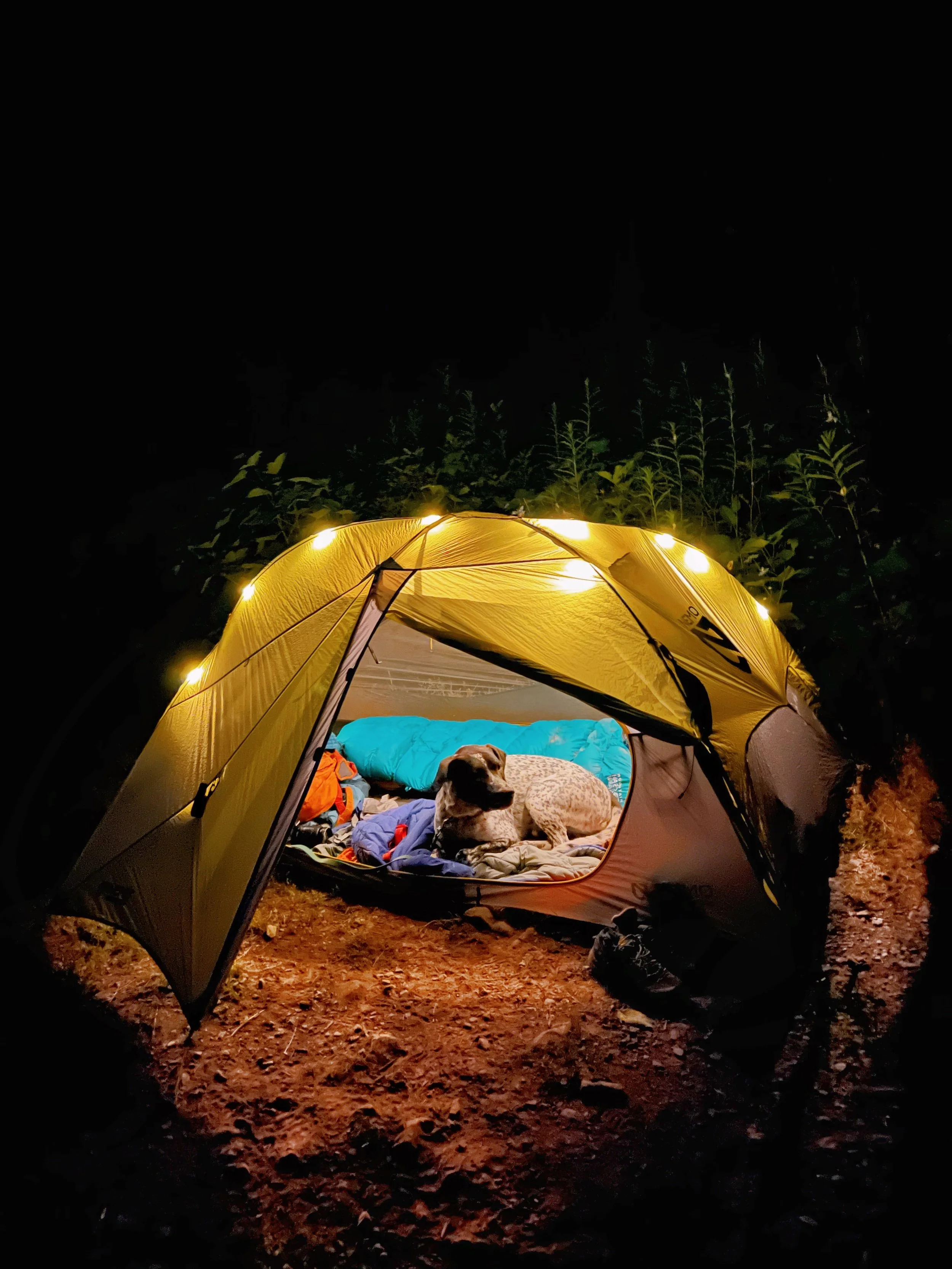
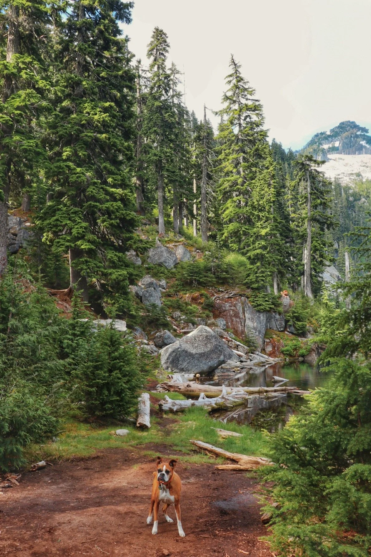
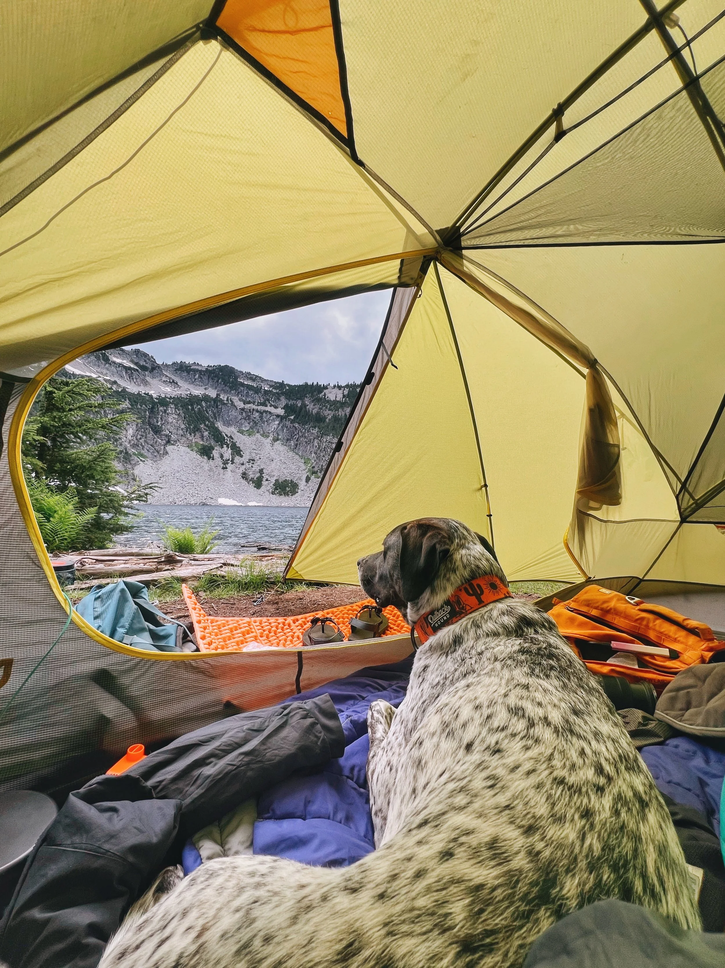
I did this as a 3-day, 3-night backpacking trip over July 4th weekend with my friends Caroline and Anthony, and of course, Tex. We started our hike on Friday evening and camped at Trout Lake. We pushed to Lake Malachite the next day. Caroline and Anthony hiked out from Lake Malachite on day three, and Tex and I continued on to set up camp at Little Heart Lake — I picked this over Big Heart Lake for the solitude before day hiking up to Big Heart with a packraft.
In this post, I’ll walk through each day, the camping options at each lake, and what to expect from the trail. Scroll down or jump ahead using the links before.
Overview
The West Fork Foss Rivers & Lakes Trail sit in the Alpine Lakes Wilderness, accessed via the Mount Baker-Snoqualmie National Forest. Unlike its neighbor, the East Fork Foss/Necklace Valley, which tunnels deep through old-growth before a brutal wall of elevation in Necklace Valley, the West Fork feels more like a progressive reveal. Each lake on the way is earned, and each one a little more dramatic than the last.
The trail is popular, especially in the lower sections. Trout Lake on a summer weekend can feel almost like a car-camping destination due to how short the hike in is. Copper Lake was actually pretty packed when I hiked past it on a Sunday. I did this trail in July, and while the lower trail was warm and exposed during the climb, the upper lakes still had a tiny bit of lingering snowfields on the surrounding ridges. The trail itself was snow free though.
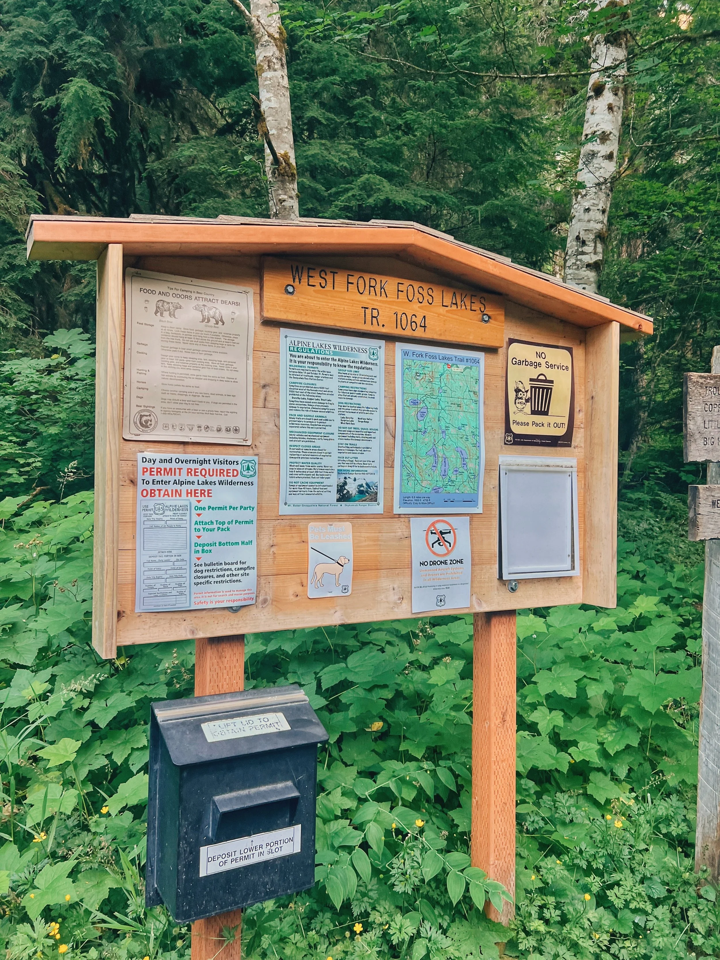
A free self-issued wilderness permit is required for overnight stays and can be obtained at the trailhead. Dogs are allowed on leash.
Getting to the Trailhead
Coordinates: 47.6786, -121.3155
The West Fork Foss trailhead is located about 2 hours east of Seattle off Highway 2, a couple miles past the Necklace Valley trailhead.
If you’re heading out on a holiday weekend, or a nice weekend, give yourself extra time. The backup on Highway 2 is no joke, especially if you’re driving back to towards Seattle on a Sunday.
The road to the trailhead is rough but doable. Expect the typical forest road with some potholes. Some are easily avoidable, and some art not. Drive with patience, and you will be fine. The parking lot can fill up quickly on busy weekends, so an earlier start is better if you can manage it. There is a privy at the trailhead. Pick up your self-issued wilderness permit here before heading in.
There is a privy at the trailhead and enough space for probably 20-25 cars.
Hiking the West Fork Foss Lakes Trail
I completed the West Fork Foss Trail in 3 days and 3 nights, really taking my time to complete each section. Below is how I’ve broken down the days. I am sure most people push for more miles than I did.
| Day | Segment | Distance | Elevation |
|---|---|---|---|
| Night 1 | Trailhead → Trout Lake |
~1.6 mi | +500 ft |
| Day 1 | Trout Lake → Lake Malachite |
~3.2 mi | +1,500 ft |
| Day 2 | Lake Malachite → Little Heart Lake |
~1.7 mi | moderate |
| Day 2 Bonus |
Little Heart → Big Heart & back
🛶 packraft
|
~2.6 mi RT | +700 ft |
| Day 3 | Little Heart → Trailhead |
~6.5 mi | mostly descent |
Mileages are approximate based on my GPS recording.
Night 1: Trailhead to Trout Lake
Trout Lake the next day in the morning light.
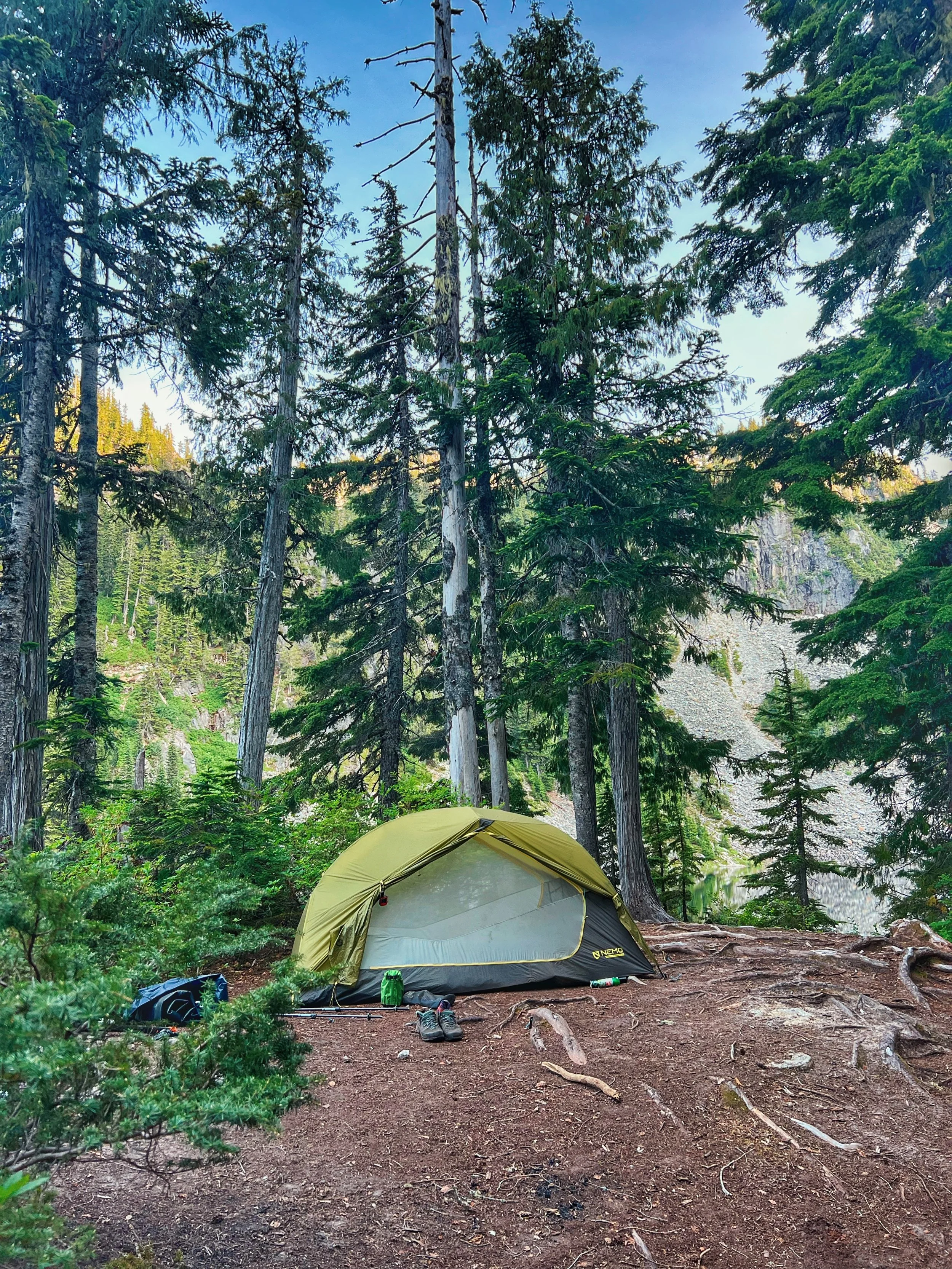
Our plan was to keep the first night simple and get a head start on the trail. We hiked to Trout Lake and set up camp. It’s a short carry, only about 1.6 miles with ~500 feet of gain. It is a relatively easy walk to bank some miles without arriving at camp in the dark, although we quickly lost daylight as we were setting up camp.
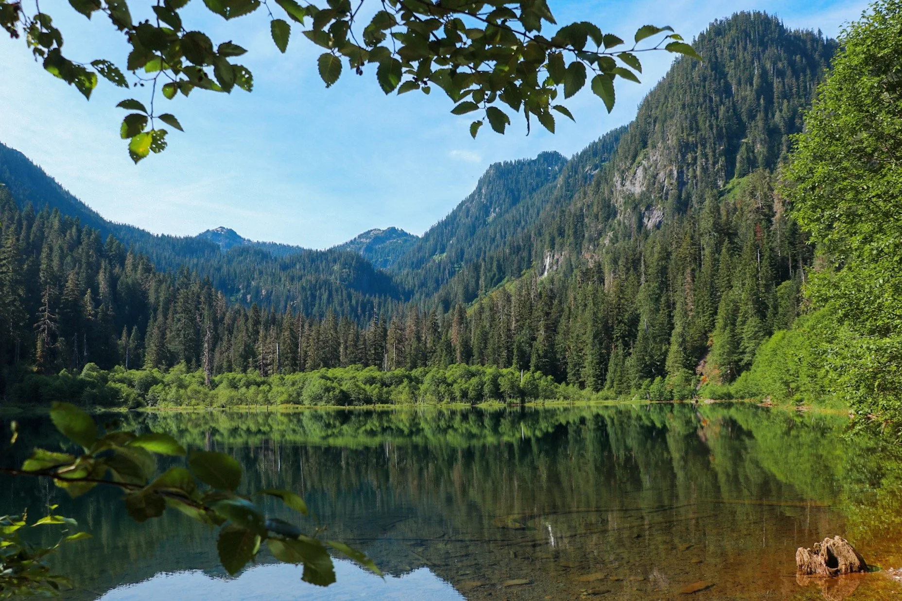
The trail enters the Alpine Lakes Wilderness almost immediately and winds through a beautiful forest of old hemlock and cedar. After crossing a sturdy bridge over the West Fork Foss river, the trail climbs gently before arriving at Trout Lake. It has a natural swimming beach and established campsites. I didn’t see a privy here. We didn’t see anyone else camping here on a Friday night despite being July 4th weekend.

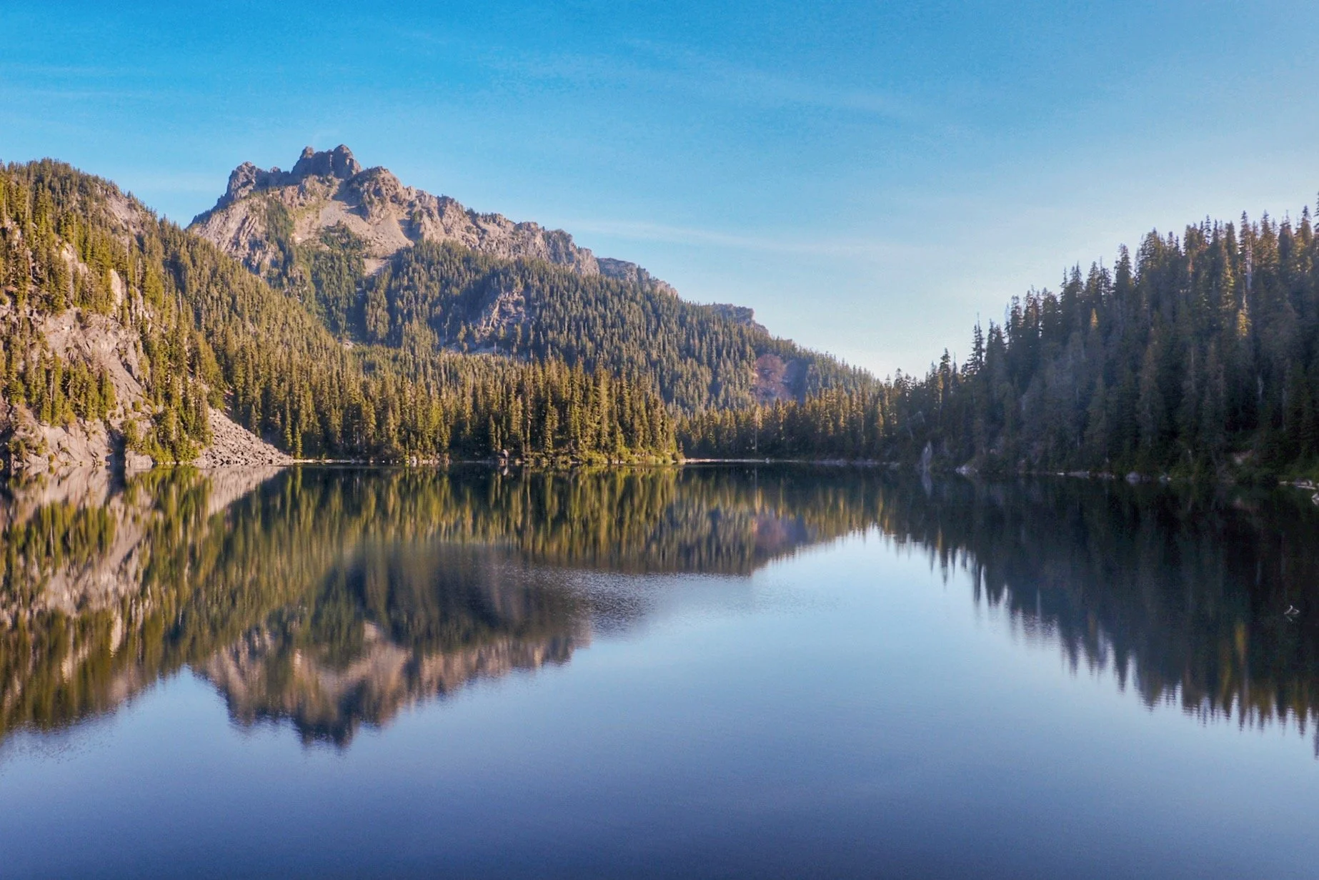
Day 1: Trout Lake to Lake Malachite
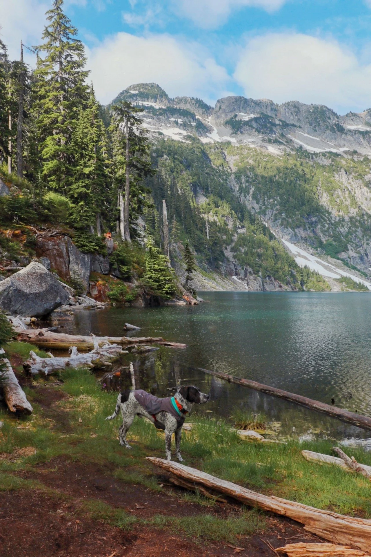
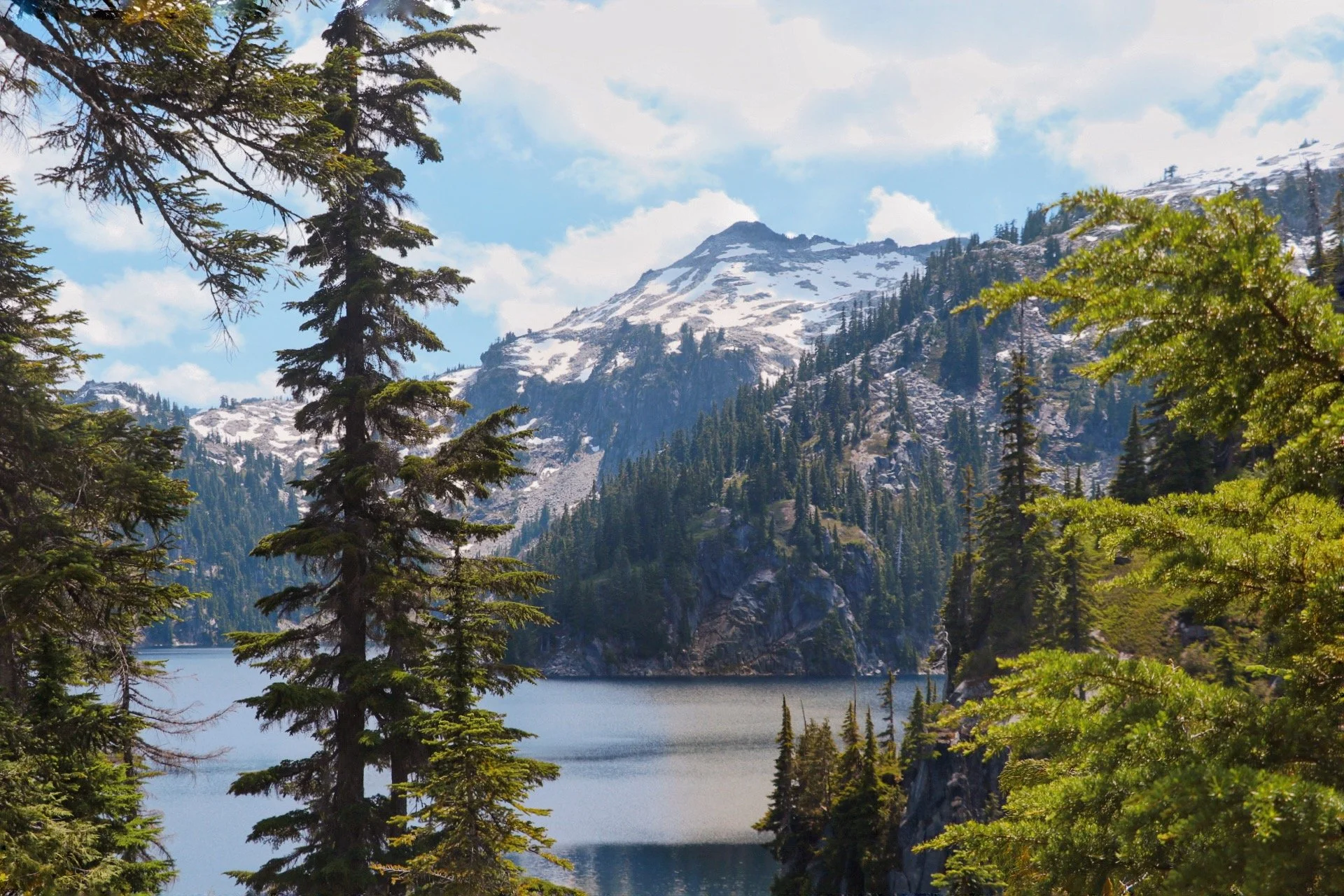
Lake Malachite in the morning when the clouds cleared.
I would say this was the hardest day of the trip, and it earned its reputation especially with a fully loaded pack with a packraft.
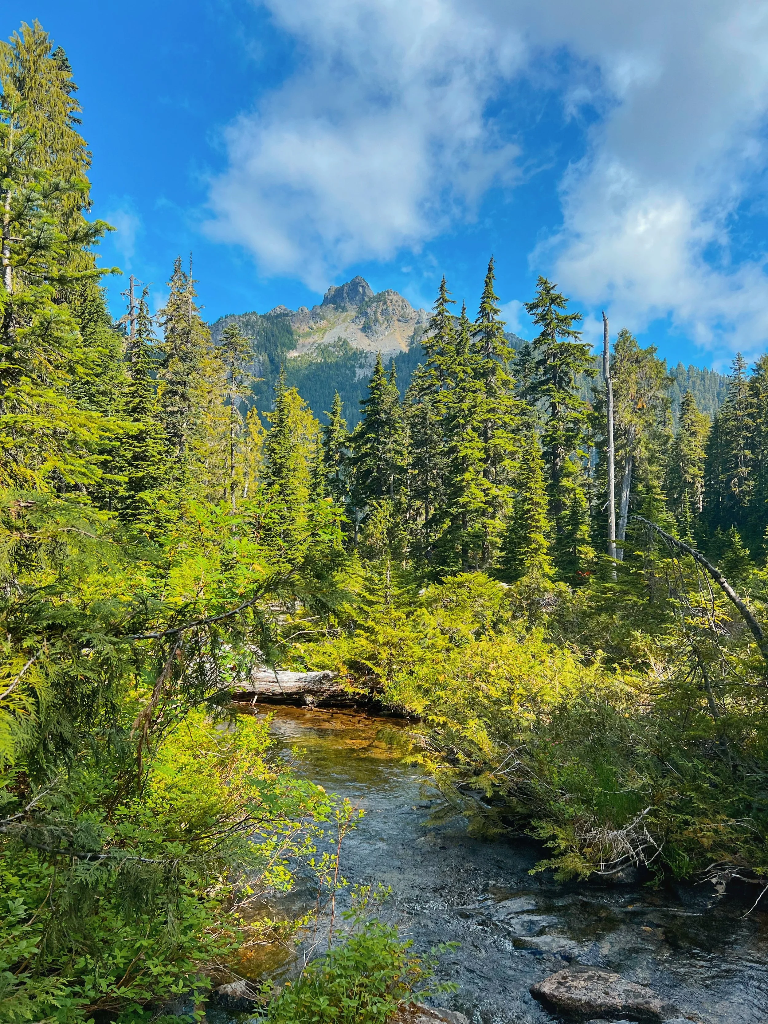
From Trout Lake, the trail follows Copper Creek before beginning a long, sustained, and exposed climb on switchbacks toward the upper lakes. This section was also very rocky. You gain around 1,500 feet between Trout Lake and the junction to Malachite and Copper — a stretch that’s largely exposed, hot in July, and relentless with a full pack. Bring plenty of water because this section was quite dry. There was a small stream near the top and a little area to rest before continue the push.
You’ll pass Malachite Falls and some striking options sections of the valley before the climb finally eases. At around 4.75 miles from the trailhead, you’ll reach a junction: a short, steep, rooty spur trail 0.2 miles west to Lake Malachite, while the main trail continues straight toward Copper Lake.
We took the spur trail up to Lake Malachite and camped there. It was later in the afternoon by the time we arrived, the clouds had rolled in, and a chill had settled in — not the warm, sunny lake arrival we’d imagined. We didn’t get to paddle out on the water with our packrafts. But we did just hang out and chill and took photos of Milly and Tex (Caroline and I’s dogs).
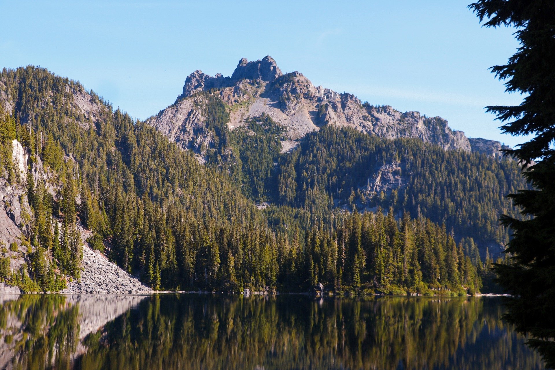
Malachite has a striking, moody quality to it and tucked into a cirque with steep walls rising around it.
Day 2: Lake Malachite to Little Heart Lake
After saying goodbye to Caroline and Anthony at the Lake Malachite junction, Tex and I rejoined the main trail and continued toward Copper Lake. The trail from the junction onward is genuinely more pleasant than what we had tackled the day before.
Copper Lake appears first: a subalpine lake ringed by steep barren slopes on three sides, sitting in a rocky cirque. The weather had completely turned by the time I passed through — it was warm, sunny, and clear. I stopped at Copper Lake for a short moment to fill up some water. There were definitely more parties camped at Copper Lake than Lake Malachite.
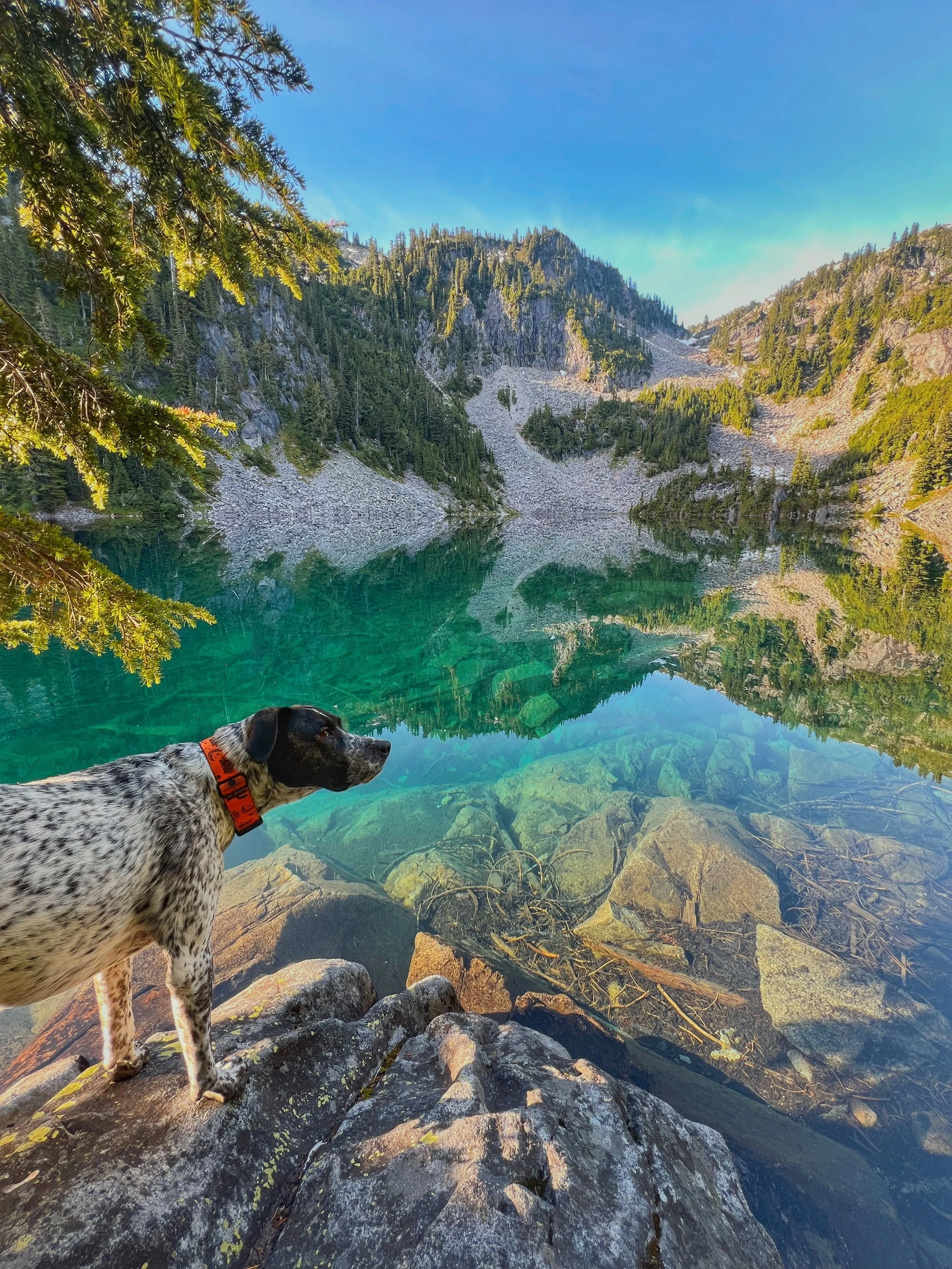
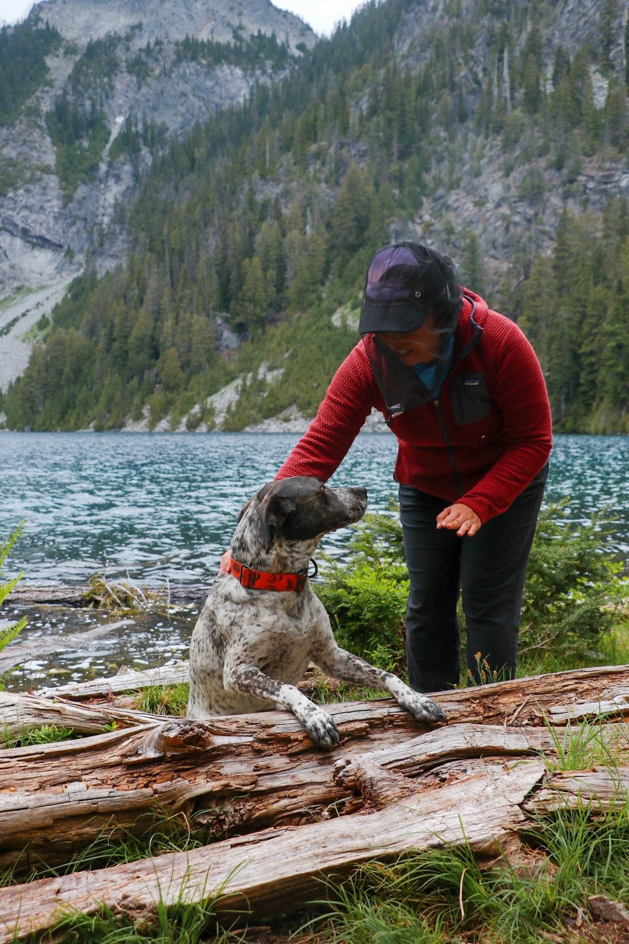
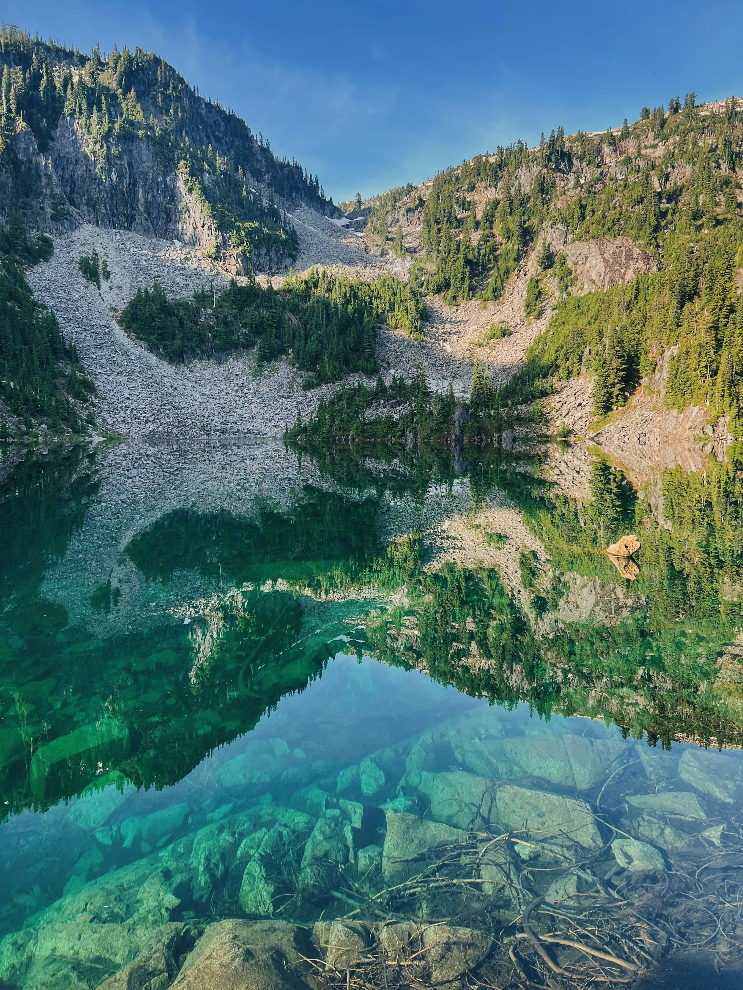
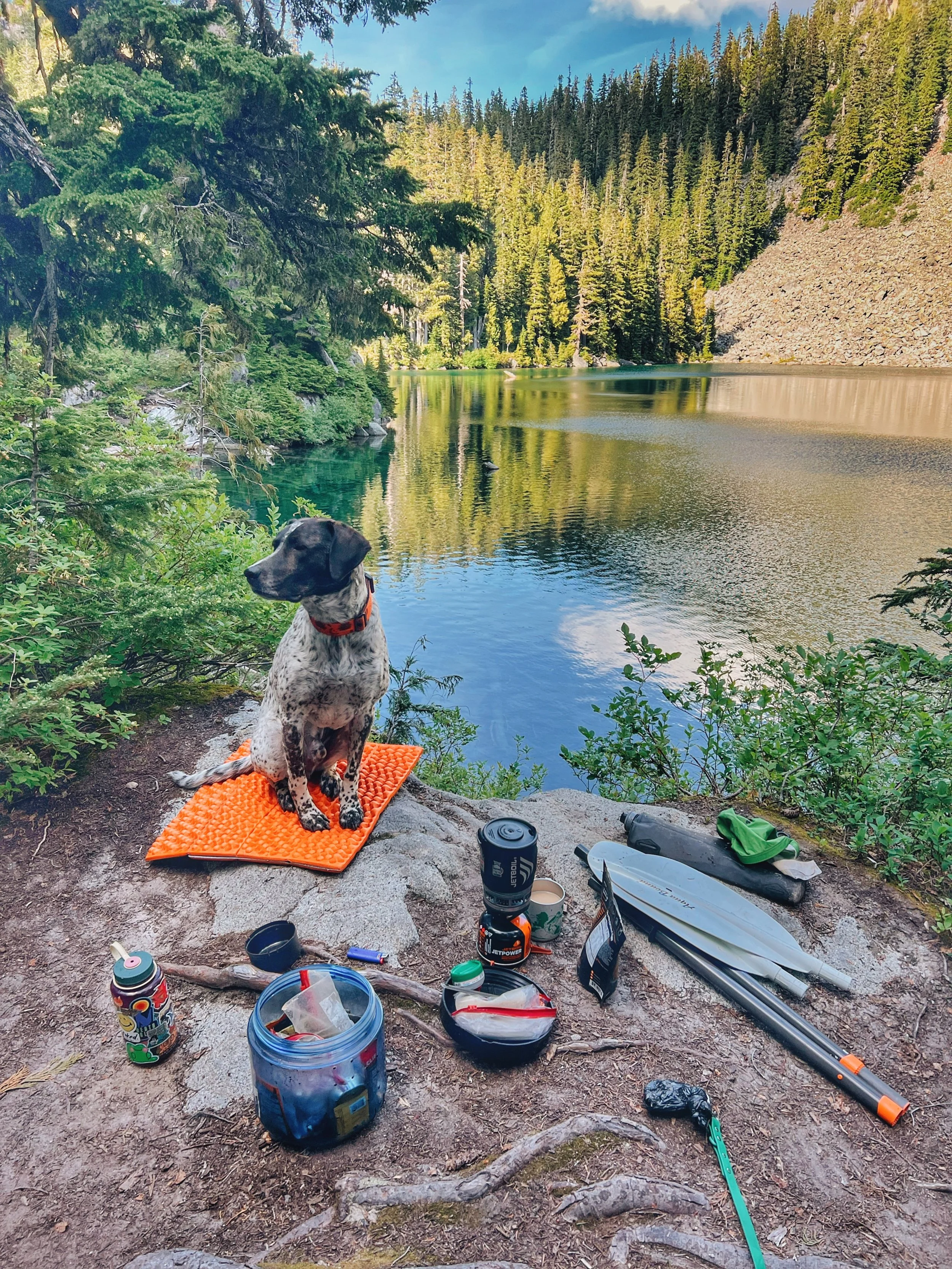
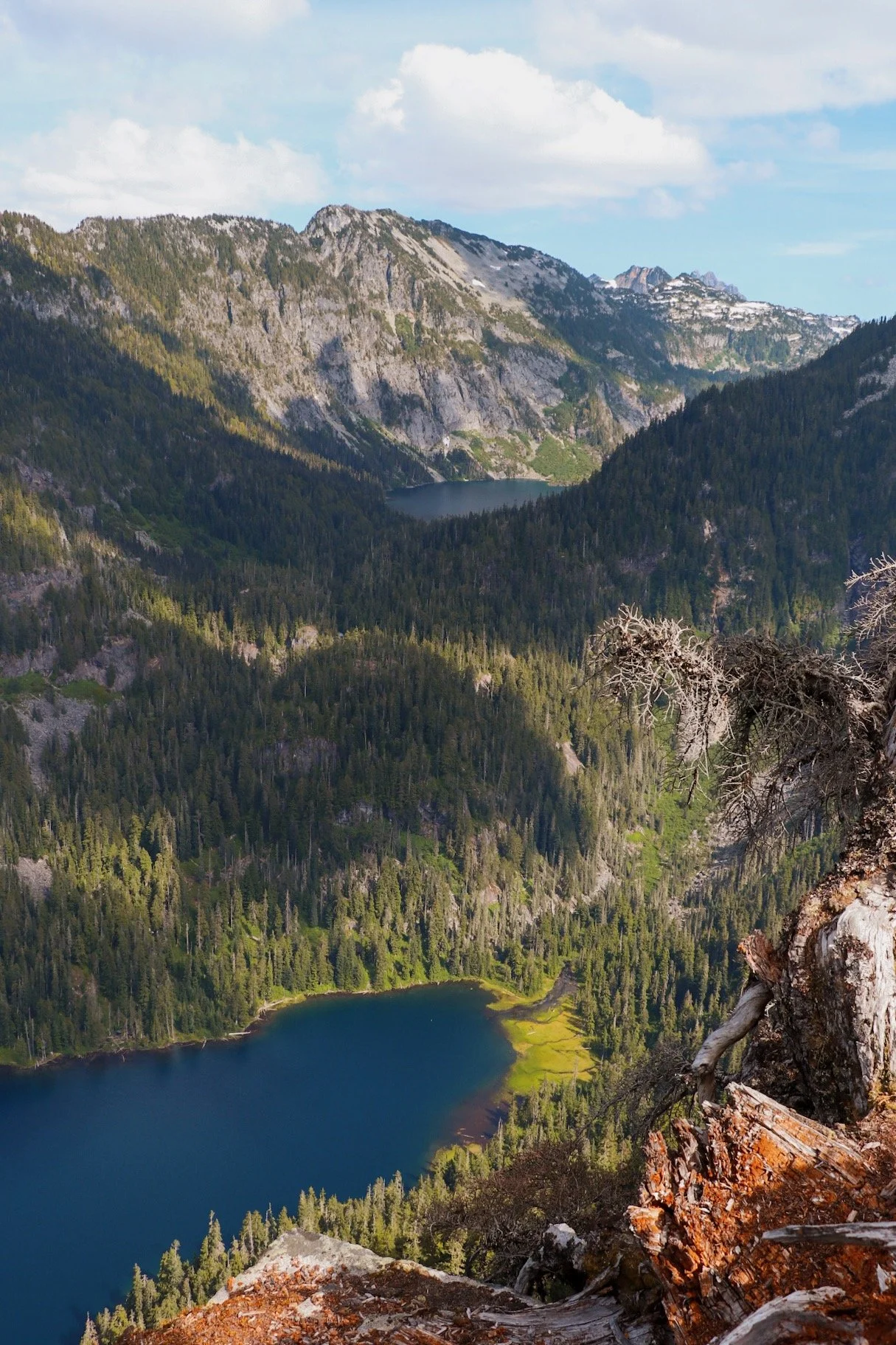
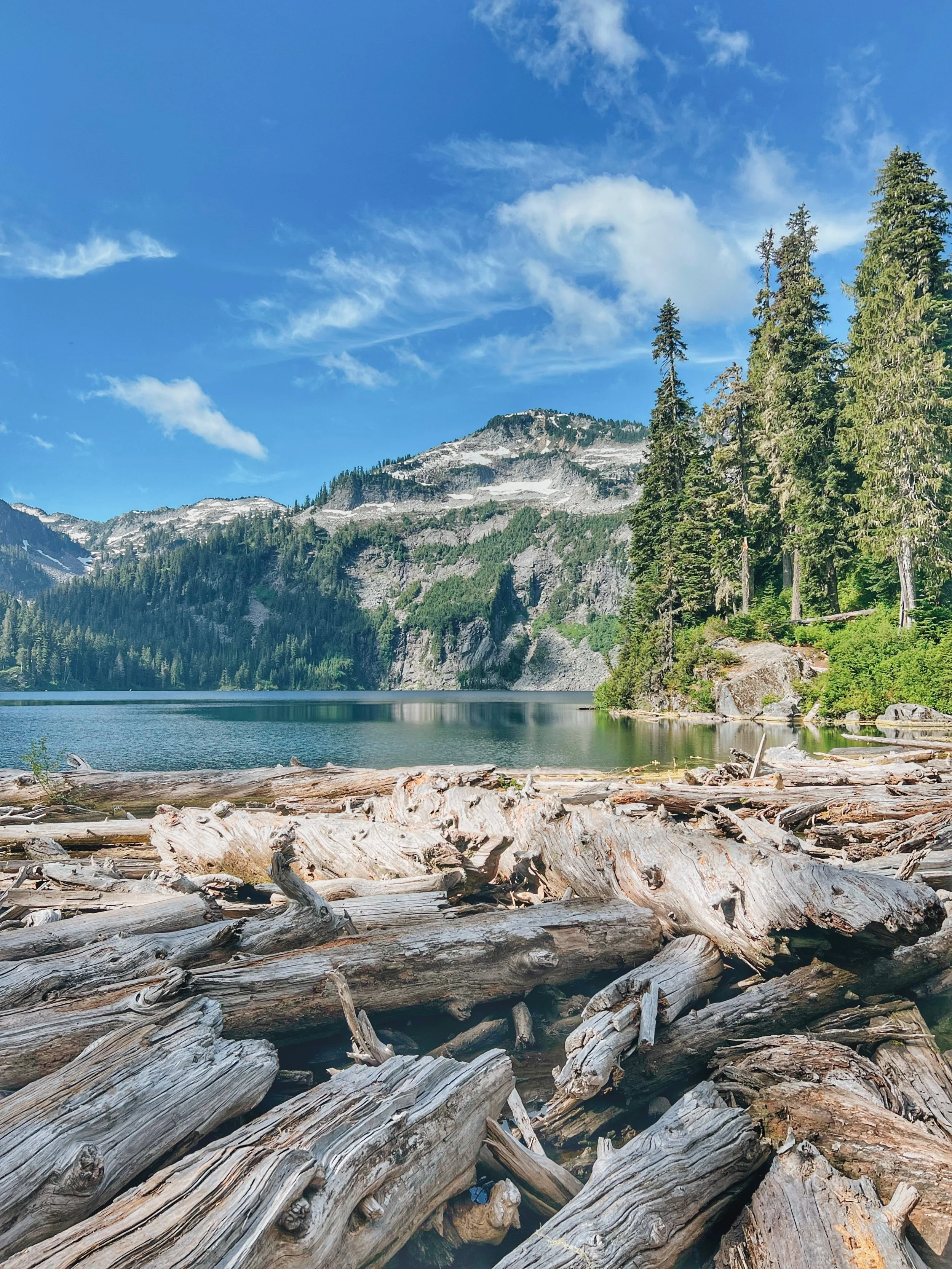
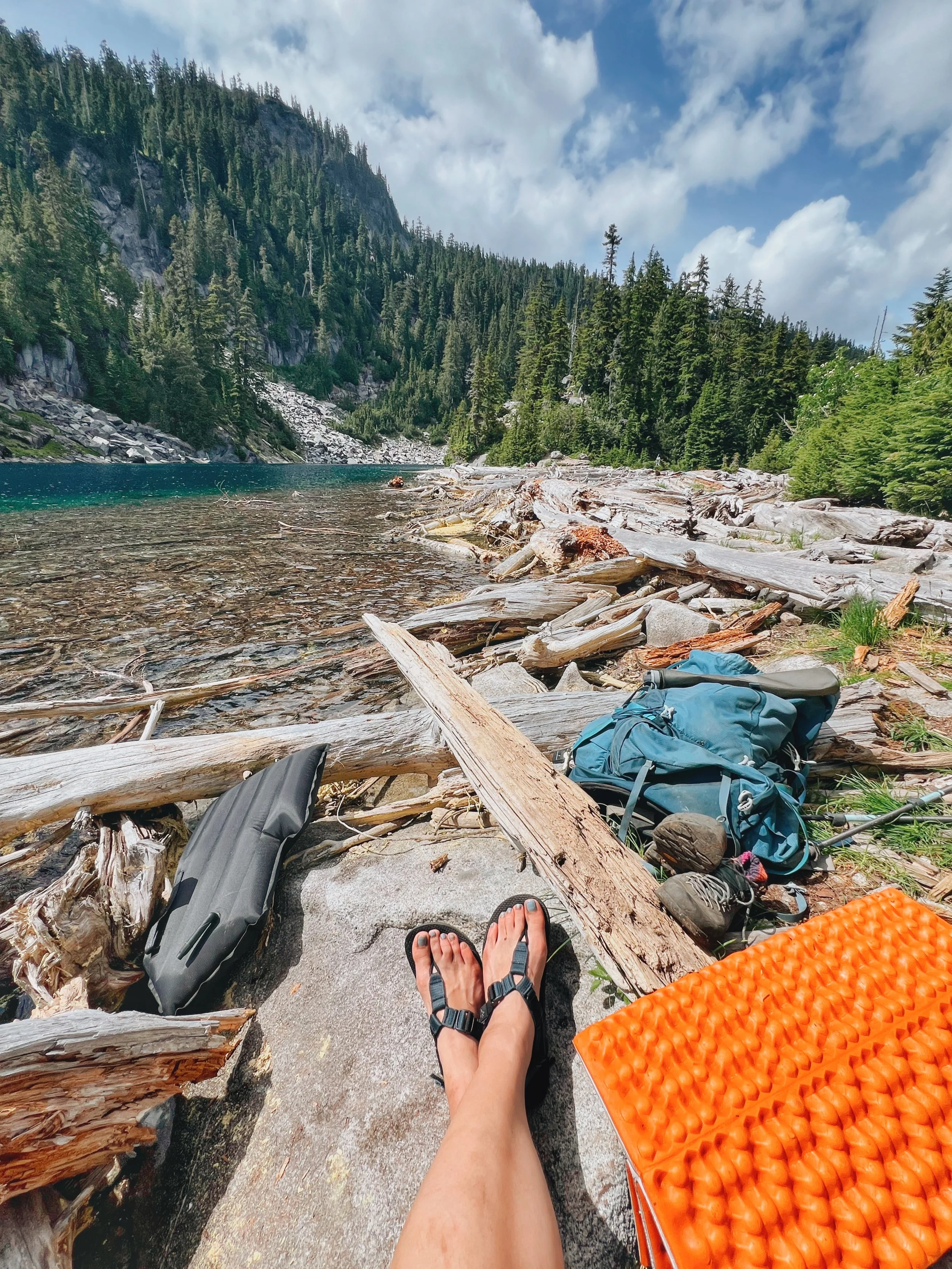
From Copper Lake, the trail continues along the east shore of the lake before heading southeast along a creek up to Little Heart Lake. The trail is rockier in this section but the grade is absolutely manageable. Little Heart is roughly the size of Trout Lake but feels a world away — more remote and more alpine. The color of the water was unreal. I’d read that it offered more solitude than Big Heart Lake, and I chose it deliberately as my camp.
I wasn’t wrong. I saw maybe one other group that night and they were gone by early morning, probably super deterred by the bugs because I definitely felt that way. Tex and I had the place almost entirely to ourselves.
Day 2 Afternoon: Day Hiking to Big Heart Lake
First peak at Big Heart Lake after the descent.
After setting up camp at Little Heart Lake and dropping my pack, Tex and I headed out for the day hike up to Big Heart Lake. This section involves a little bit of a climb but it didn’t seem too much, especially with a lighter pack. The bugs were quite relentless on this stretch. Pack bug spray and consider a head net if you’re doing this in July.
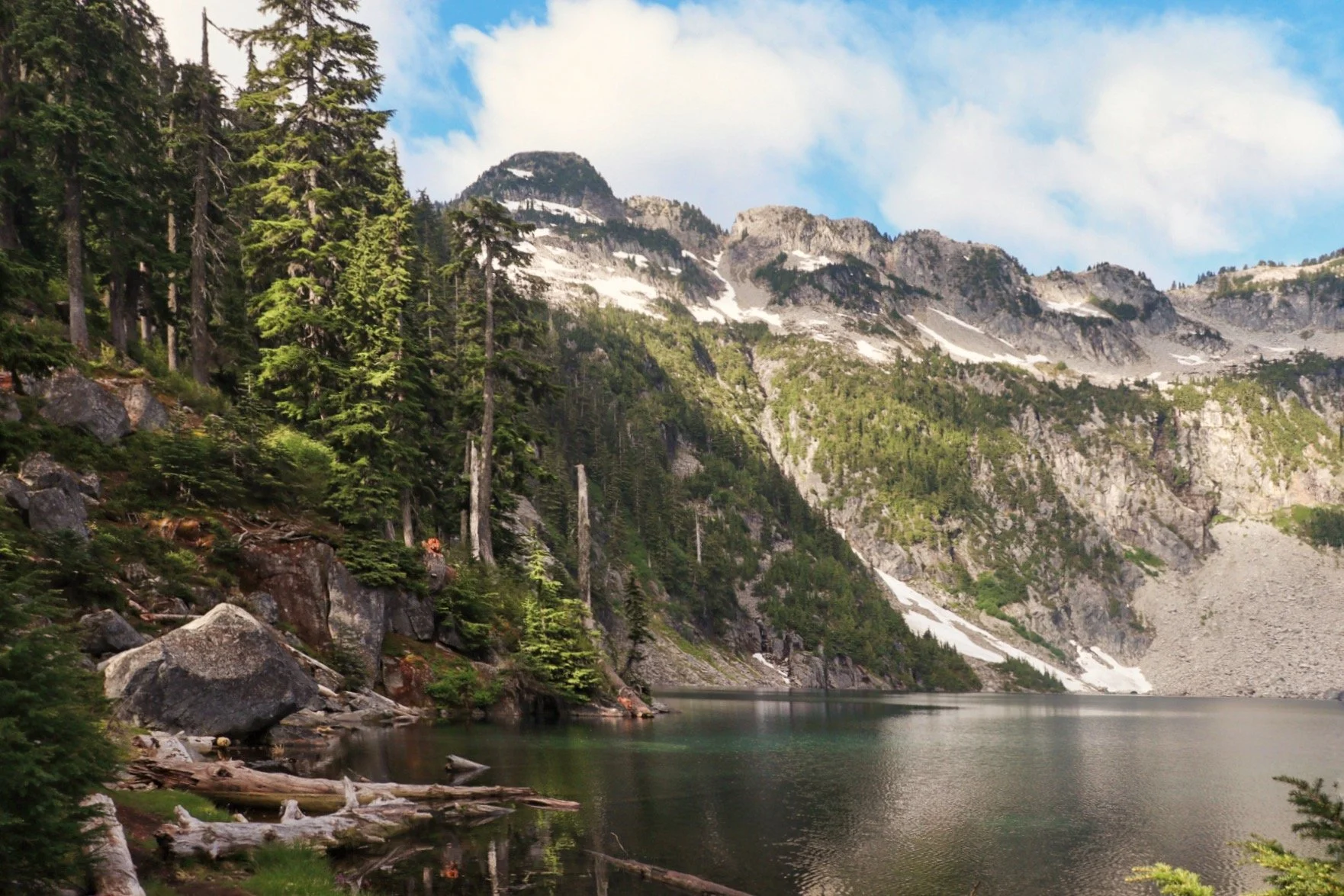
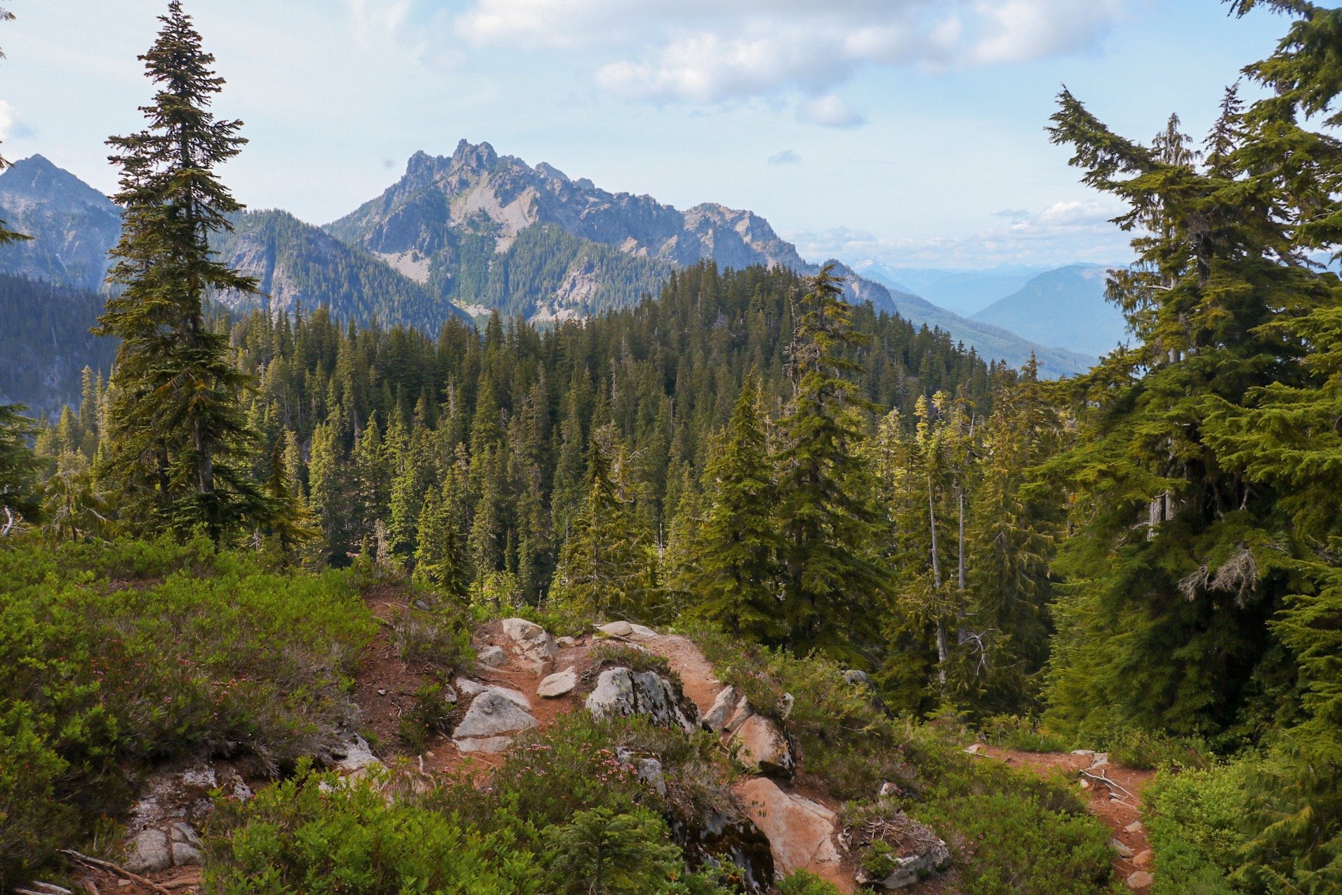
When I finally reached the ridge before descending to the lake, it offered sweeping views back down the the West Fork Valley. On a clear day, you could get a distant glimpse of Glacier Peak. The descent to Big Heart Lake was gradual, and the lake revealed itself slowly but nonetheless, it was dramatic as heck and I totally loved it.
Big Heart is the most dramatic and biggest of the five lakes. It sits deep in a cirque with near-vertical rock walls and lingering snowfields in July, the water an almost impossibly deep blue. I found a spot on the outskirts of the lake, where I could inflate my Kokopelli Hornet Lite and get out on the water.
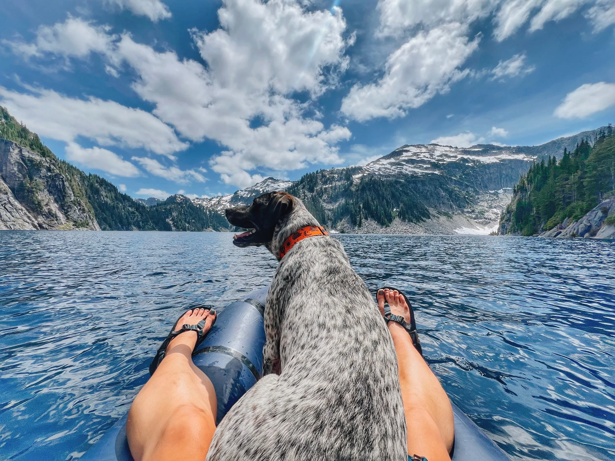
Tex and I floating in our packraft at Big Heart Lake.
The Hornet Lite has become a stable on my backpacking trips. It’s light enough to actually justify the weight penalty, and getting out on an alpine lake in a packraft is a completely different experience than just looking at it from shore. Tex, as always, took his spot on the bow and looked like he was on edge the entire time.
We stayed out on the water until it felt like it was time to head back to camp for dinner. The hike back to Little Heart went quickly.
Day 3: Little Heart Lake to the Trailhead
The hike out always feels long but at least this trail was straightforward. You just retrace your steps through Copper Lake, past the Malachite junction, and back down the rocky switchbacks to Trout Lake, and the final easy stretch to the trailhead. The descent from the junction back to Trout Lake was steep and did tire my legs. Take your time on the rocks, especially if it’s been warm and any sections are dry and loose.
The last 1.6 miles from Trout Lake felt like it took forever. I was so happy when I finally saw the parking lot. Tex was so ready for the car as well.
Final Thoughts
The West Fork Foss Trail delivered everything I’d hoped for. It’s a trail that asks something of you on Day 1, and then pays you back generously once you’re in the upper lakes. Choosing Little Heart over Big Heart as a base camp was the right call — the solitude was unmatched and this was exactly what I wanted for the solo stretch. Having Big Heart as a day hike made it feel like a destination rather than a campsite.
The packraft also made all the difference. It has changed how I experience alpine lakes. Being out on the water, in the middle of this alpine lake, with just Tex and the wind — that’s hard to replicate from shore. If you’ve ever thought about adding one to your kit, the Hornet Lite from Kokopelli is worth looking at for trips where weight matters.
If you’ve done the East Fork Foss and are looing for a companion trip in the same area, the West Fork Foss is a natural next step. There is also a way to connect the West Fork Foss with the East Fork Foss, perhaps that could be a trip I do in the future. The East Fork Foss is more old-growth and boulder scrambles into a hidden valley and Tank Lakes, the West Fork Foss is an open, lake-hopping progression into the high alpine. Both are worth your time.
Photos from the Trail


Resources
West Fork Foss River and Lakes on WTA: Trail description, passes, and directions
USFS Trail 1064 Info: Official trail page
Kokopelli Hornet Lite Packraft: The packraft I brought along