
Hiking Guide: 20 Essential Hikes to do in Washington

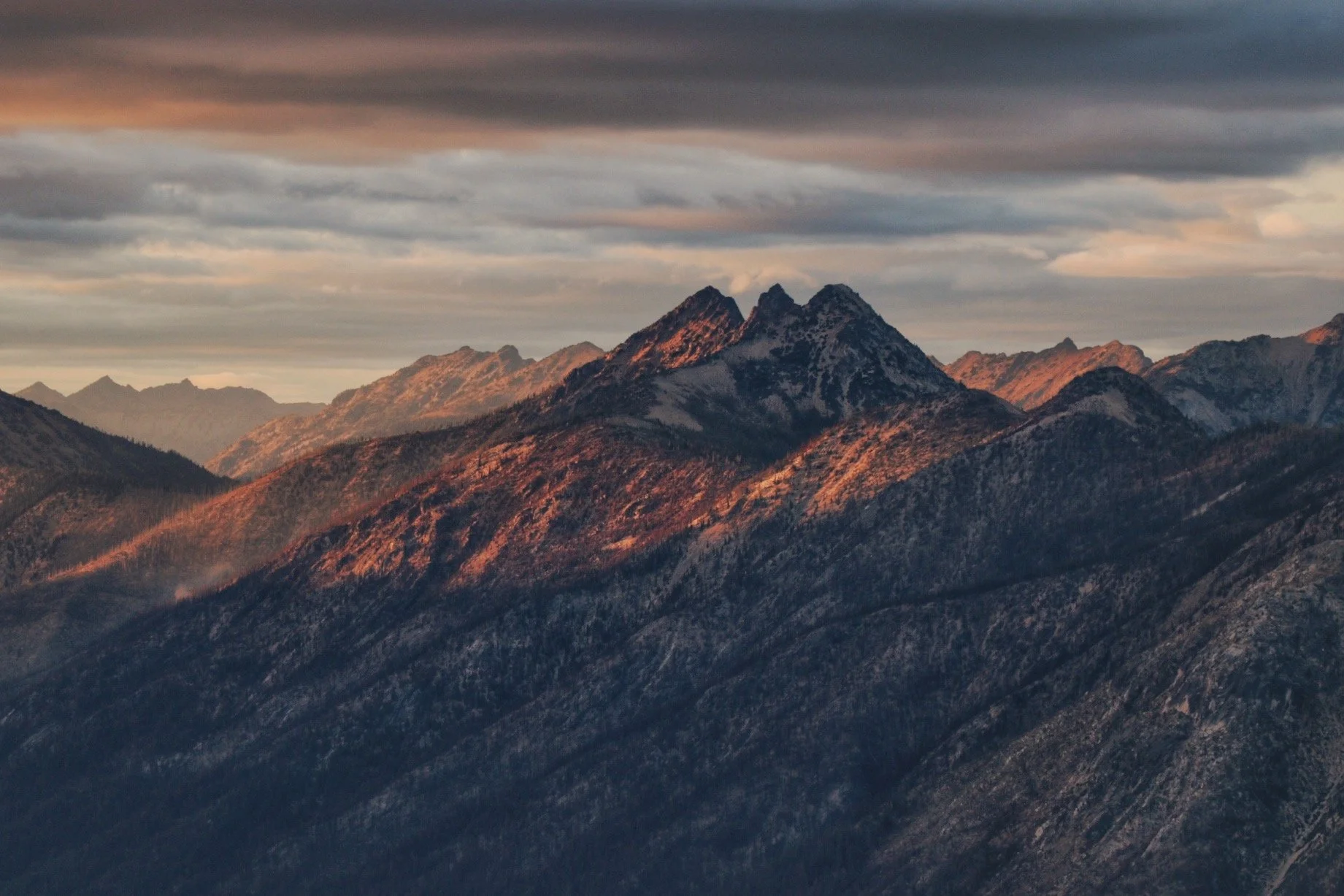
Southbound of the Pacific Crest Trail (PCT) near Chinook Pass - right at the junction to the Naches Peak Loop trail.
With thousands of incredible trails to explore, Washington offers endless hiking opportunities. Even after 16 years of living in the Seattle area, I’ve only scratched the surface—there are still so many trails I have yet to experience, including some of the most popular ones. This list is a personal collection of hikes that I have personally done and have stood out to me. While I wish I had the time and energy to hit the trails every weekend, that’s not quite a reality—at least not yet. My goal with this post is to inspire your next adventure. I hope these trails bring you as much joy and ‘trail magic’ as they have brought me
I’ve broken this post down into several key areas in Western Washington.
Hiking 101: How to Get Started & What to Pack

Feel free to download the guide on the left to help you get started with hiking! There are so many resources available online. I plan on eventually writing a post on what I always pack on my hikes but in the meantime, use the list to the left and this article from REI to learn why it is important to always pack the 10 essentials.
Please always remember to take great care of the wilderness, the trails, and brush up on the leave no trace principles.
Olympic Peninsula

I love visiting the Olympic Peninsula in the off season. It is truly a breathtaking blend of rugged coastline, dense temperate rainforests, and towering mountains. Home to Olympic National Park and the Olympic National Forest, it offers endless hiking opportunities. Beaches, rainforests, summiting peaks, or backpacking through the wilderness, the Olympic Peninsula’s diverse landscapes make every adventure worth it.
Royal Lake

Upper Royal Lake - the gateway to the true Olympic Wilderness.
Length:
16 miles roundtrip
Elevation Gain:
2650 feet
Pass:
America the Beautiful
Best Season:
July to September
Check out my trip report here.
The hike to Royal Basin - Royal Lake is located in Olympic National Park and it is a stunning journey through lush old-growth forests, meadows with wildflowers (in the summertime), and rugged alpine scenery. It starts at the Upper Dungeness Trailhead and has plenty of parking spots. This is also a popular spot for other hikes like Marmot Pass and the Tubal Cane Mine trails. This first 4 miles of this hike very gradually ascends alongside the Dungeness River before climbing up to the pristine waters of Royal Lake, surrounded by jagged peaks. I highly recommend hiking up the well-traveled boot path to the upper basin as it offers breathtaking views of tarns and dramatic rock formations.
I did this as an overnight backpacking trip and a backcountry permit is required for overnight stays. Information and permits can be found here.
2. Enchanted Valley

The famous chalet located in Enchanted Valley.
Length:
26 miles roundtrip
Elevation Gain:
3368 feet
Pass:
America the Beautiful
Best Seasons:
May to September
Check out my trip report here (with more photos!)
Have you seen the photo of a chalet with snow-capped mountains as the backdrop? Chances are, you were probably looking at the Enchanted Valley Chalet. The hike truly feels like stepping into a fairytale. The Enchanted Valley hike winds through towering old-growth forests, alongside the East Quinault River, and into the heart of Enchanted Valley — where waterfalls tumble down moss-covered cliffs, and the iconic chalet stands as a quiet sentinel of the past. It starts at the Graves Creek trailhead near Quilcene. The road is a little bumpy but it is suitable for any type of car.
It is a long trek, but every mile is worth. I did this as the first backpacking trip of the season back in 2022 and the mileage definitely kicked me butt a little. I’d say most of the gain came in the form of rolling hills. I remember feeling small yet completely in awe of the sheer beauty surrounding me. The first 9 miles of the hike can definitely feel a little mundane. However, once you get closer to the valley, the scenery changes and opens up to meadows. This hike is known for black bear sightings and I saw a few of them myself. Two on the way in and a couple more just minding their own business at Enchanted Valley. I also saw a few elk grazing the meadows.
💡 Tip: Enchanted Valley is a 26-mile hike located in Olympic National Park. I suggest you backpack this trail — there are several campsites to choose from. I did it in only two days and that meant having to hike 13 miles on day one and 13 miles on day two. It was doable but if I had the chance to do it, I would split the trail up and camp at Pyrites Creek for the night.
A backcountry permit is required. Bear canisters are required anywhere in the Olympic National Park backcountry campsites. More information can be found here.
3. Lower Lena Lake


Length:
7.2 miles roundtrip
Elevation Gain:
1300 feet
Pass:
America the Beautiful or NW Forest Pass
Best Seasons:
April to October
Lower Lena Lake is a year-round hike that’s both accessible and rewarding. This 7-mile hike is located in the Olympic National Forest. Since it’s not within the national park boundaries, this trail is dog friendly. It steadily climbs through lush, moss-covered forests, and crosses a few wooden bridges and offers glimpses of the surrounding peaks before reaching Lower Lean Lake.
Many people enjoy this as a day hike but this is a also a fantastic trail for first-time backpackers. With plenty of rocky outcroppings and plenty of campsites to choose from, it is.a great place to enjoy a snack, dip your feet in on a warm, and set up camp for the night. My dog, Tex definitely enjoyed standing on the outcrops while I enjoyed a snack.
4. Mount Storm King

My friend Micah, on top of the rock outcrop at the very top of Mount Storm King, overlooking Lake Crescent.
Length:
4 miles roundtrip
Elevation Gain:
2065 feet
Pass:
America the Beautiful
Best Seasons:
March - October
I did this hike back in 2019 and that was when I first started getting serious about hiking and yet, Mount Storm King still kicked my butt especially since my friend and I did in late February. Much of the trail was covered in snow and I didn’t own any microspikes and snowshoes. Let’s just say the trek up was tiring but the view at the end was so worth it.
Mount Storm King is no doubt one of the prettiest hikes in the Olympic Peninsula. The trail is short but a brutal leg burner with fantastic views. This 4 mile hike may not be long, but the relentless switchbacks and steep terrain will make you feel like it’s leg day. Just when you think you are near the top, the infamous rope section appears — giving you a final, thrilling scramble to earn the iconic view of Lake Crescent far below. If you’re up for the challenge, the reward is worth the sweat.
💡Tip: The rope section can be dangerous. Only do it if you feel comfortable. I would say this was a Class II or III scramble. However, since I did this hike in the winter, the rope section was actually covered in snow which make the ascent a little easier because the snow was rather firm. Coming back was a different story, but at least I got to glissade down!
North Cascades

The North Cascades is hands-down, one of my favorite places to hike and backpack. It is pure magic — jagged peaks, glacial valleys, and some of the most stunning alpine lakes you will ever see. Trails like Ptarmigan Ridge offer up-close views of Koma Kulshan (Mount Baker), while Maple Pass delivers one of the best panoramic views in the state. Grasshopper Pass, tucked deep in the Pasayten Wilderness, is also an absolute gem in the fall when the larches turn gold. Many trails here are dog-friendly, so your pup can enjoy the adventures too.
5. Chain Lakes Loop

Length:
6.5 miles roundtrip
Elevation Gain:
1820 feet
Pass:
America the Beautiful or NW Forest Pass
Best Seasons:
July to September
I have done the Chain Lakes Loop a handful of times. Even though this trail can get really busy at times, I feel like this hike is the best buck for you money. The hike itself isn’t too difficult but I always find climbing over Herman Saddle a leg burner especially with an overnight pack on. I’ve done this hike as a day hike and an overnight backpacking trip - there are two spots to camp at: Hayes Lake and Mazama Lake. You can do this hike clockwise or counterclockwise starting from the Artist Point trailhead. I personally like to get Herman Saddle (the biggest climb off the hike) out of the way. Going this way, you will be greeted unparalleled views of Kulshan (Mount Baker) and get to Hayes Lake first. The entire trail offers some of the best views in the Mount Baker Wilderness area.
6. Ptarmigan Ridge


Length:
9 to 11 miles roundtrip
Elevation Gain:
1800 to 2400 feet
Pass:
America the Beautiful or NW Forest Pass
Best Seasons:
July to September
Ptarmigan Ridge is one of those hikes I keep coming back to—I've done it three times, all as overnights, and it’s always worth it. Starting from Artist Point near Mount Baker, the trail offers nonstop alpine views as it winds along a scenic ridgeline. It’s about 9 miles round-trip to Camp Kiser with ~1,800 feet of gain, though the ups and downs add up.
There are a few great camping spots: Goat Lakes, the ridge before the boot path down to the lakes, and Camp Kiser. If you're feeling bold, you can continue past Camp Kiser to Portals East (another ~600 feet of elevation gain or so)—just know that section is unmaintained and gets scrambly fast but the close-up of Kulshan (Mount Baker) make this scrambly section totally worth it.
Best done in late summer or early fall once the snow melts out. Wildflowers, epic sunsets, and Mount Baker practically in your face the whole time—it’s a stunner.
7. Winchester Mountain Lookout


Length:
3.4 miles roundtrip
Elevation Gain:
1300 feet
Pass:
America the Beautiful or NW Forest Pass
Best Seasons:
July to September
Winchester Mountain Lookout is one of those hikes that delivers way more than what you’d expect for the effort. I camped at Twin Lakes (first come first serve) and did this as a sunrise hike. The views of Mount Baker and the surrounding Cascades were absolutely breathtaking and this was hands down one of the most beautiful spots I’ve ever watched the sun come up. The trail is short and well-maintained. It is about 3.4 miles roundtrip with around 1300 feet of elevation gain.
Getting to the trailhead is a bit of a mission—the road up to Twin Lakes is rough and definitely requires high clearance and AWD. If you’re planning to hike early or catch sunrise, staying the night at one of the first-come, first-served campsites at Twin Lakes is a great option. The lookout itself is also first come, first served. We didn’t stay in it, but when we arrived at around 7 a.m., a couple was just heading out—so if that’s your goal, getting there early is key. Whether or not you stay overnight, the panoramic views from the top are absolutely worth the effort.
8. Heather - Maple Pass Loop


Length:
7.2 miles roundtrip
Elevation Gain:
2020 feet
Best Seasons:
July to September
Pass:
America the Beautiful
NW Forest Pass
The first time I hiked the Heather - Maple Pass Loop was in August of 2020. This is definitely one of the classic hikes in Washington state and for good reason as well. In recent years, crowds literally flood to this trail in the summertime and in the fall for the larches. I was lucky to be able to encounter some solitude the first two times I’ve completed this hike. I always forget that this trail gains elevation steadily especially when you begin to depart from the forest.
The last time I did this hike was in September of 2024. I had no intent to see the larches - I simply wanted to finally do this hike during sunset and it did not disappoint. We got to the high point right as the sun was beginning to set and it was so magical. Unfortunately, there was a fire burning afar and we could see the smoke from it but it didn’t quite obstruct any views. Every time I do this hike, I feel so blessed to be able to call Washington home.
💡This hike gets super crowded especially on the weekends in the summer and in the fall. The parking lot is mid-sized but fills up quickly. I recommend starting super early to secure a parking spot. When I was driving back from Mazama last fall, both sides of Highway 20 were lined with cars and was absolutely a zoo. If you opt to park alongside the highway, please make sure your car is within the shoulder. It creates unnecessary traffic. There are other hikes in the area too so please plan accordingly and have a plan b!
9. Grasshopper Pass

Grasshopper Pass showered by golden larches. You can see the faint trail guiding us to our destination for the day!


Length:
5.5 miles
Elevation Gain:
454 feet
Pass:
America the Beautiful
NW Forest Pass
Best Seasons:
July to October
Grasshopper Pass is a hidden gem in the North Cascades, specifically in the Pasayten Wilderness, an area I am desperate to explore this year. I opted for this hike to catch some larches because I knew the other trails were going to be packed. Grasshopper Pass isn’t the most accessible due to its location. To get to the Brown Bear trailhead, you get to drive on one of the most exciting roads in Washington, Hart’s Pass Road. I was a little underwhelmed by the road because I was really expecting steep drop-offs but I have felt safe the entire time. The road is rough but pretty doable for all types of cars. I stopped by Goats Beard to ask about road conditions. You can also call the ranger station to check road conditions as well.
I stayed at the Meadows Campground the night before. It was an overcast day and night. The campground is first come first served. There is a pit toilet. This area was clearly burned in the past and you can see remnants of burned trees but the area was absolutely beautiful. I definitely recommend camping the night before as the drive to Mazama from Seattle is long, about 4 hours one way.
Extend your trip by driving all the way up to Slate Peak! The lookout sits at about 7440” and is Washington’s second tallest lookout but note that the road beyond the Hart’s Pass trailhead is absolutely rough and a high clearance and AWD vehicle is highly recommended.
10. Blue Lake


Length:
4.4 miles
Elevation Gain:
1050 feet
Pass:
America the Beautiful
NW Forest Pass
Best Seasons:
August - October
Blue Lake is yet another hike I’ve done at least twice. My friend Caroline and I tackled it by bringing our Kokopelli packrafts up for a paddle. We did this in October and it was actually quite chilly. I wanted to take some photos of her and her dog, Milly while the larches were slowly fading. I think this hike would’ve been better as a sunrise hike based on how the sun hits the surrounding peaks.
This hike is just as popular as its counterpart, the Heather - Maple Pass Loop trail. This one feels significantly easier and the rewards at the end are amazing. I recommend starting this hike early or late. We got to the trailhead after 2pm and was able to wait in the lot for a little bit as hikers that got an earlier start began to leave.
11. Artist Point Snowshoe


Length:
4 miles roundtrip
Elevation Gain:
1000 feet
Pass:
America the Beautiful
NW Forest Pass
Seasons:
November to May
Artist Point is great for summer recreation but turns into a winter wonderland for winter recreation as well from November well into early July some years. I love coming to the Mount Baker Recreational Area because the views here are simply unparalleled and a lot of these trails are dog friendly. I’ve attempted to snowshoe up to Artist Point maybe like 3 or 4 times at this point. I’ve always had to turn around due to not so ideal conditions. I was finally able to find a nice weekend with promising weather to tackle this winter route with two friends.
Before heading out in the winter months, always check avalanche conditions. Download an offline map and be prepared to do some wayfinding if the weather turns sour. While there are many established boot paths most of the time, there are some days after a fresh pow day that might wipe those boot paths out.
In the winter, this area becomes a winter recreation area. To park overnight, you would need to purchase an overnight parking pass. This can be purchased from the official resort website for Mount Baker.
Central Cascades

The Central Cascades are a true gem that shine brightest in the warmer months. While areas like Stevens Pass are known for their ski scenes, the region’s trails on both the west and east sides come alive in summer and fall. You’ll find everything from lush forest walks to open ridgelines with panoramic views, alpine lakes, and bursts of wildflowers—or golden larches if you time it right. It’s the kind of place where you can pick your own adventure, whether you're after a mellow day hike or a longer, more rugged trek. If you're exploring must-do hikes in Washington, the Central Cascades are absolutely essential.
12. Tank Lakes, East Fork Foss - Necklace Valley

The classic view of Tanks Lakes via the East Fork Foss - Necklace Valley trail.
Length:
23 miles
Elevation Gain:
4100 feet
Pass:
America the Beautiful
NW Forest Pass
Best Seasons:
July to September
I've been wanting to hike to Tank Lakes for a while and I was finally able to do it in September last year. My friend Ryan and I did this as a 3 day 2 night backpacking trip. The weather was not looking too good but we were able to get a tiny bit of blue skies once we headed up to Tank Lakes. There are many places to camp even when you begin to gain brutal elevation gain at about mile 5, there’s a big open camping area next to a river with a pit toilet (but I never found it). If you push beyond this, you will arrive at Jade Lake - another great spot to camp for the night.
We decided to push through and camped at Emerald Lake which made the hike up to Tank Lakes the next day a lot shorter. This entire trek felt super hard on me and I almost summitted Mount Baker the same summer. However, the rewards are great and I wish we pushed even further and camped at Tank Lakes!
13. Lake Valhalla

Length:
7 miles
Elevation Gain:
~1500 feet
Pass:
America the Beautiful
NW Forest Pass
Best Seasons:
July to October
🥾 Read my Lake Valhalla trip report here.
Lake Valhalla is one of those hikes that feels straight out of a fairytale—crystal-clear water, open meadows, and mountain views that make you want to linger all day. The trail from Smithbrook is about 7 miles round-trip with ~1,500 feet of elevation gain, and it’s a steady, manageable climb through lush forest that opens up to sweeping views as you near the lake.
This spot is especially stunning in fall when the hillsides turn gold, but it’s a solid go-to all summer long for a mellow adventure with a big payoff. Pack a snack, maybe even a swimsuit, and don’t be surprised if you end up staying longer than planned.
I recommend hiking the 0.5 mile unmaintained trail up to McCausland - this trail is rough and climbs steeply before you reach the summit. But the views were so cool especially overlooking Litchenberg Mountain and Lake Valhalla.
14. Heybrook Ridge


Length:
3.3 miles roundtrip
Elevation Gain:
775 feet
Pass:
None
Best Seasons:
April to October
Heybrook Ridge is a short and sweet hike just outside of Index that delivers big views for minimal effort. The trail is about 3.3 miles round-trip with around 775 feet of elevation gain, winding through mossy forest before opening up to a ridge with stunning views of Mount Index and the Skykomish River Valley.
If you’re looking to extend your day, the nearby Heybrook Lookout Trail offers another quick climb to a historic fire tower with even more epic views. Both trails are perfect for a laid-back adventure with a solid scenic payoff.
I-90 Snoqualmie Region

The I-90/Snoqualmie Pass corridor is one of the most accessible and trail-packed regions in Washington—just about an hour from Seattle but packed with enough hikes to keep you exploring for seasons. From forested lake strolls to steep scrambles with summit views, there’s something for everyone here, whether you're new to hiking or looking for a solid challenge. It’s a go-to for quick weekday escapes or spontaneous weekend adventures, with trails that shine in every season—wildflowers in summer, golden leaves in fall, and even snowshoe options in winter. If you're building your Washington hiking list, the I-90 corridor is a must.
15. Annette Lake


Length:
7.5 miles
Elevation Gain:
1800 feet
Pass:
America the Beautiful
NW Forest Pass
Best Seasons:
Year round?
Annette Lake surprised me—in the best way. I’d seen photos and never felt super drawn to it, but in the winter, it’s a whole different experience. The trail is about 7.5 miles round-trip with ~1,800 feet of gain, mostly mellow with a few short, steeper sections. Snow started around 1.5 miles in and became full coverage beyond 2 miles. Micropikes weren’t required but definitely helped on the icy, crusty parts.
We had perfect weather, with the sun breaking through and lighting up the snow-covered trees. The avalanche chutes near the end were easy to spot—definitely a factor to consider on high-risk days. We had the lake completely to ourselves and were able to walk around it on solid snow.
Trailhead access was fine for any car—just take it slow over the potholes. There’s a privy at the trailhead and a Sno-Park permit is required, even if there’s no snow in the lot.
Beautiful, peaceful, and way better than I expected—some hikes really do shine in winter, and this is one of them.
16. Snow Lake

Length:
7.2 miles round-trip
Elevation gain:
1800 feet
Pass:
NW Forest Pass
Seasons:
Year-round
Snow Lake is one of those classic hikes that’s popular for a reason—easy access, stunning views, and a big payoff without too much effort. I’ve done this trail twice, both as overnight trips, and waking up next to that alpine lake surrounded by peaks is hard to beat. The trail is about 7.2 miles round-trip with ~1,800 feet of elevation gain, and while the switchbacks can feel a bit relentless at times, the views make it worth it.
Once you crest the ridge and catch that first glimpse of the lake, it’s pure magic. There are several campsites scattered around the shoreline, and if you’re willing to wander a bit, you can find quieter spots away from the crowds. Snow Lake can get busy during the day, but if you stay overnight, you get to enjoy the calm and beauty once most folks have cleared out.
Parking here when the Snoqualmie Ski Area is quite weird. The trail starts at the Alpental Ski Area so you would need to purchase a daily parking permit and they are quite pricey. This trail is also prone to avalanche risks so I do think it might be best to wait until summer to do it. I’ve done it in the summer and as an early fall/winter hike.
17. Rattlesnake Ledge


Length:
4 miles
Elevation Gain:
1160 feet
Pass:
Discover Pass
Seasons:
Year Round
Rattlesnake Lake is the kind of hike that’s perfect when you want something quick, scenic, and close to Seattle. The trail to the ledge is about 4 miles round-trip with 1,160 feet of elevation gain, and it’s a steady climb with plenty of switchbacks to get your legs working. At the top, you’re rewarded with a stunning view overlooking the lake, surrounding forests, and the Cascades in the distance.
It’s super popular—especially on weekends—so I’d recommend going early or on a weekday if you want a little more solitude. You will need a Discover Pass to park in the Rattlesnake Lake Recreation Area but I think there is a small lot before the gate where you don’t need a pass, and there are restrooms at the trailhead. Great for a sunrise or sunset mission, after-work leg stretch, or introducing someone to hiking in the PNW.
South Cascades/Mount Rainier

When I talk about the South Cascades here, I am including the Mount Rainier area too. This is actually the area I visit the least aside from Eastern Washington (Wenatchee and beyond). Mount Rainier definitely steals the show the majority of the time but ever since I got a dog, it’s been hard to plan trips and hike within the national park boundaries. However, there are still a few that offers great views of everyone’s favorite mountain in Washington state.
18. High Rock Lookout


Length:
4 miles round-trip
Elevation Gain:
1160 feet
Pass:
Discover Pass
Best Seasons:
Late July to October
🥾 Read my High Rock Lookout trip report here.
High Rock Lookout is a short but rewarding hike with one of the most dramatic viewpoints in the South Cascades. The trail is about 3.2 miles round-trip with roughly 1,350 feet of elevation gain, climbing steadily through forest before opening up to a rocky summit with a historic fire lookout perched on the edge of a cliff. The views of Mount Rainier and the surrounding valleys are absolutely unreal—especially on a clear day.
No parking pass is required for the trailhead, but the forest road to get there is rough—high clearance is helpful, and it's best to check conditions ahead of time. The trail is typically snow-free and best hiked from late June through early October. It's a quick trip with a big payoff, perfect for a summer sunset or sunrise adventure (if you're okay with heights—the lookout sits on a narrow ridge!).
I recommend doing this as a sunrise or sunset hike - I’ve done it both times and both are so worth it. Funny story is I tried to sleep at the trailhead before starting the hike at sunrise. I got to the trailhead at midnight and somehow there were a lot of folks hiking back to their cars and I absolutely did not sleep. I hiked up to High Rock with maybe 3 hours of sleep but I would say it was worth it.
19. Goat Lake - Goat Rocks Wilderness

Snowgrass Flats overlooking Mount Adams.
Length:
22 miles round-trip
Elevation Gain:
4623 feet
Pass:
America the Beautiful
NW Forest Pass
Best Seasons:
Late May to October
🥾 Read my Goat Rocks Wilderness trip report here.
I did this trail with a group of friends in 2021. A lot of the permits we obtained fell through due to wildfires so we decided to head over to Goat Rocks Wilderness. I think we did the pretty standard loop - we started at the Berry Patch trailhead, traveled up towards Snowgrass Flats and completed the loop going through Jordan Basin and Goat Lake. This area has been experiencing more usage so it’s extra important to only camp at designated areas or sites that have been clearly used. We wanted to do an overnight trip but if you are short on time, you can also opt to just hike to Snowgrass Flats or Goat Lake. You can’t go wrong with Goat Rocks Wilderness.
A Northwest Forest Pass or America the Beautiful is required to park at the trailhead. The access road is usually in decent shape for most vehicles. The trail is best hiked from late spring through early fall, once snow has melted out—though it really shines in mid-summer when wildflowers are blooming and the lake is accessible for swimming or relaxing by the shore. A great pick for a longer but mellow day hike or a scenic backpacking trip.
20. Dege Peak

Dege Peak is often overlooked because the nearby Fremont Lookout trail gets all the hype.
Length:
4 miles round-trip
Elevation Gain:
600 feet
Pass:
America the Beautiful
Best Seasons:
Late July to October
Dege Peak is one of the easiest ways to score panoramic views of Mount Rainier without a huge effort and one of my favorite sunset hikes to do after work before I got Tex. Located in the Sunrise area of Mount Rainier National Park, the trail is a great option for a mellow day hike with big rewards and to avoid the crowds headed to Fremont Lookout.
The trail follows a ridgeline with nonstop views of surrounding peaks, wildflower meadows in summer, and of course, that iconic close-up of Rainier. It’s especially beautiful in the late afternoon light or during sunset. An America the Beautiful Pass is required to enter and park at Sunrise. Best season to visit? Mid-July through early October, when the snow has melted and the road to Sunrise is open.
Mount Rainier National Park implemented timed-entry permits beginning in 2024, find out more about how to obtain these permits and when they are needed on the official website.