
Enchanted Valley

Enchanted Valley, Olympic National Park - The trail finally opening up to views after hiking about 12.9 miles.
I’ve heard about the Enchanted Valley hike for a while but due to the length of the trail (from the trailhead to the chalet is about 13.2 miles), the hike is a little too long for a day hike. So I decided to finally do it as a backpacking trip. It was even rather long for me to do as a 2-day backpacking trip. Nonetheless, I am so glad I was finally able experience the magic of the Enchanted Valley myself. In this post, more like a photo essay, I will go through how I prepared myself for the hike and tips for hiking in bear country. Luckily, we only really see black bears in this part of the Pacific Northwest.
Let’s get started 👇
Overview of the Hike
Getting to the Trailhead
Mile 0 to Mile 2.7 - Graves Creek Trailhead to Pony Bridge
Mile 2.7 to Mile 7 - Pony Bridge to O’Neil Creek
Mile 7 to Mile 10 - O’Neil Creek to Pyrites Creek
Mile 10 to Mile 13.2 - Pyrites Creek to Enchanted Valley
Camping in Enchanted Valley
Resources
Stats from Gaia GPS:
Distance (one way):
13.2 miles
Area:
Olympic National Park
Elevation Gain:
1700 feet
Pass:
NW Forest Pass/America the Beautiful
Overview of the hike
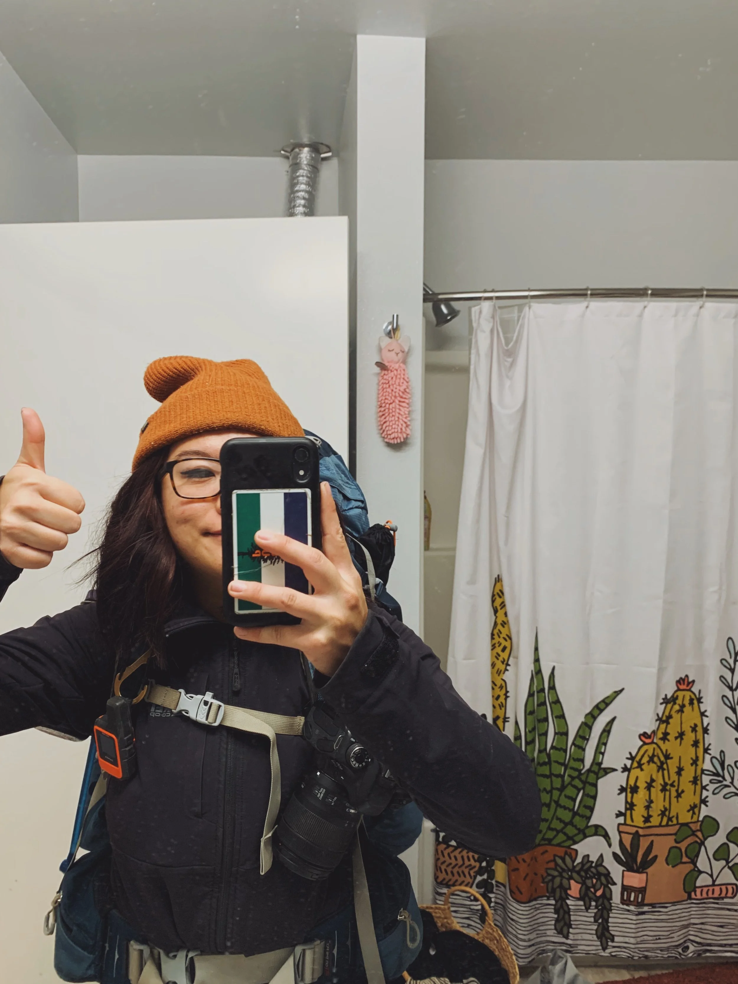
Me looking extremely hopeful before I set out for the trail
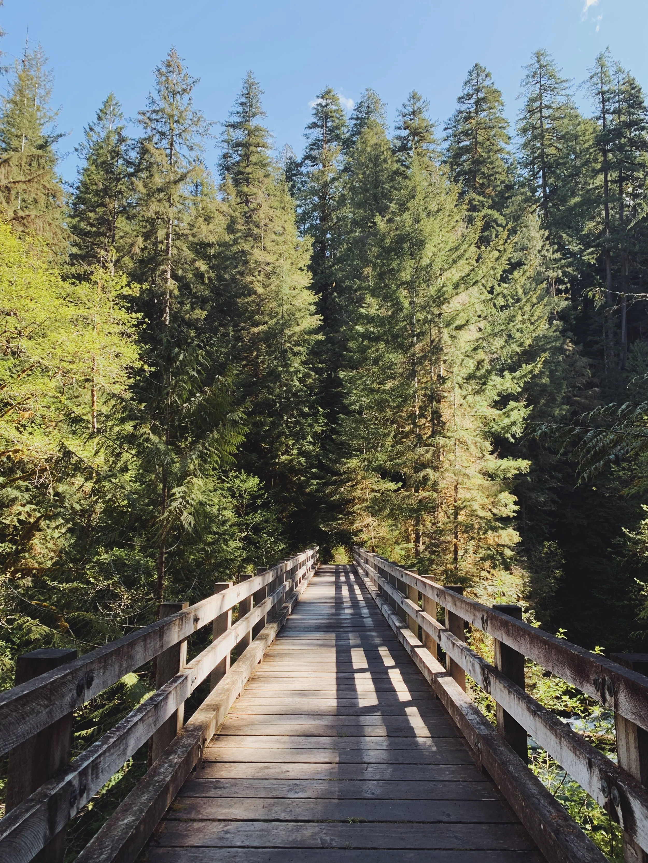
The beginning of the trail - a nice bridge crossing the first of the many creeks you will encounter
The distance from the trailhead to the chalet is about 13.2 miles. I know some people do this as a day hike, but be prepared that if you hike 13.2 miles in, you need to have enough energy to hike back out if you are not planning to stay the night. I suppose you don’t have to hike all the way to the chalet but I highly recommend that. When the trail finally opens up and find yourself surrounded by snow-capped peaks and waterfalls shooting out of the mountains, you will be glad that you made it all the way in.
The trail itself was still pretty but it’s comparable to a lot of the rainforests hikes in the area. And to be quite frank, if you are looking for a beautiful hike through an old grown rainforest, good alternatives are the Hoh Rainforest and the Quinault Rainforest.
Backpacking the Enchanted Valley means you can hike at your own pace and rest for as long as you need to without having to feel rushed. There are 4 backcountry camps along the way, with Pony Bridge being the closest to the trailhead and Pyrites Creek closest to the valley itself. Other hikers recommend staying at O’Neil Creek as that sort of acts as the midway point for the hike (~7 miles).
As mentioned, you will need to obtain backcountry permits in order to camp overnight. Olympic National Park is the only park in Washington state that doesn’t require advanced permits or uses a lottery system which means this area hasn’t been overused yet so it is extra important to follow leave no trace principles here.
Sign at the trailhead showing the distances for each backcountry camp on the Enchanted Valley trail in Olympic National Park.
Getting to the trailhead
Coordinates for the Graves Creek trailhead: 47.57816, -123.57031
The road to the trailhead is super straightforward. There is really only one road to get there and you will be driving through the Quinault area for a bit before you are taken off the paved road into something that resembles a typical forest service road. Potholes weren’t bad here. I would just drive with caution and take it slow as with many of the narrow roads to trailheads. You lose cell service once you drive past the ranger station.
When I did the hike on the weekend of May 21, the Quinault Ranger Station wasn’t open. This is important if you are looking to rent a bear can from the ranger station. You can’t because it’s not open. I would assume you probably would have the pick it up at another ranger station or visitor center which is located in Port Angeles.
Graves Creek to Pony Bridge
Mile 0 to Mile 2.7 / not sure about the elevation gain

Views were abundant near the trailhead
I did this hike back in May and as my first backpacking trip of the season. As someone that hasn’t been super active over the winter months in the Pacific Northwest, I was definitely worried about doing the hike. I only had the weekend off so that meant I would be hiking 13.2 miles on the first day and then another 13.2 miles out. I had made plans with two of my friends but they were getting a head start on Thursday night to camp near the trailhead, leaving me to venture out into bear country alone.
I left for the trailhead at about 6 in the morning on an overcast Saturday morning. The small parking lot was full by the time I got there but good thing there was ample space alongside the road to park a vehicle. If you do decide to this, definitely make sure your car is not sticking on the main road. Space is tight and it makes it difficult for other cars to leave.
By the time I got to the trailhead, it was already 9:30am. I took a few deep breaths while slowly changing my birks into my hiking shoes and hit the trail. I saw a couple at the trailhead and the girl reassured me that the trail might be long but the elevation gain is moderate aka the periodic rolling hills type of elevation gain. I took one last breath and hit the trail. I was probably pretty anxious the entire time I was hiking. For the most part, I was alone. Even though it was during the day, whenever I heard a branch snap or rattling in the bushes, I automatically was on the lookout for a bear nearby. After all, you have a good 85-90% chance of seeing a bear on the Enchanted Valley trail. For some reason, I opted out of taking my bear spray with me. I probably forgot about it as I was already worried about making the 13.2 mile to camp.
This was potentially the steepest part of the trail and it wasn’t even steep. Again, my head was racing with all
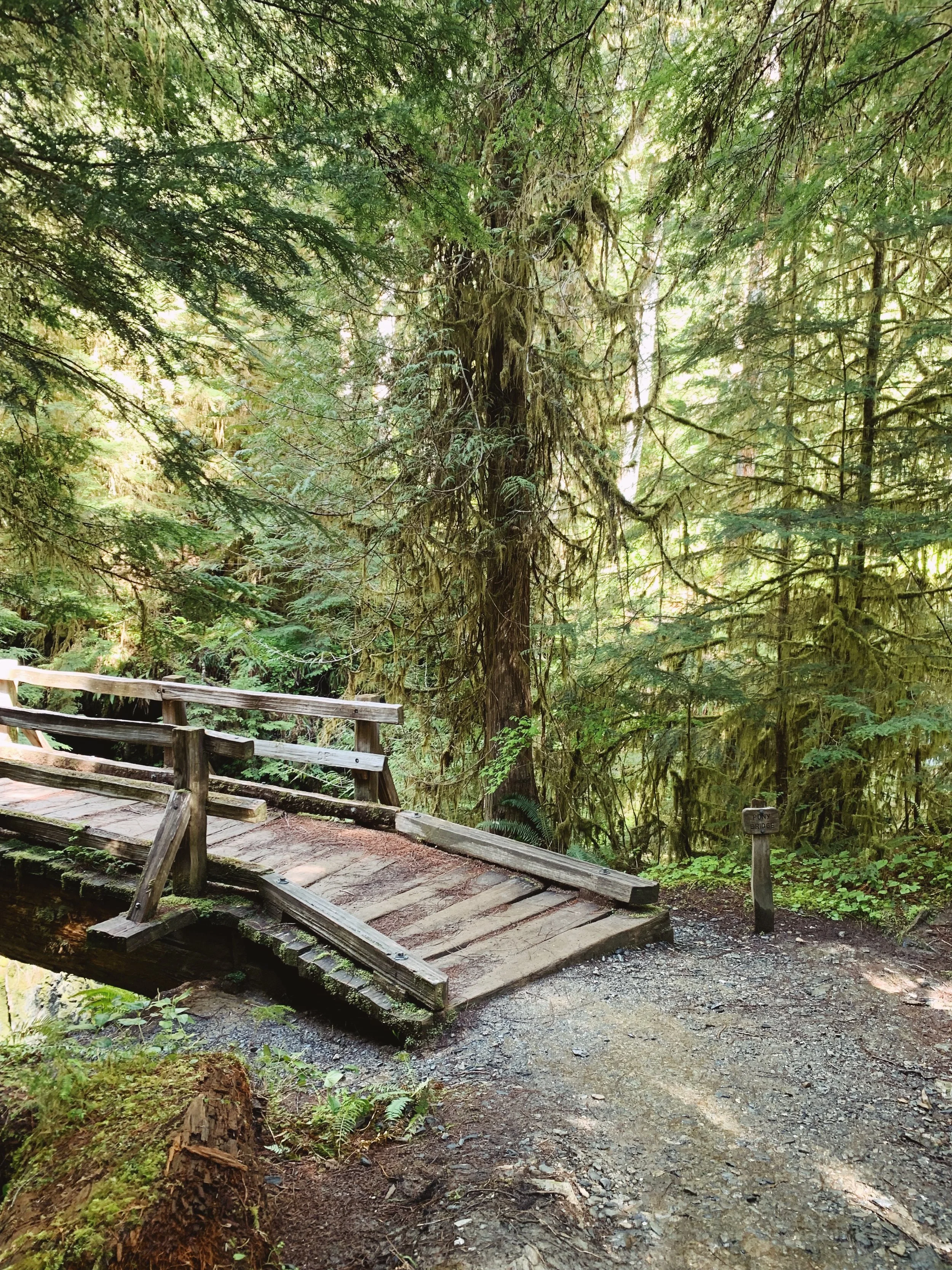
Shortly after I made it to Pony Bridge, I checked my phone to see how much I’ve hiked so far. Either my phone or my app was acting out because it indicated that I had already hiked 4 miles. In my head, I thought I was making really good time. But then I checked the photo I took earlier at the trailhead, there was no way in hell that I had already hiked 4 miles. Pony Bridge is located about 2.5 miles from the trailhead. The app definitely gave me false hope as I thought I was making really good time. But it was still early in the day. It was about 11am and I only had another 11 miles to go, right? I took a quick break and decided to continue on.
One of the many bridges on the Enchanted Valley trail - this one crosses over Pony Bridge

Another bridge crossing an unknown creek
Pony Bridge to O’Neil Creek
Mile 2.7 to Mile 7 | Elevation gain unknown
This section felt extremely long - possibly due to the fact that my GPS has stopped accurately keeping track of how many hikes I’ve done. I honestly wasn’t sure which mile marker I was at until I saw the sign to the O’Neil Creek camp. To be honest, hiking alone in the forest for more than 5 miles might not exactly be the best idea for my first backpacking trip of the season. I was terrified that once I turned a corner, I would run into a bear. Nonetheless, I made sure to talk out loud and even sang at parts of the trail when I would not see another person for at least an hour or so.
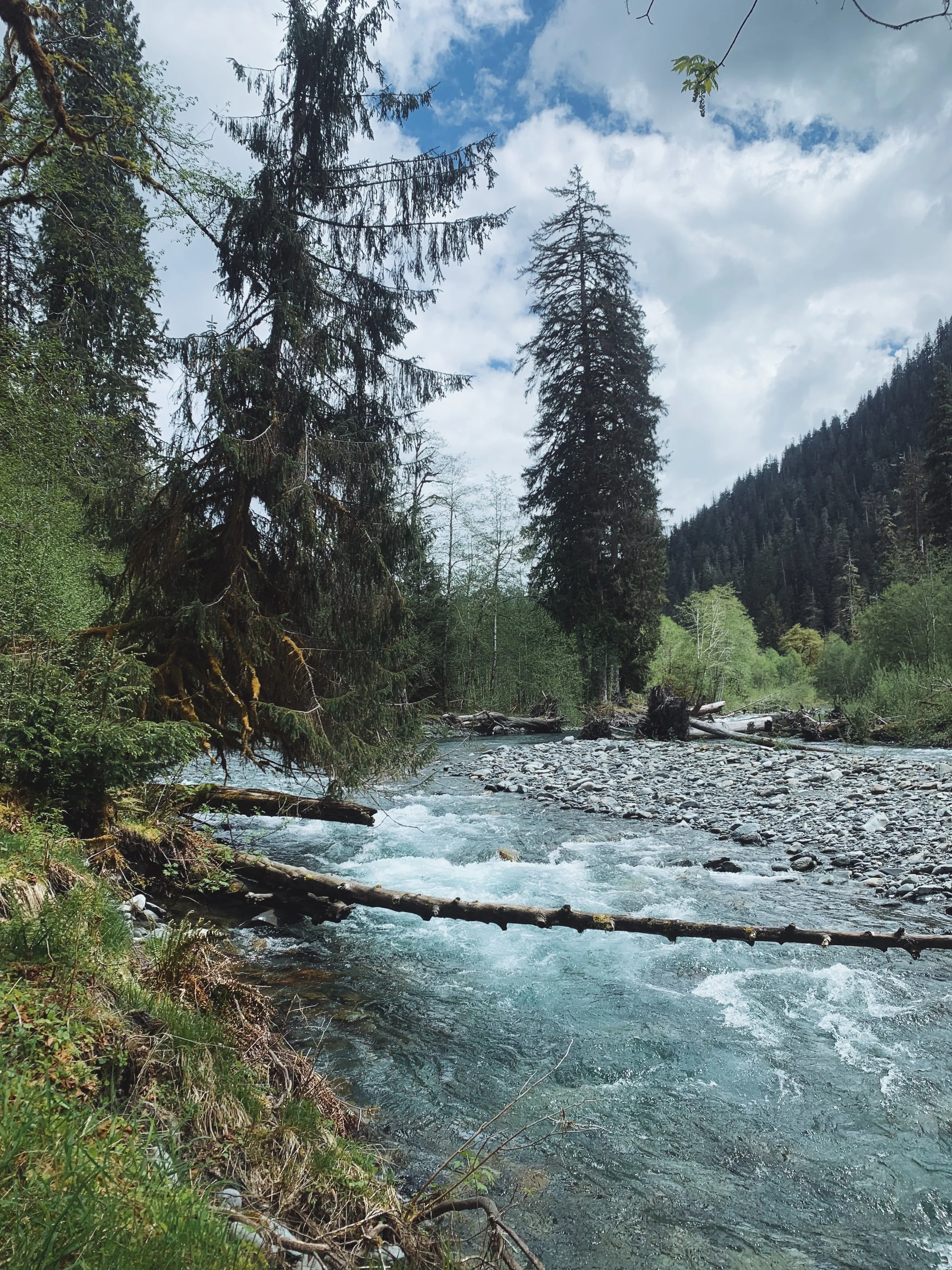
This section of the trail was more interesting than the hike between the trailhead to Pony Bridge though. There were lots of random spots along the trail where you could attempt to dip your toes in the cold East Quinault River. And of course, fill up your water bladder or water bottles if you need to. I made sure to take plenty of breaks because really, all I got was time. Since it was in May, the sun usually wouldn’t start setting until about 8. When I finally got to O’Neil Creek, I knew I was halfway to Enchanted Valley and all I needed to do was to power through for the rest of the trail.
O’Neil Creek to Pyrites Creek
Mile 7 to Mile 10 | Still have no clue what the elevation gain is
I don’t usually go for hikes that are more than 10 miles long mainly because 1) I haven’t gone on a thru-hike and 2) I avoid super long trails because I usually only have time for a day hike and knowing my abilities, I’d rather not have to stress out about hiking back in the dark. So hiking the Enchanted Valley trail was a brand new experience for me especially because I was hiking through bear country. Up until this point, I haven’t encountered any bears yet but I did start encountering more people that were either on their way into the valley or were hiking back out. I first encountered a group of people that were just chilling on the meadow and looking into the bushes. They informed me that there was a bear hanging out there. I didn’t try to look for the bear. I’d rather continue hiking since I finally ran into people for a first time in an hour. As I continued on, I saw a pack of elks just hanging out on the meadow as well. At this point of the trail, my morale was at an all time low - so to be able to spot the pack of elks motivated me to push through.
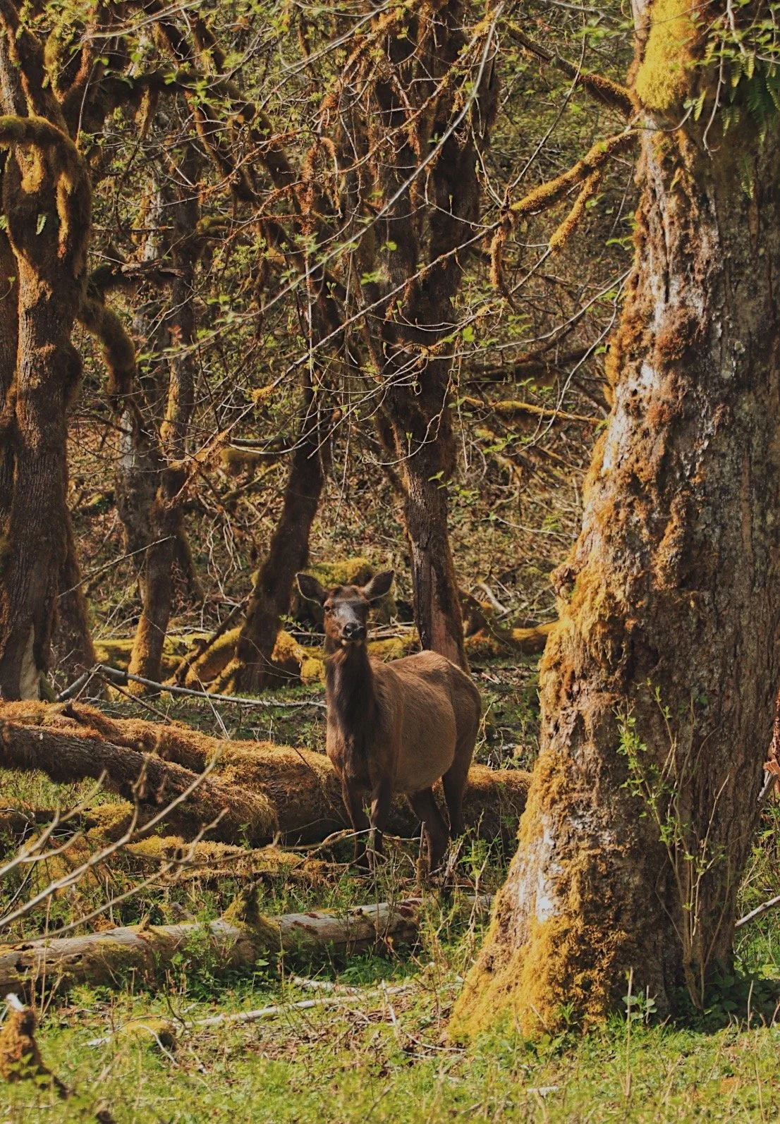
The elks were hiking in between the trees
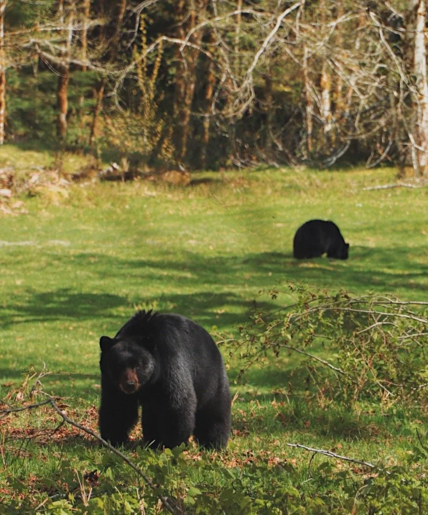
I felt like I was pretty damn close to the bears
As I slowly counted my steps (this became a regular thing to do on this hike), I ran into a couple of gals that warned me of a couple bears on the side of the trail. My first reaction was, ‘Are they close to the trail? Are they moving?’ - the gals reassured me that they weren’t close and just chilling. It eased my anxiety just for a bit as I continued to trek on.
They said the bears were located a quarter of a mile from where I was - my heart was racing. All I could think of was what if they decide to cross the trail and I made eye contact with them? I know black bears in the Pacific Northwest are considered to be a lot more mellow than grizzlies and brown bears but it didn’t quite make me feel better. A few more minutes of hiking later, I spotted the bears. They weren’t close to the trail but they weren’t crazy far either. I’d like to say I am relatively bear aware as I always try to do research on bear encounters because I do a fair amount of solo hikes. To be honest, once I saw the bears just hanging out and doing their own thing, all my anxiety disappeared. I took out my camera, thinking to myself that this might be the closest I would ever get to a bear because while I enjoyed seeing these furry creatures from a far, I know they can still be dangerous. I busted out my camera and snapped a few backs while mainly tried to stand in a visible spot that the bears acknowledge my presence. I even made eye contact with one of them but that was when I told myself that I needed to get the f out of there.
Pyrites Creek to Enchanted Valley
Mile 10 to 13.2 | The last hurrah
After the bear sighting, I was pretty over it at this point. I caught up to a group of gals hiking and ended up hiking with them for a little bit. However, they were hiking a little too fast for my liking because this being the first backpacking trip of the season, I was definitely a little out of shape and wasn’t quite prepared to do a 13.2 mile hike. I contemplated whether I should just stay in Pyrites Creek for the night and hike into Enchanted Valley the next morning to meet my friends. But the thought of sleeping alone in the woods with bears around seemed a little daunting despite having done a few solo trips in the past.
I pushed on. My GPS had completely lost track of how much I was hiking so I decided to just start a new track to give me new motivation. I’m the type that likes to constantly refer to my map to see how far I still have to hike. I do the same when I go on road trips and honestly, I don’t recommend it. It actually creates a sense of drag when you’re feeling absolutely exhausted.
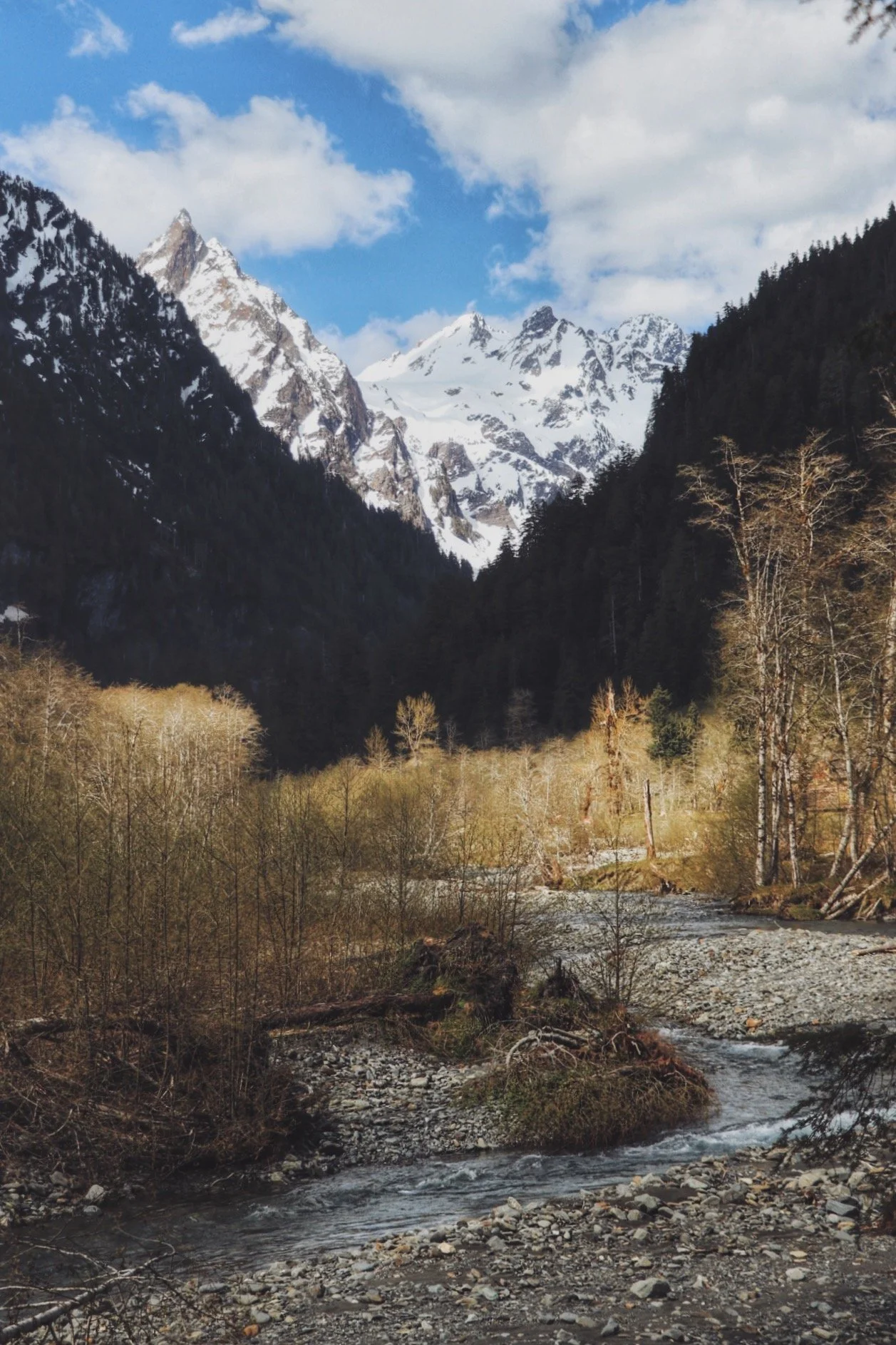
The trail occasionally opens up along the East Quinault River

So close! This was the last bridge I needed to cross to get to the valley
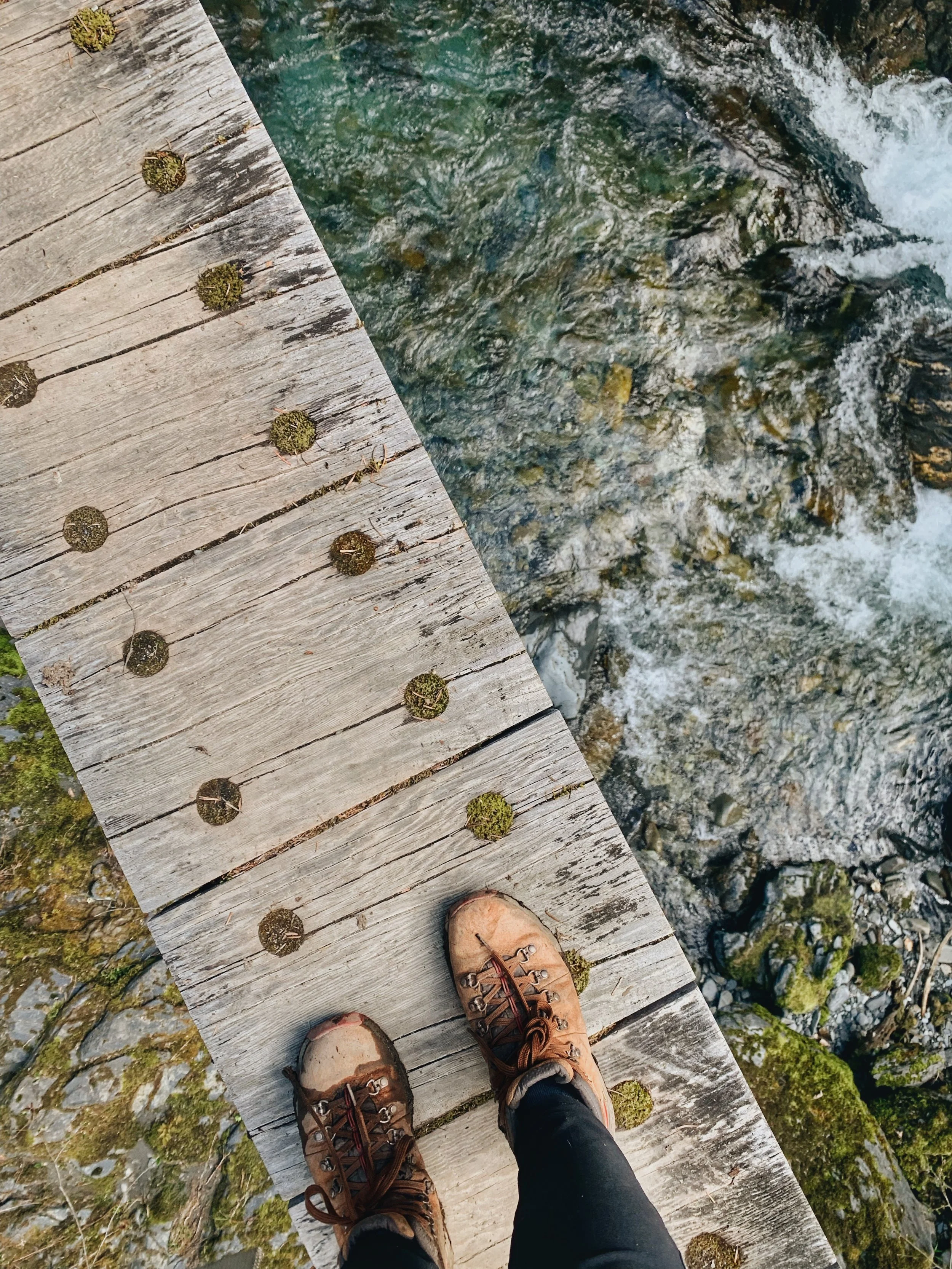
On the bridge!
This section of the trail was actually quite enjoyable, minus the fact that my feet were screaming at me. While the majority of the time I was hiking through old grown lush forests, I was nice to get the occasional river views. The trail was definitely muddy at times but I had trekking poles with me the entire time and mud was just mud - they would dry off and life goes on.
The last meadow I had to hike before I got to the bridge that crossed into Enchanted Valley felt endless. In my head, I was so focused on the trail opening up to these grand views (based on what I’ve seen in previous reports) that I barely paid attention to my surroundings. It turned out the meadow was quite pleasant - which was something I learned when I hiked out the next day.
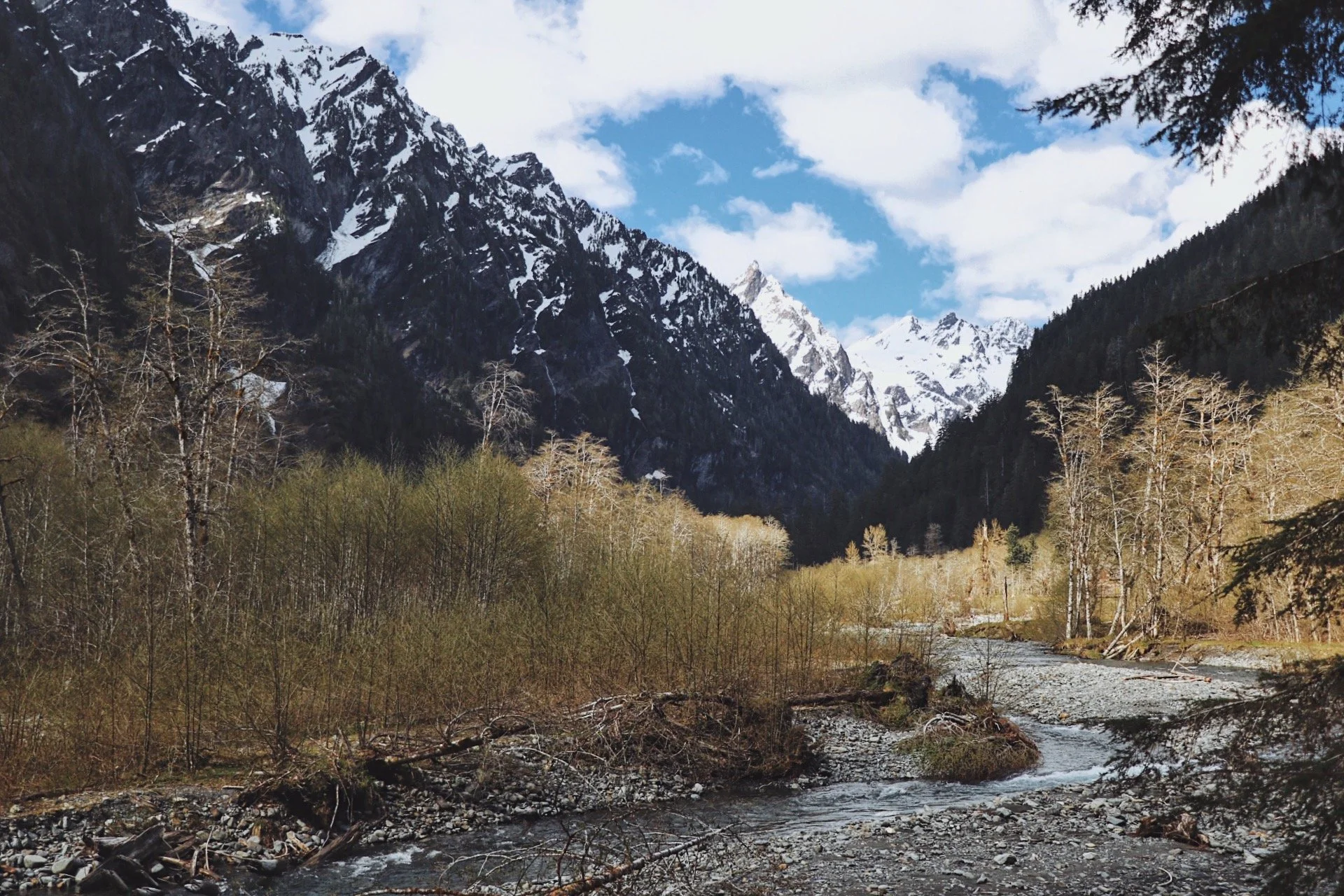
Finally at Enchanted Valley! Maybe not quite - but this view definitely made me excited all over again.
Enchanted Valley
Mile 13.2 | So much yassss
After hiking 13.2 miles - I finally made it to Enchanted Valley. I was almost in tears but of course, the trail didn’t make it easy for any of us. There was a brief river crossing. While I didn’t mind getting my shoes wet, I’d rather not so I stepped precariously on this log and crossed it. I thought I was going to tip over and honestly, it wouldn’t have mattered if I did. I saw a couple of gals that were also doing this as their first backpacking trip of the season. We traded laughs and I was well on my way again to the valley.
Entering the valley was like a dream come true. I’ve seen photos of this area so many times and they were often really overcast and gloomy shots of the valley. The weather gods were on our side this day. The valley opened up to snowy peaks in the distance and waterfalls quite literally shooting out of rocks due to snow melt from higher elevations.
The last 0.2 miles of the hike wasn’t so straightforward but I didn’t care. I was sharply focused on locating my friends and setting my pack down. Good thing they weren’t hard to find.

The infamous chalet at Enchanted Valley
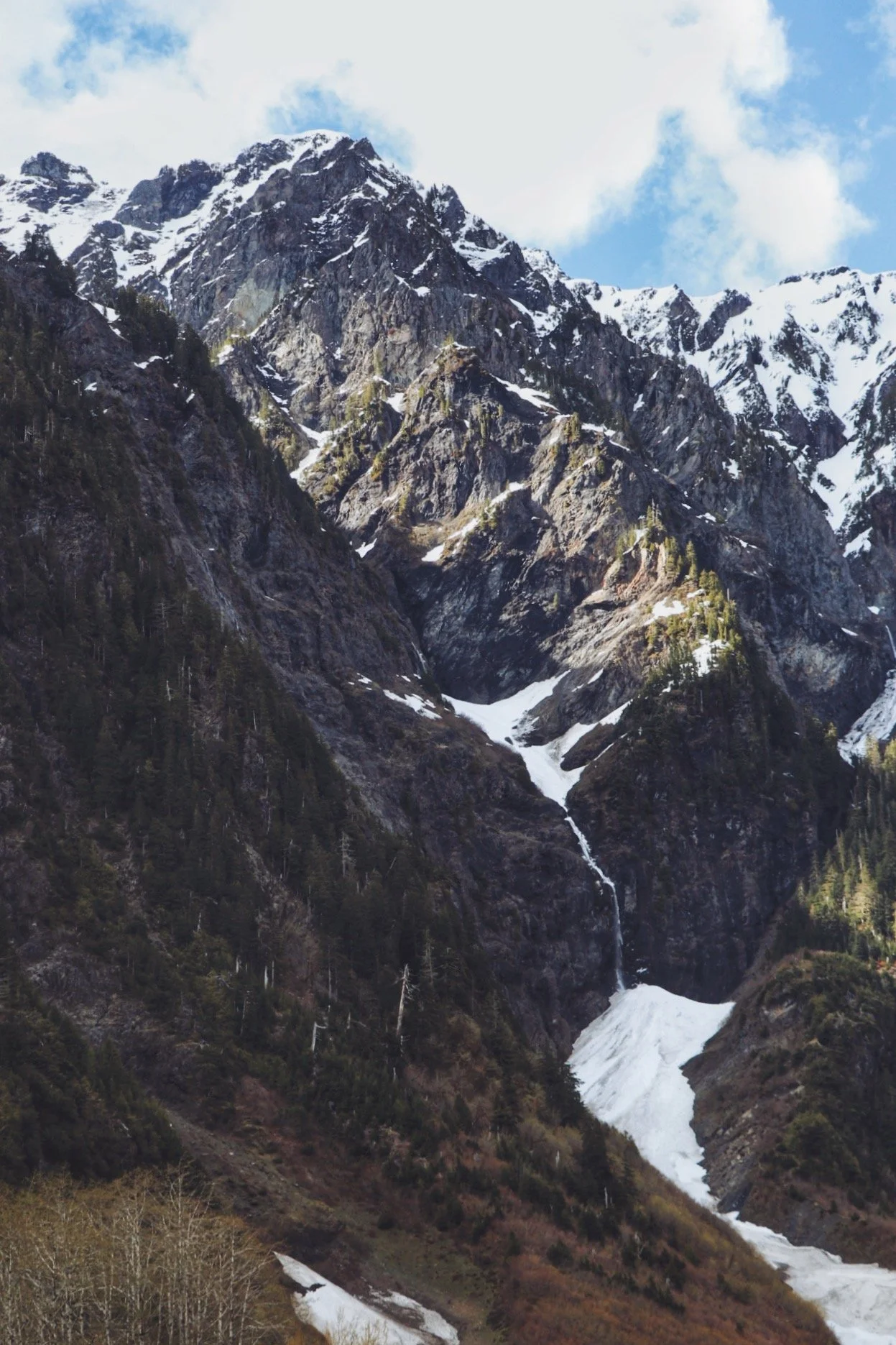
Waterfalls shooting out of the side of the mountains
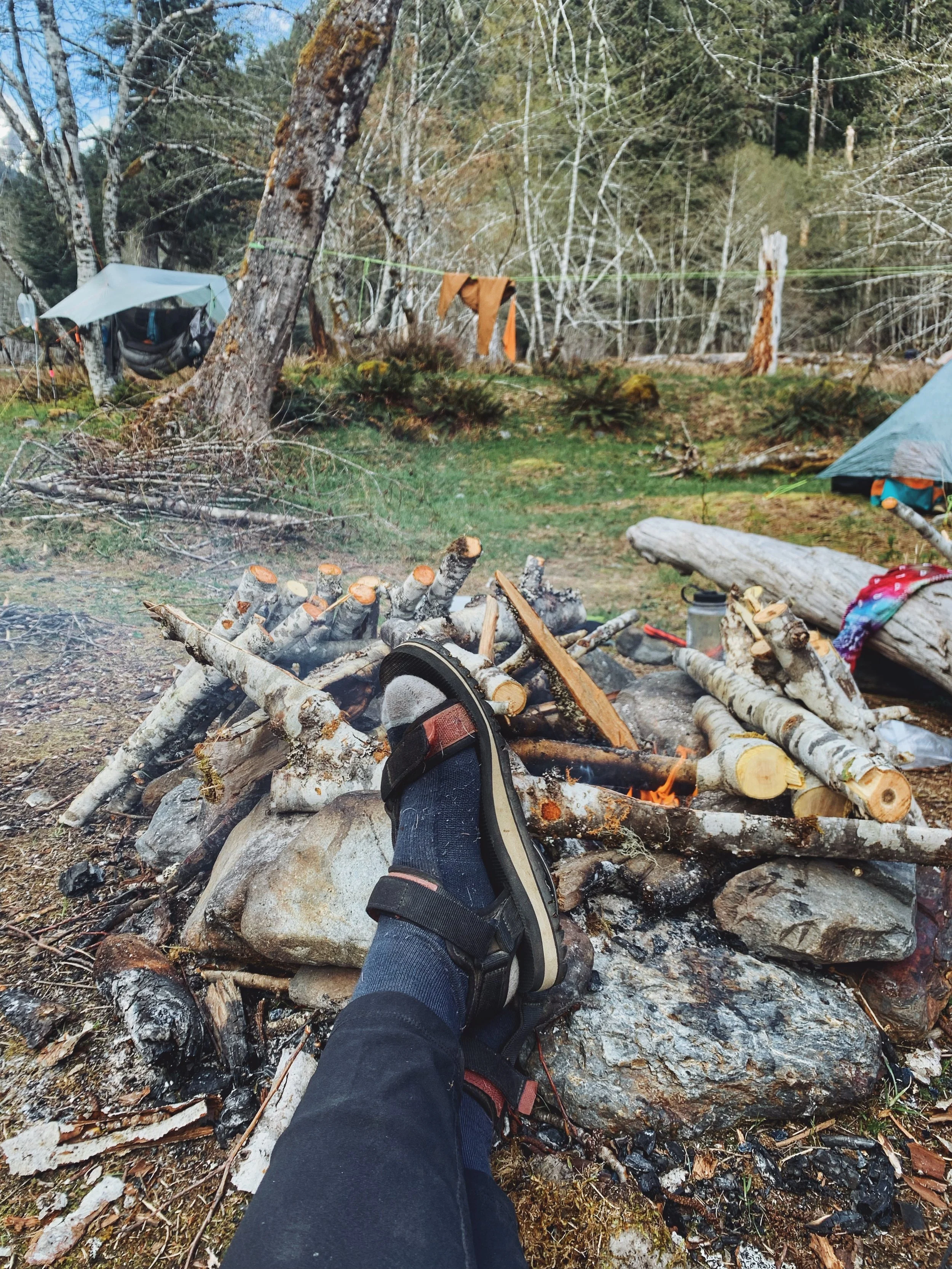
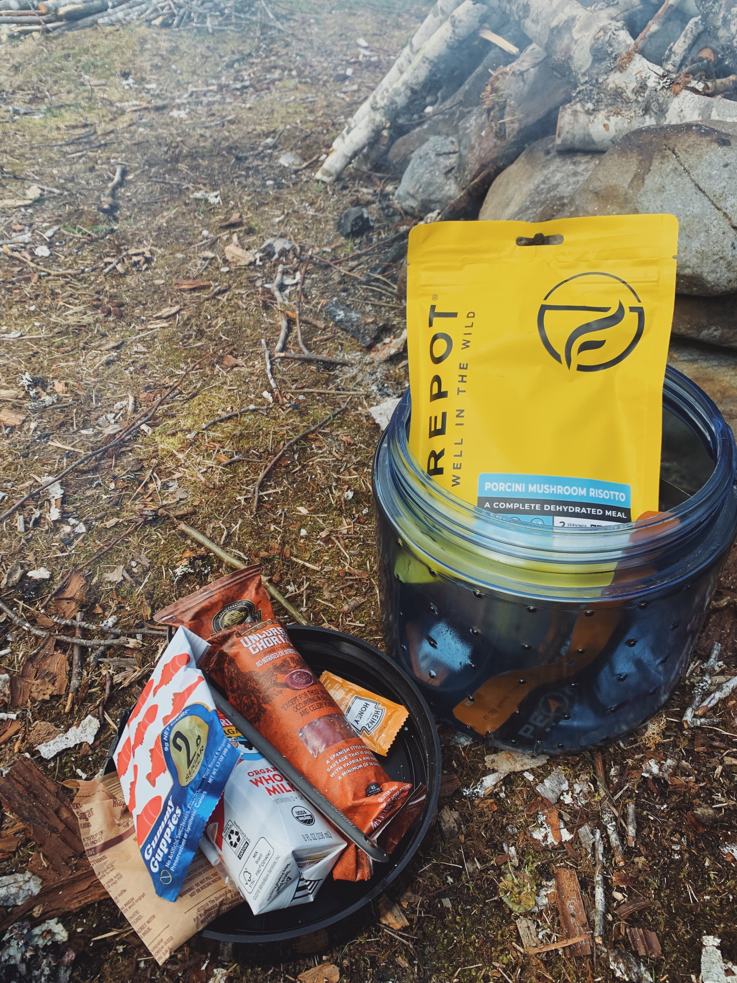
After I located my friends, I took off my pack and sat down for a good 15 minutes before I had the energy to set up my tent and everything else. I was happy to see them already have firewood gathered and the night was going to be good. The temps were supposed to drop to probably the low 40s so having a fire would be much preferred. But always check fire restrictions before heading out to a hike to see if there’s a ban in effect.
Views were everywhere!
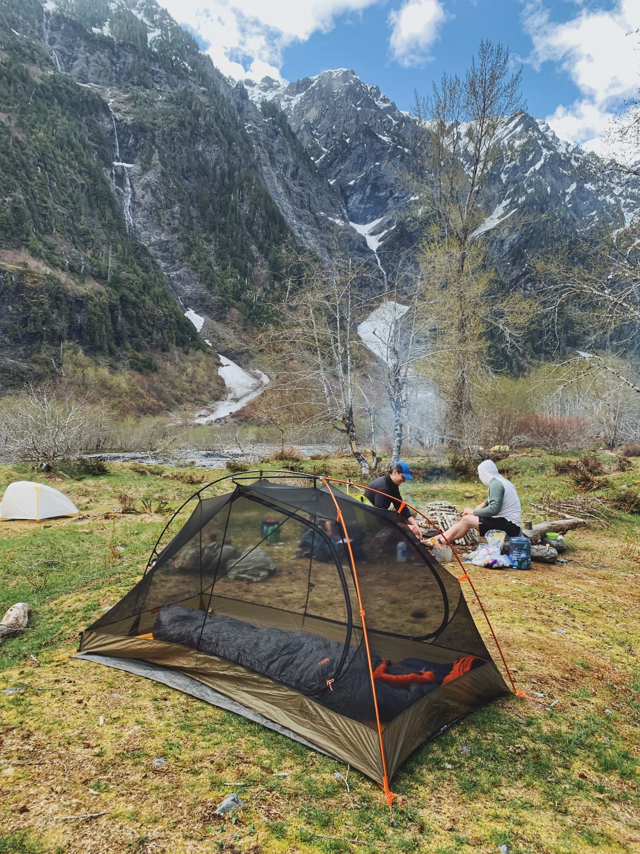
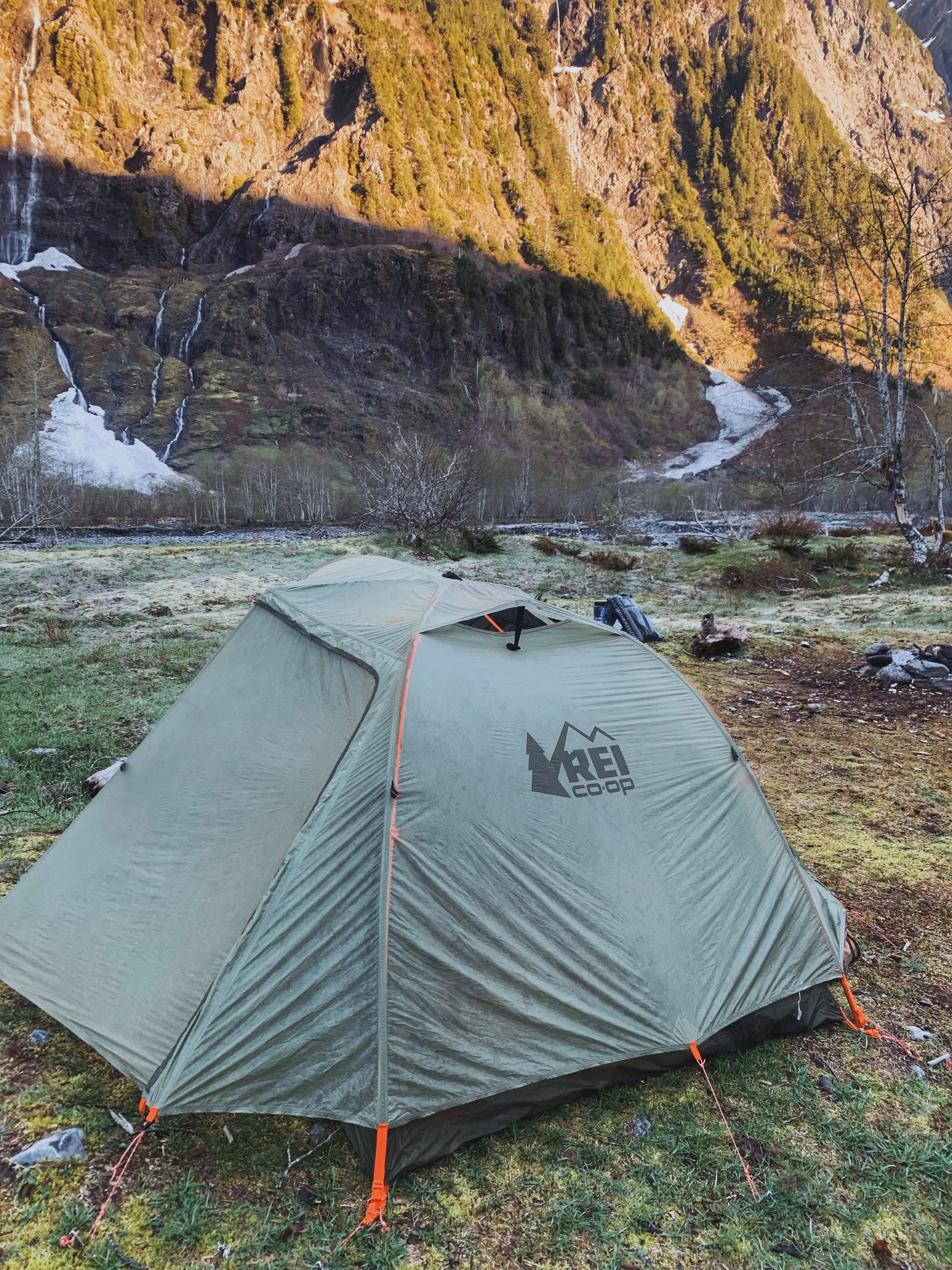
One of the prettiest campsites I’ve camped at
I spent the rest of the hike resting my body and hanging out with my friends. In my head, I was thankful and so proud of myself for being able to power through until the end of the hike. When other trip reporters mention that the hike isn’t really worth it until you hit Enchanted Valley, I’d probably say the same. This is not to say that I don’t recommend this hike to anyone but if you have time, I would definitely do this as a backpacking trip so you have more time to explore the area.

Heading back to the trailhead
I slept so good in my tent while camping in Enchanted Valley and that’s usually pretty rare for me on a backpacking trip. I suppose my body really needed to rest after pushing myself to do 13.2 miles. I took my time in the morning soaking in the views once again. At around 8:30am, I began to pack up and started my hike out. The hike out seemed a lot easier. It was probably because my body didn’t feel as stiff anymore and that I really didn’t feel any pressure hiking out as fast as I needed to. I stopped more often to take the necessary breaks and take photos of the views I saw yesterday because I was too tired the day before.
I ran into my friends once I got to O’Neil Creek (they are faster hikers and they actually had a time crunch) and we sat down and enjoyed some tuna tacos. After that, we went our own separate ways again as I continued to slowly traced my steps back to my car.
By the time I got to my car, it was roughly 2:30pm and I actually made better time today than the day before in terms of hiking time. The only ‘difficult’ part of the hike back was gaining all the elevation gain before getting back up to Pony Bridge. The weather was also significantly warmer and that section was more exposed than most of the trail. I huffed and puffed and made sure to stay hydrated and continued on. The last mile of the trail seemed like an eternity - I guess hiking anything more than 10 miles really did eventually put a dent in my soul. While walking through the forest was nice, I sometimes do wish for better views.
Overall, I would 10/10 recommend this trail to anyone that’s looking to do a moderate backpacking trip. I only rate it as moderate due to the length of the trail. The elevation gain is minimal. There were a few blowdowns on the trail and after a night of rain, the trail can indeed get muddy but it doesn’t require any technical skills.
A new layer of frost developed overnight.
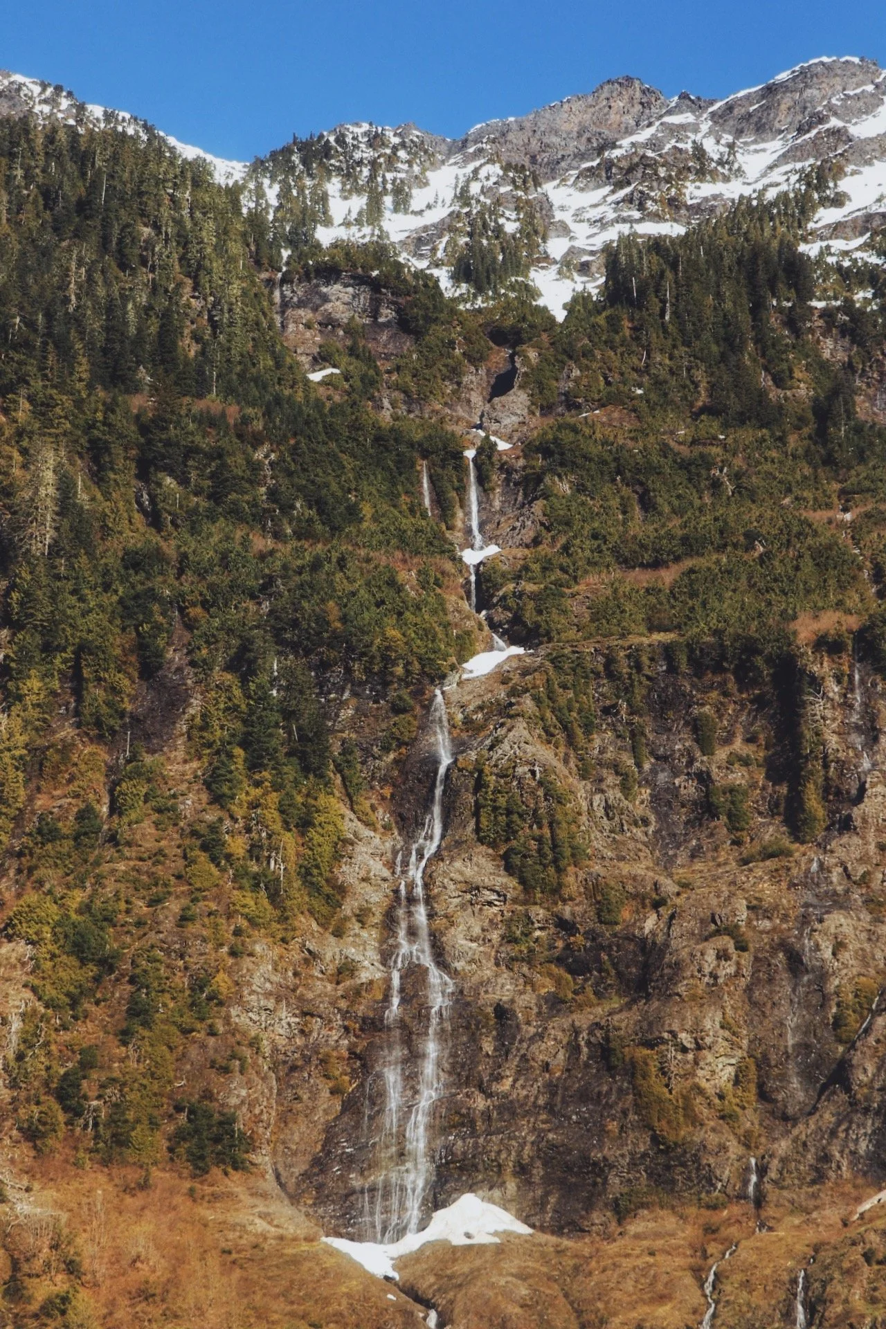
The sun was shining directly onto this side of the peaks today, so more waterfalls!
Resources:
How to Get Your Wilderness Permits at Olympic National Park - they’re required to camp in the backcountry
Stats of Gaia GPS and includes a map (note that I forgot to stop the recording).
The 7 Leave No Trace Principles - always a good idea to brush up on these!
Where to rent a bear can (it’s required!) - you can either pick one up from the Ranger Station or rent one from REI
Happy trails y’all 🥾