
A Guide to Death Valley National Park: What to Do and See

Sunset along the Golden Canyon trail in Death Valley National Park.
There’s something about the stillness of the desert that keeps calling me back.
While I grew up road-tripping through the American West with my family, it wasn’t until I began traveling solo that I fully appreciated Death Valley National Park’s quiet, powerful beauty. I’ve visited Death Valley more than once and every time, it’s offered something new. This place holds an abundant of memories for me—from sunrise hikes to spontaneous detours and side trips to the kind of solitude that can only be found one of the hottest and driest places on Earth.
In this guide, I’ll share my favorite spots in Death Valley National Park, tips for camping solo, exploring the park with a dog, and how to make most of your time in the park—whether it’s your first visit or fifth.
Start Here👇
A Brief History of Death Valley

During the California Gold Rush in the mid-1800s, European Americans first entered the valley often under harsh and deadly conditions, hence the name ‘Death Valley’. Despite its harsh climate, the area saw mining booms for borax and other minerals in the late 19th and early 20th centuries. The area was declared a national monument in 1933 and was later upgraded and established as a national park in 1994. Today, it protects not only an extreme and stunning desert ecosystem but also a rich and complex history.
Death Valley National Park is located on the traditional lands of the Timbisha Shoshone people, who have lived here for generations. This land was taken without consent and honor the resilience of the Timbisha Shoshone Tribe, who continue to protect and steward their ancestral homelands. In 2000, after decades of advocacy, the Timbisha Shoshone Homeland Act was signed into law, returning a portion of their ancestral lands and officially recognizing their sovereign rights within the park.
To learn more or support their work, visit the official site of the Timbisha Shoshone.
Interesting Facts About Death Valley
Mesquite Sand Dunes during sunset - I landed in Las Vegas the same day and drove straight into the national park to see the full moon.
It’s the hottest and driest place on Earth:
In July 1913, Death Valley recorded a temperature of 134°F (56.7°C) at Furnace Creek—the highest air temperature ever recorded on Earth. Some years, the park receives less than 2 inches of rainfall. That’s less than the Sahara Desert in some seasons.
You can visit both the lowest and one of the highest points in the U.S. in a day.
Badwater Basin is 282 feet below sea level, and just 85 miles west is Mount Whitney—at 14,505 feet, the tallest peak in the lower 48.
The landscape was shaped by volcanoes, shifting tectonic plates, and flash floods.
Those dramatic salt flats, colorful canyons, and crater-like features are the result of millions of years of geologic activity.
The park is huge.
Covering over 3.4 million acres, it’s the largest national park in the lower 48 states.
Visiting Death Valley with Your Pet

Tex hanging out with me as I made breakfast at the Furnace Creek Campground.
Dogs are allowed on all campgrounds, paved and unpaved roads, developed areas and outside of buildings as long as they are leashed under 6ft.
Find out more information on how to visit Death Valley with your pet on the official NPS website here.
I camped at Furnace Creek Campground so it was easy to have Tex hang out while I was at camp. I took him to the side of the roads towards Badwater Basin. The last spot we went together was the Mustard Canyon Road - instead of driving, I decided to walk Tex along the road. While these roads don’t offer the best views, it’s a great way to explore the park with your furry friend.
If you don’t want to miss out on hiking then I highly recommend staying at one of the pet-friendly lodging options within the park:
Best Time to Visit Death Valley
The best time to visit Death Valley National Park is from late fall to early spring, specifically between November and March. Here’s why:
November to March – Ideal Season
Temperatures: Daytime highs range from 60°F to 80°F (15°C to 27°C), making it perfect for hiking and exploring without melting.
Crowds: Winter is popular, but the park never feels too crowded due to its size.
Camping & Stargazing: Cool nights are great for cozy camping and unbelievably clear night skies.
February to April – Wildflower Season (If You're Lucky)
In years with decent rainfall, superblooms can carpet the desert with wildflowers—especially around Badwater Basin and the alluvial fans near Furnace Creek.
I personally would avoid visiting the park outside of this window. I’ve been to the park in October and the temperatures felt extremely high.

The classic cracked ground in the desert.
What to Do in Death Valley

In the map below, I’ve included all the campgrounds available in the park. I’ve included the hikes and scenic drives I have personally done before. I included two spots to visit if you happen to have time to spare while visiting Death Valley National Park - Alabama Hills and Ryolite - a ghost town with very interesting art installations.
Camping in Death Valley

I’ve camped at Furnace Creek Campground every time I’ve visited the park. The winds can really pick up at night so having a tree as coverage is ideal.
I’ve camped at Furnace Creek a few times now, and it’s a solid base for exploring. It has actual bathrooms, potable water, and even a little general store nearby. If you’re new to camping solo, it’s a good option.
Death Valley has a few other campgrounds:
Furnace Creek Campground: Best for amenities and location. Reservations recommended during cooler months.
Texas Springs: No hookups, but beautiful views and quieter than Furnace Creek. First-come, first-served.
Sunset Campground: A big gravel lot, popular with RVs. Not glamorous, but affordable and close to Furnace Creek.
Wildrose Campground: At higher elevation, so it’s cooler. A bit farther out and more primitive. Worth it if you want more solitude.
Furnace Creek Campground is the only campground that is open year-round. This campground has 136 total sites with 18 being sites with a hookup, 45 tent-only sites and 35 walk-in sites. During the peak season, October 15 to April 15, reservations are highly recommended. In the off-season, only 41 sites remain open. I’ve camped at the walk-in sites and the walk from your vehicle to your site is generally short but expect little to no privacy at times.
Other campgrounds that are open outside the October 15 to April 15 window are Emigrant Campground, Wildrose Campground, and Mesquite Spring Campground.
Hiking in Death Valley
Below are some of my favorite hikes that I have actually done when visiting the park. I can’t remember how many times I’ve visited Zabriskie Point but this will always be my favorite spot for sunrise or sunset.
It gets hot hiking in Death Valley even during the cooler months - remember to bring plenty of water and sunscreen when you hit the trails!
Golden Canyon / Zabriskie Point


Length:
3 to 8 miles
Elevation Gain:
535 to 834 feet
Difficulty:
Easy to Moderate
I’ve hiked the Golden Canyon Loop a couple of times now, though I’m still not entirely sure I’ve followed the official trail route according to the Death Valley National Park website. Both times, I started from the Zabriskie Point parking lot and followed a trail that winds deep into the canyons. There’s some signage along the way, but once the trail opens up, it’s easy to lose track of the exact path. Still, it’s one of my favorite hikes in the park—the elevation gain felt manageable, and I believe I made it as far as Red Cathedral, where you’re rewarded with a stunning overlook of the surrounding badlands. I think my app tracked about 3.63 miles and 453 feet of gain.
Golden Canyon lives up to its name—the canyon walls truly glow with golden hues when the sunlight hits just right.
If hiking’s not on your agenda, Zabriskie Point itself is absolutely worth a visit for sunrise or sunset. The parking lot is small, so try to arrive early if you can. Even if you only hike a short section of the trail, it takes you down into the base of the badlands and offers a unique perspective of Zabriskie Point from below.

Zabriskie Point at sunrise - December 2022.

Red Catherdral - January 2020.

The type of view you get when hiking the Golden Canyon trail at sunset.
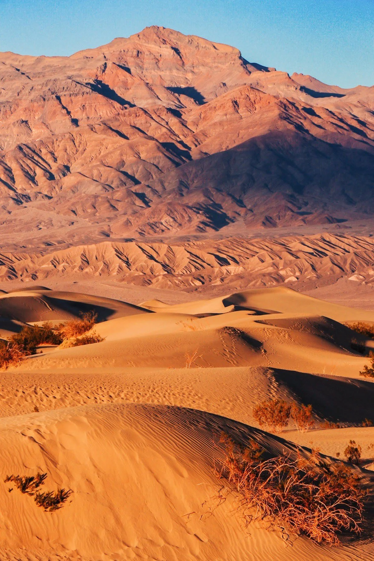
Mesquite Flats Sand Dunes

Length:
2 miles
Elevation Gain:
185 feet
Difficulty:
Easy to Moderate
The Mesquite Flat Sand Dunes was the very first place I ever hiked in Death Valley National Park, and it left a lasting impression. I had just landed in Las Vegas and made the drive out to the park, stopping by the visitor center as soon as I arrived. The ranger on duty suggested I head straight to the dunes—especially since it was a full moon that night. I’m so glad I listened. Watching the sun dip below the horizon while the moon rose over the rippling sand was one of the most magical desert experiences I’ve had.
What I love about the Mesquite Dunes is how unstructured the experience is. There’s no set trail—just soft, rolling hills of sand that you can wander freely. Whether you want to find a high vantage point or a quiet pocket away from others, it’s easy to carve out your own little slice of solitude. And because the area is open and relatively flat, it’s not too hard to find your way back to the parking lot, even as it gets darker.


I’ve been back once since that first visit, again for sunset. While the colors were just as beautiful, nothing quite compares to that first night—watching the full moon rise over the golden dunes, completely alone, and feeling like I had the entire desert to myself. It’s still one of my favorite memories in the park.
Ubehebe Crater

Length:
1.5 miles
Elevation Gain:
500 feet
Difficulty:
Easy to Moderate
Ubehebe Crater is a massive volcanic maar—roughly half a mile across and up to 777 feet deep—formed by steam-triggered explosions when magma met groundwater. It’s the largest and most recent of the Ubehebe volcanic field—likely formed around 2,100 years ago, though some evidence points to an age between 800 and 2,100 years
I haven’t visited Ubehebe Crater ever since I did my first solo trip to Death Valley in January 2020. I remember the drive was long so definitely keep that in mind if you have limited time in the park. I think it is about 55 miles from Furnace Creek to Ubehebe Crater. What makes it more difficult is that the Scotty’s Castle Road has been closed in recent years due to flooding.
It felt really cool to be able to walk right on the rim of the crater and that’s when you realize how small you are. I went super early in the morning because I had other items on the agenda. But according to Google, it might be a cool time to visit the crater in the afternoon when the light hits the depths of the crater.
Dante’s View

Length:
1 mile
Elevation Gain:
~200 feet
Difficulty:
Easy
If you're looking for the most jaw-dropping view in the park, Dante’s View is it. Perched 5,575 feet above Badwater Basin on the edge of the Black Mountains, this overlook gives you a sweeping panorama of Death Valley below and the Panamint Range beyond. The salt flats look like a swirling white canvas—and if you’re a Star Wars fan, you might recognize it as the stand-in for Mos Eisley.
It’s a favorite spot for sunrise and sunset, especially for photographers. Even though it’s a well-known destination, it’s easy to find a quiet spot—just take a short walk along the ridge to the north.
Badwater Basin

The infamous sign at Badwater Basin.
Badwater Basin is potentially the only place I remember visiting when my dad took us to Death Valley. I thought it was appropriate to come back and check it out myself.
This is one of those places that feels like another planet. At 282 feet below sea level, it’s the lowest point in North America, and standing on the vast salt flats surrounded by mountains is truly surreal. The ground is covered in white, hexagon-shaped salt patterns that stretch as far as the eye can see. It’s especially stunning at sunrise or sunset, when the light softens and the textures really pop.
There’s a short, flat walk from the parking lot that takes you out onto the basin. You can go as far as you want—just keep an eye on the heat and your water. I’ve visited more than once, and it never gets old. It’s one of those must-see spots that really captures the wild contrast of Death Valley.
Harmony Borax Works
Just a quick stop off the main road near Furnace Creek, Harmony Borax Works offers a glimpse into Death Valley’s mining history during the late 1800s. It was once a major hub for borax production—think “20 Mule Team” wagons hauling minerals across the desert. There’s not much left besides ruins and interpretive signs, but it’s a fascinating spot that ties together the story of California’s mining boom. Even without photos, it’s a worthwhile stop to stretch your legs and learn something new.
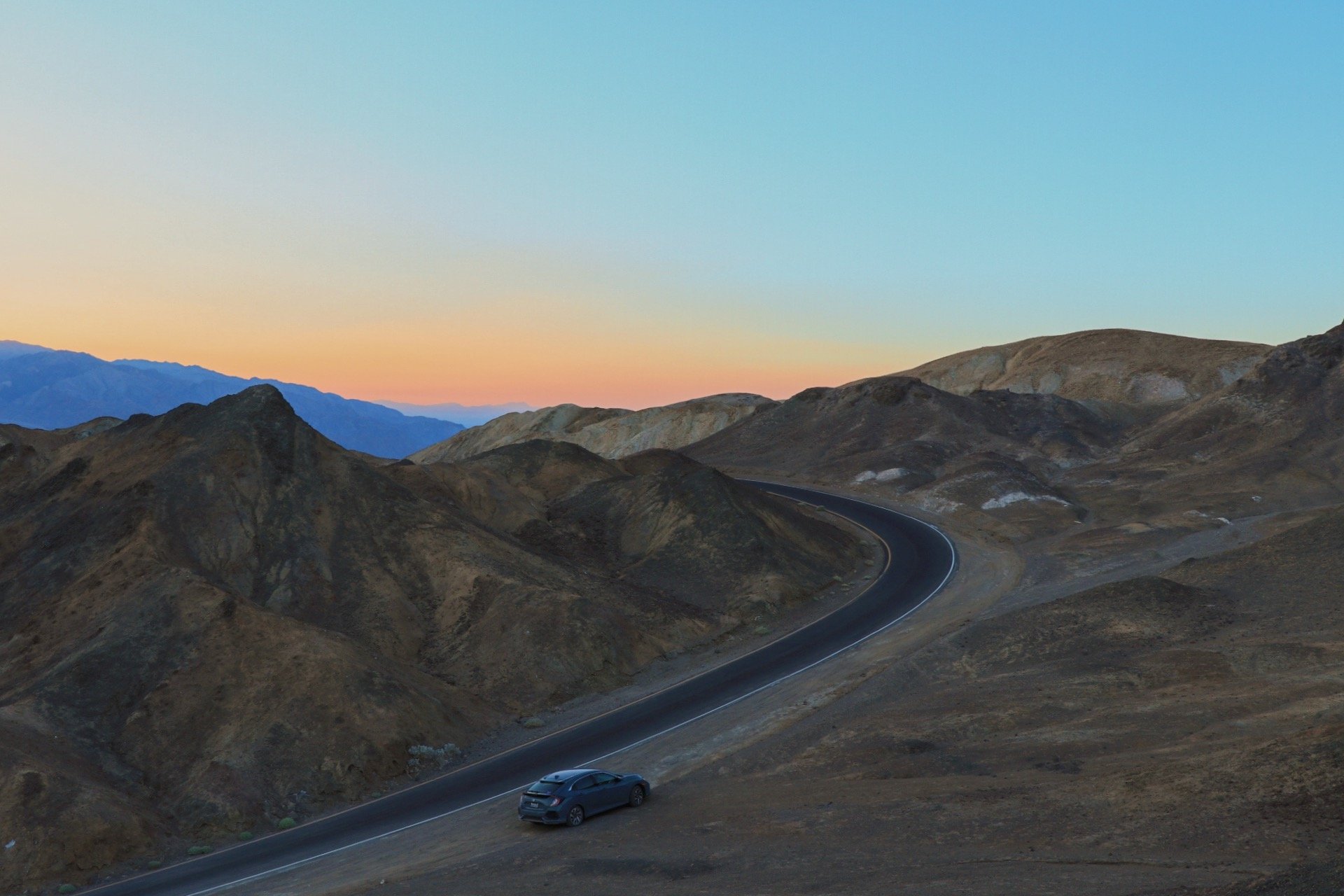
Scenic Drives in Death Valley

If hiking isn’t on your agenda, there are plenty of ways to explore Death Valley in your car. Below are a few of my favorite roads to drive on. Don’t forget to get out occasionally to stretch your legs and soak in the views.
Artist Palette
If you search for Death Valley on social media, chances are you’ll come across a photo of Artist’s Palette—the colorful rock formations along Artist’s Drive that look like they’ve been splashed with pastel paint. It’s definitely a popular spot, and while I’ve done the scenic drive twice, I’ve never actually hiked down to that iconic viewpoint. From what I understand, it's technically off-trail, and both times I visited, it was pretty crowded—not really my scene.
What has stuck with me is something a ranger told me during my 2020 visit: “Just pull over anywhere and explore.” That simple advice completely changed the way I experienced the park. Sure, the random pullouts might not lead to Instagram-famous views, but they’ve led me to quiet, beautiful spots that felt like my own personal discoveries.
Driving through the park has honestly become one of my favorite ways to explore—especially with Tex. He’s able to hop out and roam a bit with me (on leash, of course), and it’s a great way to see more of the landscape without overheating your pup. If you’re traveling with a dog, or just want a more laid-back way to explore, I definitely recommend choosing the scenic pullout-and-wander approach.


Devil’s Golf Course

Devil’s Golf Course is one of the most bizarre spots in Death Valley—a field of jagged, spiky salt formations that look like something from another planet. It’s easy to access right off Badwater Basin Road and makes a quick, dog-friendly stop. There’s no trail here, just a rough landscape to explore carefully (watch your step and your pup’s paws!). The salt even crackles in the heat if you listen closely. Short and surreal, it’s well worth the detour.


Badwater Basin Road


Badwater Basin Road is one of my favorite ways to explore Death Valley—especially if you’re traveling with a dog or just want a more relaxed, unstructured adventure. This main road runs south from Furnace Creek and connects you to several of the park’s most iconic spots, including Golden Canyon Trailhead, Artist’s Palette, Badwater Basin, and Devil’s Golf Course.
Since pets aren’t allowed on most hiking trails, this drive is a great alternative. Dogs are welcome along the road and at developed pullouts, so it’s easy to stop, stretch your legs, and soak in the scenery without breaking park rules. I love how flexible it feels—no itinerary required. Just pull over where it looks interesting and go for a short walk (with your pup on leash, of course).
Whether you're chasing golden light at Artist’s Drive or catching the surreal salt flats at Badwater, this drive is a must-do—dog or no dog.
Mustard Canyon Drive
Mustard Canyon Drive is a short, unpaved loop just off the main road near Furnace Creek, and it’s a great little detour—especially if you're exploring by car or with a dog. The drive winds through soft yellow hills that resemble—you guessed it—mustard. It’s not as dramatic as some of the park’s other landscapes, but it’s a fun way to get a closer look at the badlands without hiking. Plus, it’s dog-friendly and usually pretty quiet, making it a nice break from the more crowded stops.
Twenty Mule Team Canyon
Twenty Mule Team Canyon is one of my favorite drives in the park—a narrow, winding one-way road that weaves through golden badlands and tight canyon curves. It’s only about 2.5 miles long, but it feels like a mini adventure. The name comes from the famous twenty-mule teams that hauled borax out of the valley in the late 1800s—an essential part of Death Valley’s mining history.
The road is unpaved but usually passable by most vehicles, and it's dog-friendly too. There are plenty of little pullouts where you can stop, snap photos, or just take in the strange and beautiful landscape. If you love scenic drives with a bit of drama, don’t skip this one.
Side Trip - Visit Ryolite!
I’m not going to lie—visiting Death Valley with a dog can be a little tricky. While camping at Furnace Creek, I found a bit of cell service near the General Store and decided to look into nearby spots that might be easier to explore with Tex. In past years, I’ve entered the park from Beatty, Nevada, a small desert town I originally stumbled upon after booking a last-minute Airbnb. Turns out, it’s a hidden gem.
If you’re in the area and looking to expand your adventure beyond the park, Ryolite is a town worth checking out:

Ryolite
Just outside of Beatty, Nevada and about 40 minutes from Furnace Creek, Rhyolite is one of the most memorable detours you can take near Death Valley. Once a booming gold rush town in the early 1900s, Rhyolite was home to thousands of people—complete with a bank, a school, a train station, and even an opera house. But like many mining towns, the boom didn’t last long. Within a few years, it was abandoned, leaving behind crumbling buildings and empty streets.


What makes Rhyolite especially unique today is the mix of historic ruins and modern desert art. Right next to the ghost town is the Goldwell Open Air Museum, a bizarre and beautiful outdoor art space with larger-than-life sculptures set against the open desert backdrop. Think ghostly figures made of plaster, a giant pixelated miner and penguin, and other surreal installations that seem to appear out of nowhere.
It’s free to wander, dog-friendly, and incredibly photogenic—especially around golden hour. Whether you're into history, offbeat art, or just love weird roadside finds, Rhyolite is a must-see stop that feels like its own little universe.
Why I Keep Coming Back
I have visited the park 3 times in the last 4 years. There’s something about the stillness of the desert that keeps calling me back. Death Valley might seem barren at first glance, but when I travel solo—especially when I’m camping—I notice more. I hear more. The silence isn’t empty; it’s grounding.
Every time I visit Death Valley, there are always new revelations and discoveries.
On my first solo trip, I stopped by the visitor center and a ranger told me to pull over anywhere and “just hike.” That simple advice changed how I explore the park. I stopped chasing checklists and started chasing solitude. I’ve found myself wandering along unmarked washes, watching the light shift across the badlands, and sitting in sand dunes under a full moon, far from any noise or people.
Resources

I hope you enjoyed this guide to visiting Death Valley and hope that you are able to find some inspiration on what to do while you are in the area. I’ve included some resources below to help plan your visit better!
NPS “Things to Do” & Park Guide: The National Park Service’s official hub offers everything from trail maps to pet regulations and trip-planning tools.
Renee Roaming: Ultimate Guide to Death Valley: A long-form, beautifully structured guide covering when to go, where to stay, top hikes, scenic drives, and practical planning tips.
Travel + Leisure – Expert Overview: Professional tips on driving all 1,000 miles of park roads, best dune hikes, and top night-sky viewing locations.