
A Guide to Backpacking Thornton Lakes in the North Cascades
Thornton Lakes doesn’t get nearly the hype that Sahale Glacier Camp or Hidden Lake Lookout does. I get it — those are the headliners of the North Cascades. But this one wrecked my legs and shoulders in the best, and I think it deserves a lot more attention than it gets.
I did this as my first backpacking trip back from a 4-week trip in Hong Kong, 2 weeks was spent in quarantine, and I was jetlagged and running on maybe three hours of sleep. I also wasn’t as active as I am now. But it still stands out as one of my favorite North Cascades backpacking trips.
Here’s what you need to know before you go.
Trail stats
Permits for Thornton Lakes
Thornton Lakes requires a backcountry permit through North Cascades National Park. In recent years, the park has implemented an Early Access Lottery system — meaning if you win the lottery, you are able to make a reservation for one itinerary before it opens to the general public.
More information can be found here on the official NPS website.
If you’re not a planner, you can try walking up to the Marblemount Ranger Station, but I wouldn’t count on it during peak season. When I did Thornton Lakes, there was no lottery system. I emailed the ranger station about which dates I wanted to backpack to Thornton Lakes. Those were the good times.
Getting to the Trailhead
Coordinates: 48.6537, -121.3242
When I did Thornton Lakes back then, the access road was rough with deep potholes. I think they’ve since fixed the road a little bit so any car should be able to make it.
The trailhead lot is small, fitting maybe 5-10 cars, so plan on parking along the road. Just make sure you’re not blocking the road itself — people coming off this hike want to get to their cars without a standoff.
Hiking to Thornton Lakes
The Thornton Lakes Trail runs 10.4 miles round trip on the official North Cascades National Park website but it’s listed as 9.7 miles on Washington Trails Association (WTA). My Gaia tracked about 11.2 miles and gained about 2,500 feet. The first two miles are an easy stroll on an old logging road — a little overgrown in spots, but manageable.
From there, the trail climbs in earnest, steep in sections and comparable to Lake 22 or Mount Storm King. Snow lingers at higher elevations until mid-June, though the heaviest snow I hit was on the final descent into the lake basin. The last half mile drops about 550 feet, just remember you have to gain it all back.
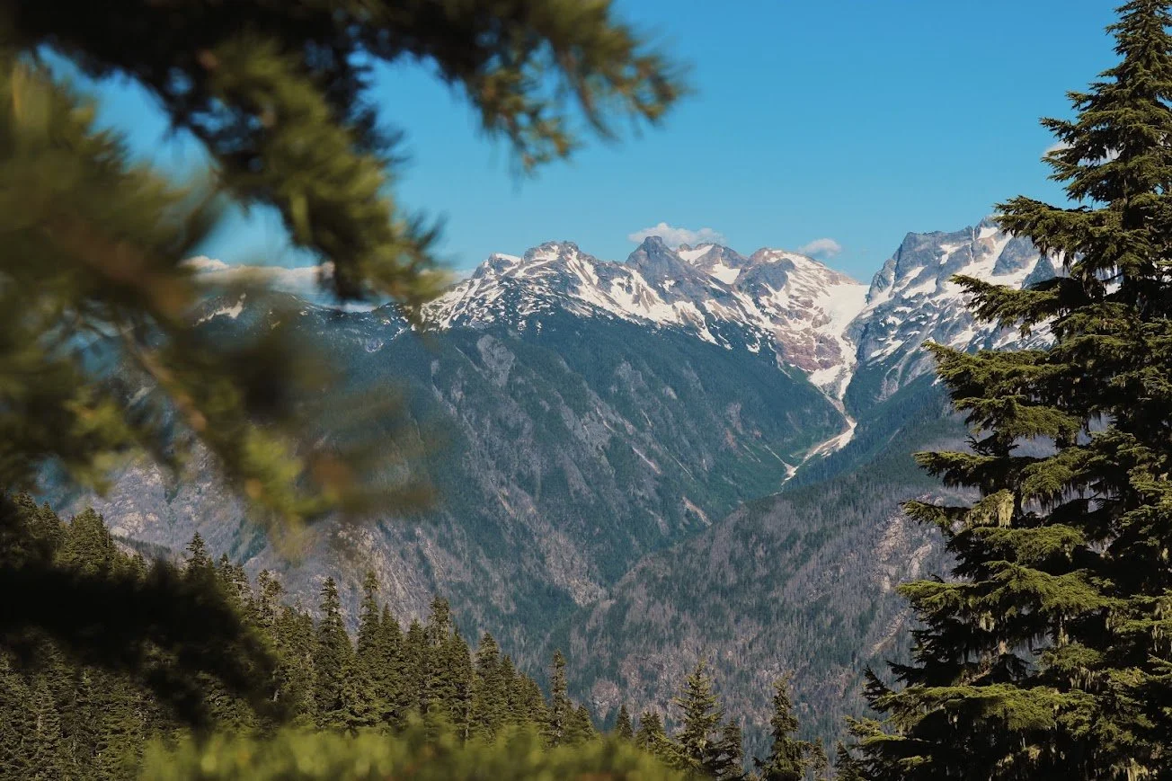
After 5 miles of constant struggling, this view was everything.
If your objective is Trappers Peak, I would factor in roughly 2 extra miles beyond the lake intersection. Since I was pretty out of shape back then, my friend and I skipped this. We were both cooked by that point and wanted to set up camp. The views up there are worth it if you’ve got the legs.
Getting to Camp

Classic view of the Cascades while descending into Thonrton Lakes
Before the descent down to the lakes, the trees broke open and suddenly we were above the tree line. I said “wow” almost the entire way down to the lake. My legs were burning, my pack felt 20 pounds heavier than when I’d started, and I was hating every part of the descent until I actually saw the water. Thornton Lakes wasn’t completely thawed out. It was ringed by peaks on every side — most of my hikes up to that point had been the classic tree line breaks and mountains appear, but this felt different, more enclosed. I think I nearly cried.
There’s something about a view landing exactly when your body has nothing left to give — that’s when you know you made it.
The final stretch to Thornton Lakes isn’t a groomed trail, it’s more a scramble over boulders and a log jam. The ranger at the station warned us about it when we picked up our permits: he was carrying a 30lbs pack and made it sound casual.
I am not built like the ranger. I am short, not remotely spider-like on rock, and I definitely struggled. My friend flat-out ditched his pack at one point, which I wouldn’t recommend. I found my own method: sit down and let gravity do the work. Sliding down boulders on your butt turned out to be the beta in this section. The log jam section afterward was almost a relief in comparison — just one careful step at a time,
Snow patches on the trail on the descent to Thornton Lakes
Lingering snow at Thornton Lakes, with Trappers Peak in the back
Camping at Thornton Lakes
The ranger told us to expect a full house at the permitted sites. We got to camp around 4 or 5pm, waited, and — nobody else ever showed up. Just my friend, me, and the very real awareness that it was just the two of us out there with whatever else was wandering around in the dark.
I’ll admit that part still gets to me a little, especially when I am on a solo backpacking trip. We found a spot close to the lake with a hidden view back toward the Cascades, pitched our tents, and made dinner.
I was still jetlagged and running on maybe three hours of sleep, so I mostly skipped what was supposed to be a good night for stargazing, though I kept popping my head out of the tent to check the sky anyway. What gets me about the North Cascades is how remote it manages to feel despite being only roughly three hours from Seattle. It doesn’t feel like a park that close to a major city has any business in feeling that wild.
Temperatures dropped into the low 30s overnight despite a genuinely hot day, and I spent a good chunk of it rolling around trying to get comfortable. My sleeping bag liner, a new addition to my gear that trip, earned its keep.

The log jam and boulders you need to climb over before getting to camp
Overlooking the lake
Spots are good enough for 2 tents or maybe 3?
The next morning, I took my camera near the lake as the morning fog was beginning to dissipate. My friend and I spent some time hanging out on the lake and decided that we were going to make our way back to our cars. The hike out was almost even better because I was less tired and felt less defeated because I was heading home and felt like I had more time to really soak in the views. I love the North Cascades personally and I feel like I don’t give it nearly as much love as I should.
What To Know Before You Go
Camping: 3 backcountry sites, backcountry permit required, first-come within your permitted dates. There is a privy at the trailhead.
Permits: Required May 15 through September 30. Check the website to see lottery information and other key dates.
Water: Filter from the lake and confirm current conditions with the Wilderness Information Center before you go. Seasonal streams might be available on the trail.
Dogs: Not allowed on this trail — Thornton Lakes sits inside the North Cascades National Park boundaries, where pets are restricted to the Pacific Crest Trail (PCT) corridor and within 50 feet of roads. I didn’t have Tex yet when I did this hike.
Season: Late June through early September. The road to the trailhead is the real limiting factor more than the trail itself.
Final Thoughts

Still some lingering snow at Thornton Lakes in early July.
Thornton Lakes rewards the effort it demands. It's a legitimate leg-and-shoulder burner, made harder for me by jetlag and a body that wasn't ready for elevation gain — but the payoff at the lake, ringed by peaks with the North Cascades' particular brand of remoteness, is worth every pothole on the drive in. If you're building toward something bigger like Sahale or Copper Ridge, this is a solid proving ground.
Resources
Trail info & conditions
Thornton Lakes — Washington Trails Association — trip reports and current conditions
North Cascades National Park — Backcountry Permits (NPS) — official permit reservation info
Leave No Trace — especially relevant in a low-traffic wilderness area like this one
Before you go / after you're back
Mondo Restaurant — I love stopping at Mondo before or after a trip. They are owned by a Korean lady and I always get their bulgogi.
Happy hiking! 🥾