
A Guide to Hiking the Hannegan Pass Trail in the North Cascades

Hiking down from Hannegan Peak towards Hannegan Pass
Distance:
10.4 miles roundtrip
Elevation Gain:
3100 feet
Pass:
NW Forest Pass
Area:
Mount Baker Wilderness
I’m not exaggerating when I said I’ve been wanting to do this hike for about 4 years. I first learned about this hike from a gal I met through a Facebook hiking group. Her name was Elena. We had just completed a backpacking trip up to Anderson and Watson Lakes. I had plans to photograph sunset near Artist Point while she said she was going to sleep in her car at a Sno-Park before you drive up to Heather Meadows so that she could get an early start on the hike up to Hannegan Pass.
Since then, this hike has been in the back of my mind but for some reason, I haven’t thought to complete it until this summer.
This hike was worth every step and every mile and it is possibly one of the most underrated hikes in the North Cascades/Mount Baker Area. I think I can safely say that Hannegan Pass is one of my all-time favorite hikes I have done in Washington.

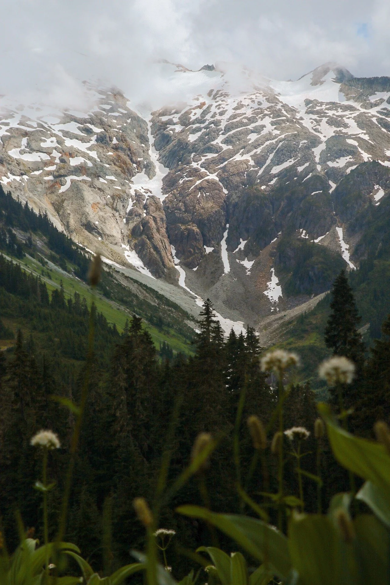
Ruth Mountain viewed from the climb between Hannegan Camp and the junction.
Overview
The Hannegan Pass trailhead is located within the Mount Baker-Snoqualmie National Forest along 542 - the Mount Baker Highway. The trailhead is at the end of the Hannegan Pass Road also known as Forest Service Road 32 (FS Rd 32).
This hike can be done as a relatively long day hike but can also be backpacked. There are several options to camp depending on what your objective(s) for the day is. The Hannegan Pass trail is also the entry point to the Copper Ridge Loop in North Cascades National Park. That trail recently reopened. It was partially closed due to the 2022 Chilliwack Fire.
The Hannegan Pass trail is dog-friendly and moderate. The first 3 miles through the valley is gentle with Ruth Mountain accompanying you the entire way.
The elevation gain doesn’t really pick up until you reach Hannegan Camp and becomes quite steady until the junction for Hannegan Peak and Copper Ridge. After the junction, the trail climbs steeply until you reach Hannegan Peak.
I highly recommend hiking all the way up to Hannegan Peak for 360 views of the North Cascades. Take a long break and fill up water at Hannegan Camp, as this is the last spot with a reliable water source unless there’s still lingering snow up top.
Getting to the Trailhead
The Hannegan Pass Trailhead is at the end of Hannegan Pass Road (Forest Road 32), about 5 miles off the Mount Baker Highway (WA-542).
I have never driven on the Hannegan Pass Road (FS Rd 32) before so I had no prior experience to compare with. I had heard the road was at some point washed out and became really rough. But when I hiked Hannegan Pass in July 2025, the road was fine. There were some potholes and washboards but any car can most certainly make it. Again, just take it slow as it can get really dusty at times and might affect visibility.
The parking area was actually pretty big but when I arrived at the trailhead on an overcast Saturday, it was already filled up and I had to park along the road. There was a pit toilet available but it wasn’t stocked when I was there. Remember, a Northwest Forest Pass is required to park here - not the Discovery Pass.
Directions
Trailhead coordinates: 48.9101, -121.5927
From Seattle:
Take I-5 north to Exit 255 for Sunset Drive/Mt. Baker Highway (WA-542).
Head east through the town of Glacier (last reliable stop for food, water, and gas).
About 12 miles past Glacier, turn left onto Hannegan Pass Road (FR 32).
Follow FR 32 for ~5 miles until it dead-ends at the trailhead parking lot.
Hiking the Hannegan Pass + Peak Trail
I think this trail can be divided into 3 distinct sections. This hike has a little bit of everything. Alpine meadows, valleys, mountains, wildflowers and berries.
You start out by hiking in the valley and through meadows before entering the forest to Hannegan Camp. You stay in the forest for a while, definitely great if you are hiking in on a hot and sunny day as it provides shade. The last section up to Hannegan Peak wasn’t technical but it was definitely steep and had a lot of loose rocks.
Trailhead to Hannegan Camp - 3 miles
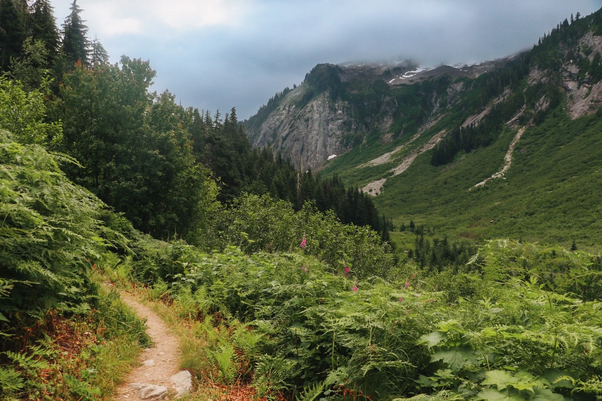
Hiking in the valley for the first 3 miles of the Hannegan Pass trail.
While the elevation gain is not too much on this hike, the trail is rather exposed. Even though the weather was partly cloudy when we did it, it felt hot and humid. The first 3 miles of the trail was a gentle hike through the valley. Shortly after the first mile or two, Ruth Mountain appears and will accompany you for the majority of this gentle section until you return to the forest before reaching Hannegan Camp.
This section of the trail was rather rocky but nothing technical. I would just watch your step. It definitely felt humid and at times muggy while we were hiking through the vegetation. I remember my friend gave me a fair warning about this as she had just completed this hike a week go.
I can’t imagine being Tex but I could definitely feel the heat radiating from the plants and I kept telling my friends that I was hiking with about it but they didn’t seem to be as affected as I was about the heat. It could’ve just been a me problem.
Hannegan Camp to the Junction - 1.4~ miles
This section was mostly in the forest and Hannegan Camp provided as a nice spot to fill up water and take a long break before climbing further up to wherever your destination might be for the day - climbing Ruth Mountain, Copper Ridge Loop or Hannegan Peak.
This was the last reliable water source before getting up to Hannegan Peak. My friends and took a long break here to grab a snack and fill our water filters. I had Tex with me so I was ready to carry 5 liters of water as we had planned to camp up at the peak and we were not sure what the snow situation might look like.
The hike between Hannegan Camp and the Junction for Copper Ridge and Hannegan Peak was significantly more uphill but still very much manageable. This was probably one of the most maintained trail I have been on so far this season and it definitely made the trek easier.
The views opened up further and Ruth Mountain was beginning to feel closer and closer. The wildflowers were also beginning to show during this section. My jaw dropped as we continued to climb towards the junction. I took a few short breaks here and there to try my best to capture the beauty this area had to offer. Once I felt like I was never going to take enough photos, we continued on.
Junction to Hannagen Peak - 1 mile

This is probably going to be everyone’s favorite section and for good reasons. This was also the steepest portion of the hike, gaining over 800 feet in a mile. But what was to come was definitely enticing enough for us to push through.
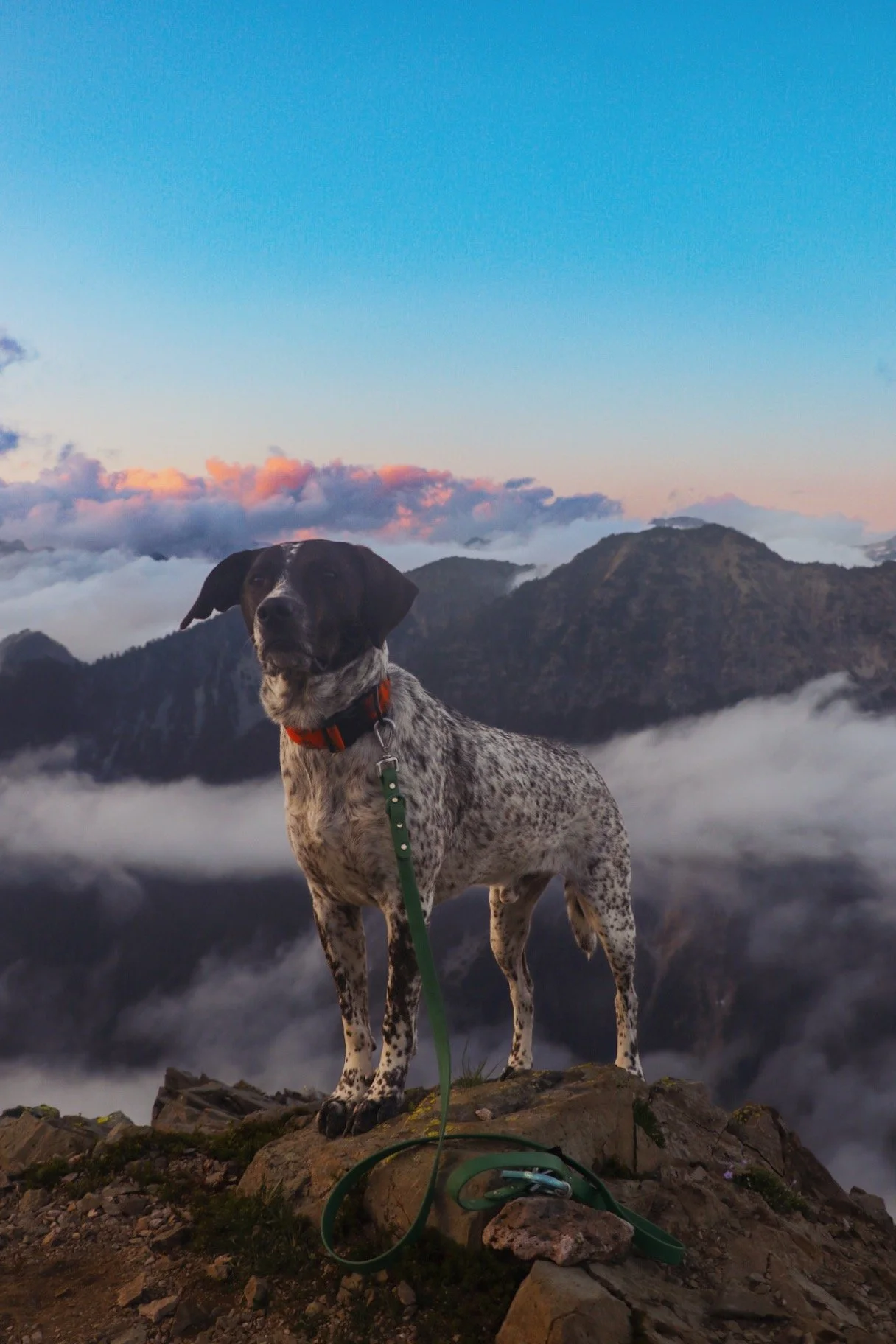
One of my friends in the group had done this hike many times and he encouraged all of us to push through to reach the top of Hannegan Peak to set up camp. It was a rather hot day so I was beginning to lose some motivation and stamina. I was already carrying 4 liters on my back (thanks Jo for carrying the remaining 1 liter of water).
This section was also the ‘roughest’ section of the entire trail. It had a ton of small loose rocks and it definitely felt dusty and sandy as well. The mile did pass by relatively quickly as the views were just getting better and better as you trek higher up.
When we finally made it to one of the false summits, we began to look for camp. There were still small patches of snow which camping here a little difficult. We decided that we would continue to push on to see if the prime camping spot was available.
Spoiler alert: we ended up camping somewhere else.
Hannegan Peak - 6,187 ft
A lot of folks would call getting to Hannegan Pass their objective of the day but if you have the energy, whether you’re day hiking or backpacking, definitely push for the last mile up to Hannegan Peak.
From the pass, the trail climbs steeply along a ridge for about 1.5 miles one way and adding about 1200 feet of elevation gain. To the west of the peak, Mount Baker dominates the horizon. To the south, you can see Mount Shuksan and to the east, Ruth Mountain continues to dominate while stretching into the heart of the North Cascades.
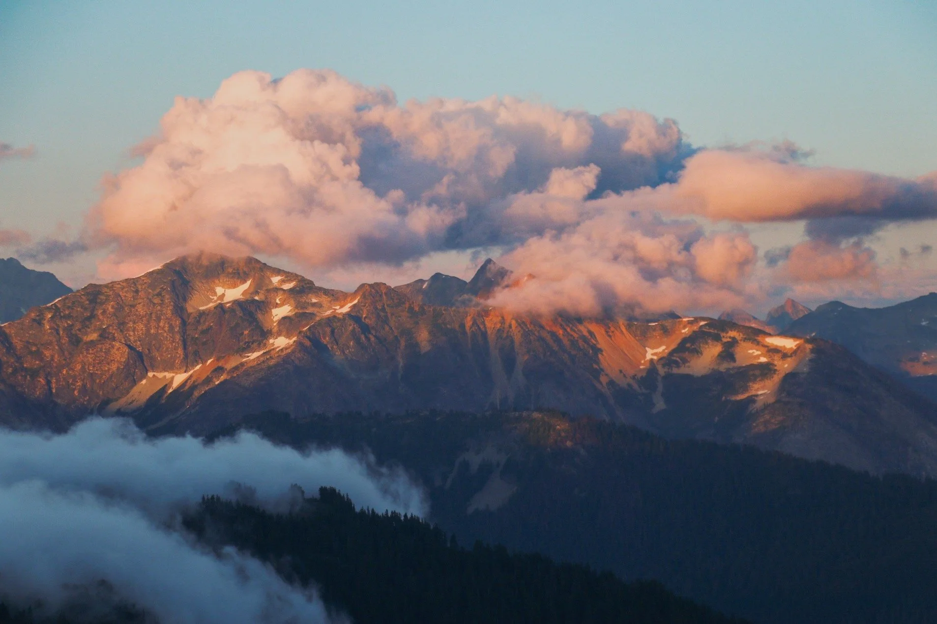
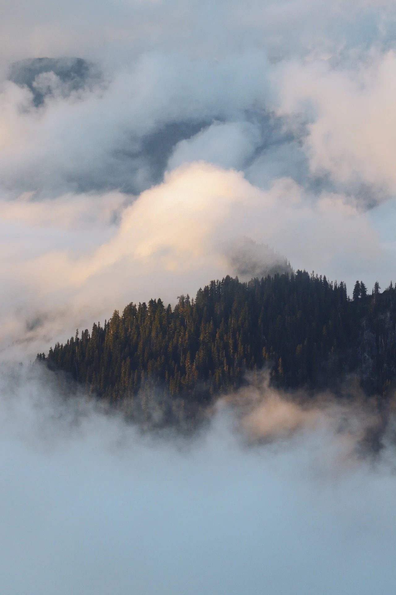
We finished setting up camp at around 5:30pm and we took our time relaxing and exploring the area a little. I continued to hike west of the peak and found a spot where I experienced quite a bit of solitude. Since the clouds were rolling in and out, I was actually able to see one of my first cloud inversions and it was so soo cool!
This was one of the best sunset I’ve ever experienced but to be fair, you can’t go wrong with any sunsets in the North Cascades. That alpine magic is so real.

Where can I camp?
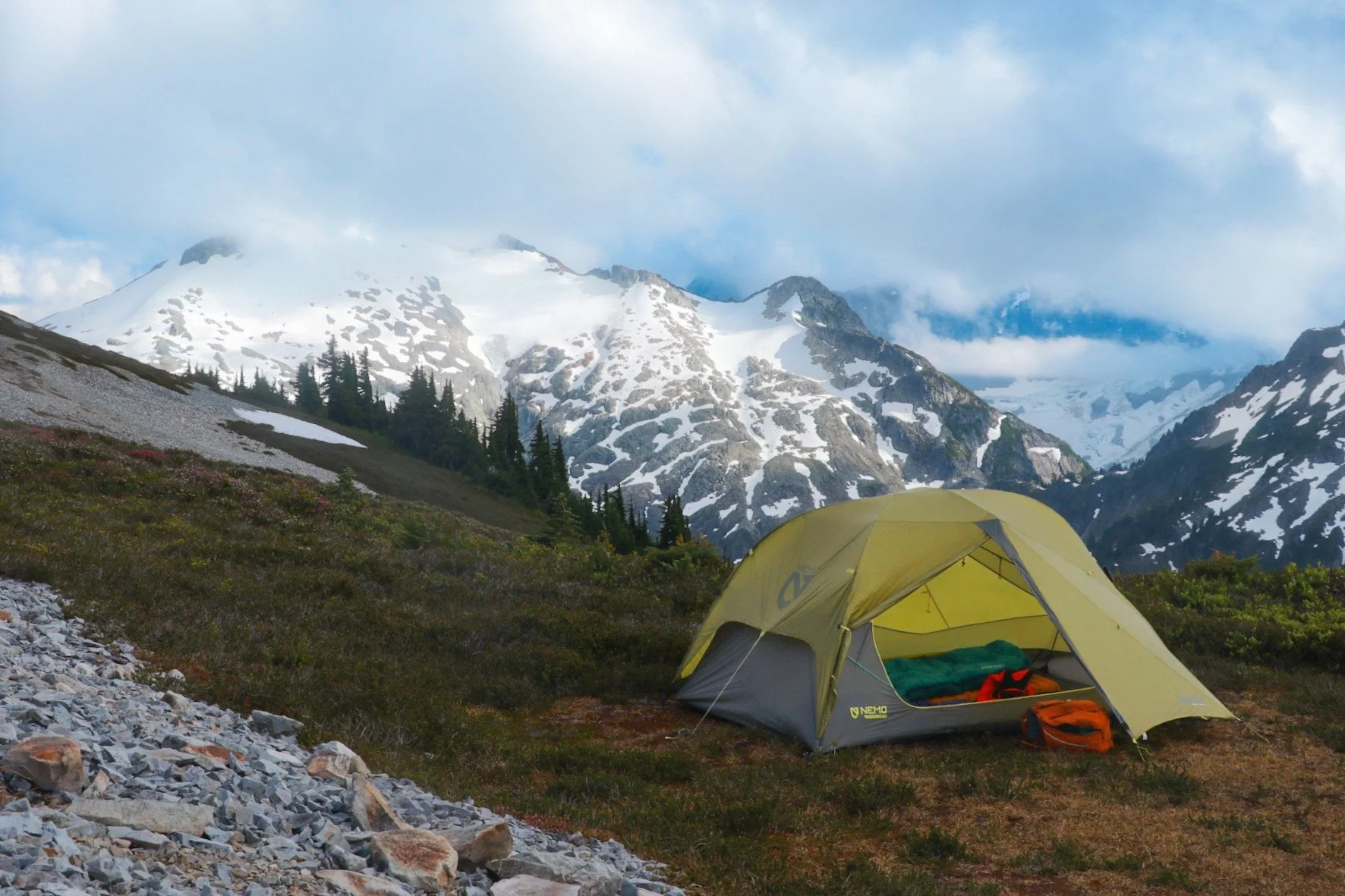
Camping up at Hannegan Peak was worth it. This spot didn’t have 360 degree views but it was just a short walk from the summit.
It was a rather busy Saturday but most of the folks that we encountered were day hikers or their objective was to climb Ruth Mountain. There were several options to camp along the trail with the two official ones being Hannegan Camp and Boundary Camp. However, I did see a huge flat spot as you reach the junction for Copper Ridge and Hannegan Pass.
There were a few options on the way to Hannegan Peak and at the peak itself although a few of them were still covered in snow. The prime spot to camp up in Hannegan Peak had some tree coverage and it was pretty obvious and that seemed to serve as the high point once you reach the peak. While the views would have been amazing at this spot, this was also where most day hikers and backpackers choose to take photos.

We hiked a little further west of the peak and found a nice spot with sufficient wind protection. We weren’t sure what the weather was going to be like later at night as the clouds were rolling in and out, obstructing views of Ruth Mountain, Mount Baker, and Mount Shuksan at times. We thought it was best to be shielded from the wind.
Hannegan Camp: has a backcountry toilet and cooking area
Junction of Copper Ridge and Hannegan Pass: no toilet or cooking area
Boundary Camp: backcountry toilet
Hannegan Peak: no toilet or cooking area; camp on durable surfaces only
Final Thoughts

I am so glad that I was finally able to check this hike off my list and completed yet another hike in one of my favorite areas in Washington, the Mount Baker Wilderness. The views this trail have to offer are endless. Whether you choose to climb Ruth Mountain, relax at Hannegan Camp or push a little harder to get up to Hannegan Peak, you know you will be surrounded by the classic views the North Cascades has to offer. Jagged peaks, melting glaciers, and meadows filled with wildflowers when they’re in season.
Every time I complete a hike in the Mount Baker Wilderness area, I always enjoy stopping by North Fork Brewery for a post-hike bite and drink. They have wifi and amazing pizza and brews too! This time, my friends and I opted for Gunners Tex Mex BBQ again and I always forget how wonderful their food is.


Resources
🌲 Wilderness Regulations - USFS resource on wilderness regulations
🌲 Ptarmigan Ridge Trail on WTA - Trail description, passes and directions
🌲 Mount Baker Wilderness - check trail conditions and fire restrictions
🌲 North Fork Brewery - pizza and beers, perfect spot for a post-hike nom
🌲 Gunners Tex Mex BBQ - the latest addition to a growing list of restaurants in Glacier