
A Guide to Backpacking to Gothic Basin and Foggy Lake

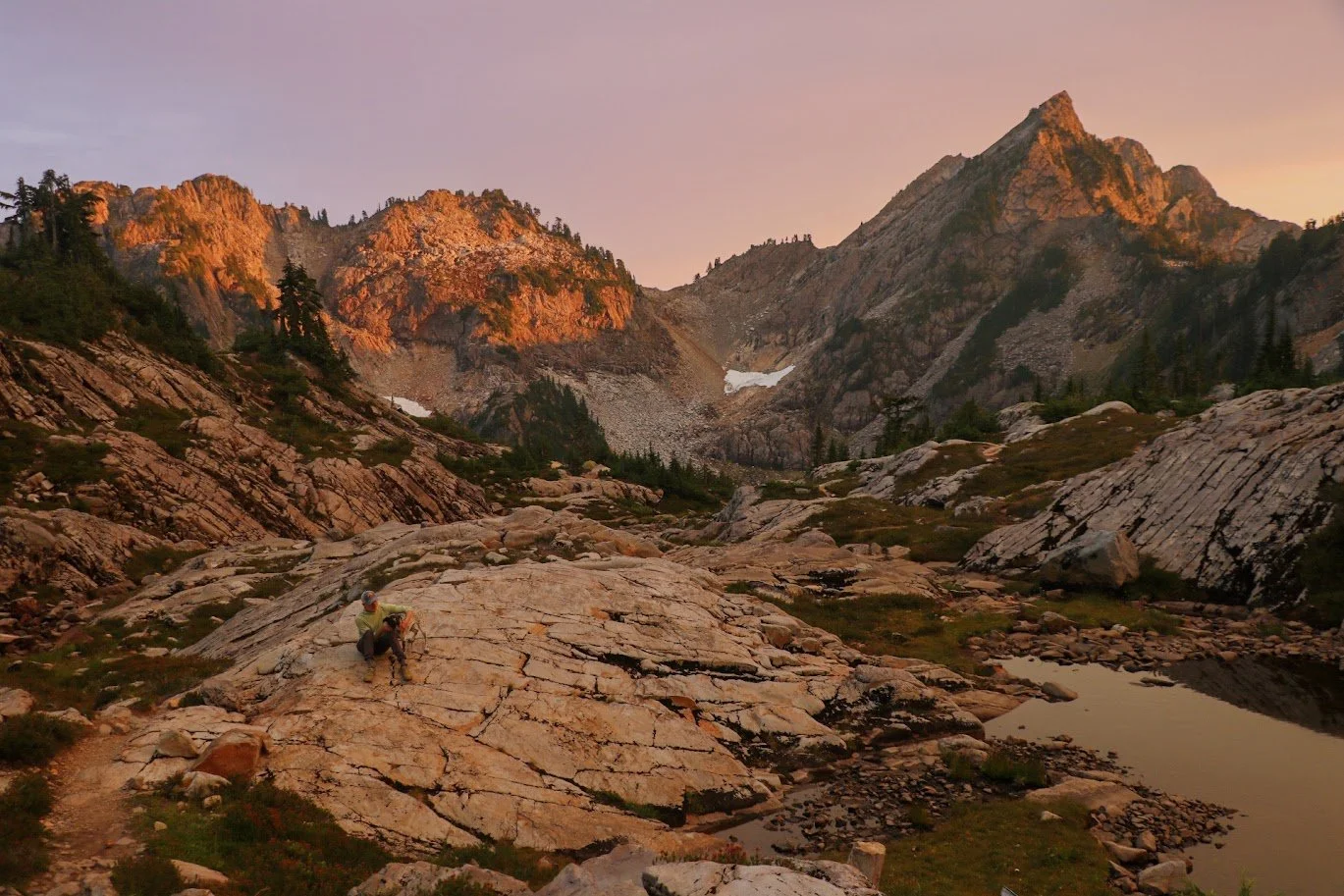
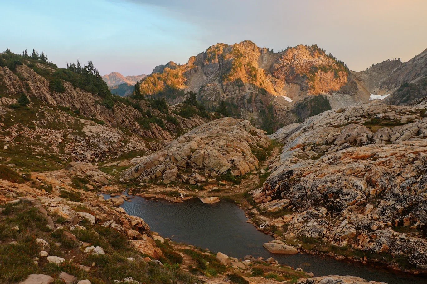
Sunset over Gothic Basin
Distance:
9.2 miles roundtrip
Elevation Gain:
3164 feet
Pass:
NW Forest Pass
Area:
Mountain Loop Highway
Gothic Basin has been on my hiking bucket list for years, but with my work schedule, I’d always only have time hike and backpack on weekends. I’ve heard stories about how packed this trail and area can be. So I finally decided to take a couple of weekdays off and made it up to Gothic Basin with my friend Dave. It was absolutely worth the wait to go on a quieter weekday. This dramatic alpine destination offers stunning views, challenging terrain, and a real sense of accomplishment.
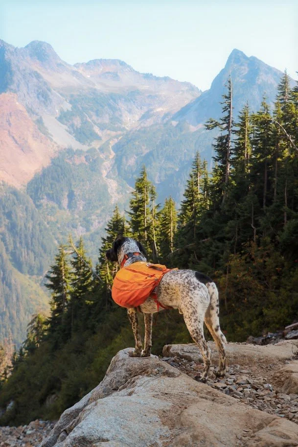
Tex overlooking the mountains at a really good rest spot about 2ish miles into the hike.
Overview
The hike to Gothic Basin begins at the Barlow Pass Trailhead - about 19.4 miles into the Mountain Loop Highway when traveling east from Granite Falls. There are two options to park your car - the Barlow Pass Trailhead has a larger parking lot and another smaller lot that fits less car on the other side of the road.
Trail coordinates: 48.0261, -121.4425
Difficulty
The hike to Gothic Basin including Foggy Lake is 9.2 miles roundtrip and gains a total of 3000+ feet of elevation gain during the last 2 miles or so. This hike is difficult as this is an old mining trail. The terrain becomes rocky, uneven and steep. The first 2 miles are on flat and rather smooth trail until you come to the intersection with the Monte Cristo Trail.
Best Season to Hike Gothic Basin
I personally think the best season to do this hike is in late July-Early September. This is the prime time for this hike. No snow, and the alpine wildflowers were still hanging on. The trail was in good shape, though those slabs can still be slick if it's been raining and it can get muddy as well.
Getting to the Trailhead
Directions from Seattle
From Seattle to Barlow Pass Trailhead (approximately 85 miles, 2 hours):
Take I-5 North to Exit 194
Follow Highway 2 East for about 2 miles
Stay in the left lane and merge onto Lake Stevens Highway 204
Follow Highway 204 for 2 miles to Highway 9
Turn left onto Highway 9 toward Lake Stevens
After just under 2 miles, turn right onto Highway 92 toward Granite Falls
Follow Highway 92 for about 9 miles until it ends at a T-intersection in Granite Falls
Turn left onto the Mountain Loop Highway
Follow the Mountain Loop Highway for approximately 31 miles to Barlow Pass
Parking: Park at Barlow Pass (elevation 2,360 feet). There's a parking lot on the left side of the road where the pavement ends. A Northwest Forest Pass is required for parking. The lot can fill up quickly on weekends, which is another great reason to go on a weekday!
Accessing the Trailhead: From the parking area at Barlow Pass, you'll need to walk approximately 1.5-1.7 miles south along the gated Monte Cristo Road (a flat, old road bed that parallels the Sauk River). The actual Gothic Basin/Weden Creek Trail #724 starts on your right, just before the Sauk River crossing. Look for the trailhead sign and old outhouse.
Hiking to Gothic Basin and Foggy Lake

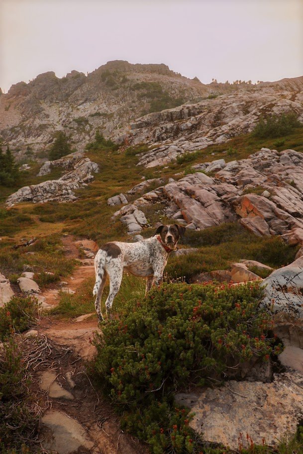
Classic view of Gothic Basin.
I’ve really tried to spend more time in the backcountry this summer and by the time I got around to this hike, I thought I was going to physically (and mentally) stronger. However, this hike really challenged my abilities! I had just completed an overnight trip up to Rampart Lakes via the Rachel Lake trail. I thought the 1.5 mile section up to Rachel Lake was difficult but the last 1.5 miles up to Gothic Basin truly kicked my butt. Despite this being a popular destination for backpackers and day hikers, don’t underestimate this hike.
Fun fact!
Gothic Basin is named after William Gothic, an early prospector who was one of the first people to stake a claim there. The name became official in 1967. Pretty cool bit of history!
Miles 0-2: Easy Warm-Up
This hike starts at the Barlow Pass trailhead. The first two miles were super chill. This was a nice gentle introduction that lulls you into thinking this might be an easy day (and it can be). The trail follows along relatively flat terrain through a forest until you reach Weden Creek where you must cross it to continue to Gothic Basin. This section offers a nice warm-up for what’s to come.
Pro tip: If you're looking for an easier alternative or want to explore more, you can skip Gothic Basin entirely and continue on the Monte Cristo Trail instead.
The Climbing Begins
At mile 2, you cross Weden Creek. When we went in September, the water wasn’t high and I am uncertain if the water levels ever get high. This was also a relatively good spot to take a break and filter water if it’s a hot summer day.
After you make the crossing, this is when you will begin climbing steadily and the trail does not give in. You'll tackle a very steep set of switchbacks that'll get your heart rate up quickly. After about a mile of this relentless climbing, you'll pop out onto a slightly flatter section with nice views across the valley, a welcome reprieve and a good spot to catch your breath and another great spot to fill up your water again!
This area marks the border between the Mt. Baker-Snoqualmie National Forest and the Morning Star Natural Resources Conservation Area managed by the Washington State Department of Natural Resources (DNR). It's important to note that this NRCA protects sensitive plant communities, high-quality wetlands, and fragile subalpine meadows, so stay on the trail, snow, or rock to avoid damaging these ecosystems.

Tex always I am too slow for him on the trails.
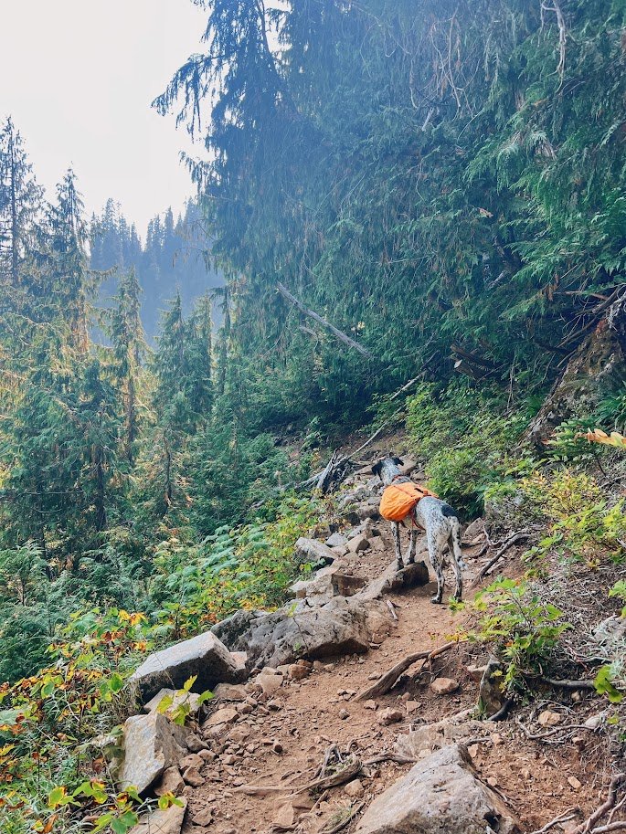
The classic miners’ trail.
Miles 2-3.5: The Final Push
From the boundary, it is about 1.41 miles to the Gothic Basin saddle. You will work for every foot of elevation.
The open area here includes 3 creek crossings before the trail dives back into the forest and continues its relentless climbs. You will cross several more creeks and encounter some rock scrambling sections. You'll cross several more creeks and encounter some rock scrambling sections, though efforts from various trail crews (including WTA) have improved the route over the years.
This final push to the saddle is steep and largely exposed, meaning you'll be in the sun for most of the day. Take it slow and bring plenty of water. The trail transitions from forest to rocky alpine terrain, with some sections crossing steep slabs that can be intimidating, especially when wet.
During my September hike, I encountered something really cool: a DNR crew was actively working on the trail, carving out steps in some of the steeper slab sections. It was fascinating to watch them improve the trail infrastructure in real-time. These steps are designed to help hikers more safely navigate sections that get particularly slick, which is a common issue on this route.
My friend kept saying we’re almost there but this section felt like it took forever. The only thing that kept me going at this point was the open views of mountains and the anticipation to finally arrive at Gothic Basin - a place I’ve only heard my friends rave about.
Mile 3.5 - Gothic Basin
After numerous we’re almost there, we finally made it to Gothic Basin. It was gorgeous and trust me, it was indeed one of the most beautiful places I have ever been. I can’t imagine what this place looks like on a beautiful sunny weekend. When we arrived at the basin at around 5pm, we only saw one other group and they were day hikers, meaning we were pretty much alone at the basin.
Since we pretty much had the basin all to ourselves, we had choices where to set up camp. The NRCA really has been putting work into preserving this fragile environment - we saw sites marked with tags that said ‘Site #1” and so on. The unmaintained and faint trail up to Foggy Trail was also marked with similar tags. I was also excited to finally check out the new bathrooms that were airlifted and installed earlier in the summer. They were hefty and both a little bit of a hike but like most backcountry toilets, they both have great views.
We wandered a little bit and finally found a spot overlooking the valley and Sheep Gap Mountain. After my friend and I both set up camp, we spent more time exploring the basin but decided that we would tackle Foggy Lake the next day instead.
The sunset was a little different from most I’ve experienced. When we did this trail, we knew there were several wildfires burning. The wind happened to start blowing the smoke towards the basin but that made for a spectacular sunset in the backcountry. The skies turned into different shades of reds, oranges, and gold. It was hard to describe what I experienced but I have to say it was one of the beautiful sunsets I have seen.

One of the Sheep Gap Mountain peaks.

Camp for the night.
Dave and Tex hanging out on some granite slab at Gothic Basin.
Mile 3.5 and Beyond - Foggy Lake
After getting a relatively good night’s rest, we decided to venture out to Foggy Lake the next day. I was having a slow day as I made some breakfast overlooking Sheep Gap Mountain. Dave has probably awoken long before me. But coming from a week of nonstop work and back-to-back backpacking trips, it was nice to experience mountain time quite literally in the mountains.
The hike to Foggy Lake wasn’t particularly challenging and it was well marked with tags provided by the NRCA and DNR. There was a short climb on scree before the trail becomes relatively flat. This section was interesting. Gothic Basin mostly consisted of granite but Foggy Lake was instead, filled with sandstone. The colors quickly shifted as we reached Foggy Lake with Gothic Peak and Del Campo Peak looming over a pool of clear, turquoise water. We filled up some water again since we had only packed a day pack and hung out at the lake for a little while. Foggy Lake was clearly a more popular spot for overnight backpackers. We saw a few groups hanging out and a group of two guys jumping into the lake.
After hanging out at the lake for a while, we hiked towards Del Campo Peak with no intent to actually scramble to the top. As we hiked further, we found even more campsites and I found a lot of frogs that were just chilling in the smaller lakes beyond Foggy Lake. Sadly, all good things must come to an end. After most of the morning explore Foggy Lake and beyond, it was time to pack up camp and head back to the car.

Tex looking so majestic at Foggy Lake with Del Campo Peak in the background.
Leave no trace - See the privy? Use the privy.
I’ve heard stories about how Gothic Basin always gets trashed, literally by the amount of people that visit the area. This area is fragile and to be honest, there weren’t a lot of good spots to dig a hole and let alone, any real tree coverage. These backcountry toilets were airlifted to the basin to replace the old ones. There were two of them - the first being up the hill when you first enter the basin and the other was on the other side of the basin. The second one wasn’t marked on the map but you can easily find the first one on the map.
I attached the location of the second backcountry toilet in the trip report I wrote after completing the trip on WTA. You can find that here.

Look at the view though!
More Photos of Gothic Basin


Final Thoughts
After years of having Gothic Basin on my bucket list, finally making it up there felt incredibly rewarding. Spending a night in the backcountry with my friend Dave, surrounded by granite slabs and alpine lakes, was exactly what I'd hoped for. Tex had an absolute blast scrambling over the granite—there's something about dogs and rock hopping that just works.
Yes, this hike is difficult and challenging. The steep sections will test you, and that final push to the saddle is no joke. But standing in Gothic Basin, looking around at the dramatic landscape that feels almost otherworldly, made every steep step worth the effort. This is one of those hikes where the difficulty is part of the reward—you earn these views, and that makes them all the sweeter.
If you've been putting this one off like I had, make it happen. Just maybe skip the weekend crowds.
Resources
🌲 Wilderness Regulations - USFS resource on wilderness regulations
🌲 Gothic Basin on WTA - Trail description, passes and directions
🌲 My Trip Report on WTA - Location of where the second backcountry toilet is
🌲 Weden Creek (Gothic Basin) Trail 724 - check trail conditions and fire restrictions (USFS)